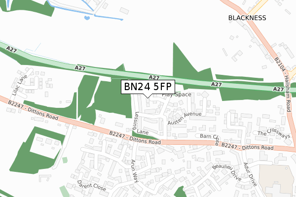
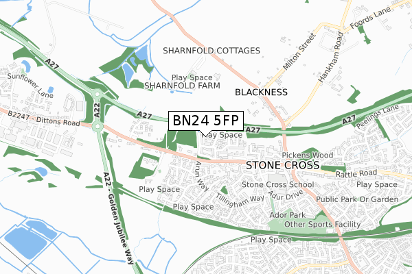
BN24 5FP is located in the Polegate Central electoral ward, within the local authority district of Wealden and the English Parliamentary constituency of Bexhill and Battle. The Sub Integrated Care Board (ICB) Location is NHS Sussex ICB - 97R and the police force is Sussex. This postcode has been in use since August 2017.


GetTheData
Source: OS Open Zoomstack (Ordnance Survey)
Licence: Open Government Licence (requires attribution)
Attribution: Contains OS data © Crown copyright and database right 2025
Source: Open Postcode Geo
Licence: Open Government Licence (requires attribution)
Attribution: Contains OS data © Crown copyright and database right 2025; Contains Royal Mail data © Royal Mail copyright and database right 2025; Source: Office for National Statistics licensed under the Open Government Licence v.3.0
| Easting | 561019 |
| Northing | 104612 |
| Latitude | 50.818667 |
| Longitude | 0.284529 |
GetTheData
Source: Open Postcode Geo
Licence: Open Government Licence
| Country | England |
| Postcode District | BN24 |
➜ See where BN24 is on a map ➜ Where is Stone Cross? | |
GetTheData
Source: Land Registry Price Paid Data
Licence: Open Government Licence
| Ward | Polegate Central |
| Constituency | Bexhill And Battle |
GetTheData
Source: ONS Postcode Database
Licence: Open Government Licence
| Arun Way (Dittons Road) | Stone Cross | 145m |
| Arun Way (Dittons Road) | Stone Cross | 160m |
| Bluebell Barn (Dittons Road) | Dittons | 251m |
| Bluebell Barn (Dittons Road) | Dittons | 262m |
| Milton Street (Hailsham Road) | Stone Cross | 420m |
| Hampden Park (Sussex) Station | 2.5km |
| Polegate Station | 2.8km |
| Pevensey & Westham Station | 2.9km |
GetTheData
Source: NaPTAN
Licence: Open Government Licence
| Percentage of properties with Next Generation Access | 100.0% |
| Percentage of properties with Superfast Broadband | 100.0% |
| Percentage of properties with Ultrafast Broadband | 100.0% |
| Percentage of properties with Full Fibre Broadband | 100.0% |
Superfast Broadband is between 30Mbps and 300Mbps
Ultrafast Broadband is > 300Mbps
| Percentage of properties unable to receive 2Mbps | 0.0% |
| Percentage of properties unable to receive 5Mbps | 0.0% |
| Percentage of properties unable to receive 10Mbps | 0.0% |
| Percentage of properties unable to receive 30Mbps | 0.0% |
GetTheData
Source: Ofcom
Licence: Ofcom Terms of Use (requires attribution)
GetTheData
Source: ONS Postcode Database
Licence: Open Government Licence


➜ Get more ratings from the Food Standards Agency
GetTheData
Source: Food Standards Agency
Licence: FSA terms & conditions
| Last Collection | |||
|---|---|---|---|
| Location | Mon-Fri | Sat | Distance |
| Arun Way | 16:00 | 11:00 | 197m |
| Adur Drive | 16:00 | 11:00 | 426m |
| Milton Place | 16:00 | 11:00 | 439m |
GetTheData
Source: Dracos
Licence: Creative Commons Attribution-ShareAlike
The below table lists the International Territorial Level (ITL) codes (formerly Nomenclature of Territorial Units for Statistics (NUTS) codes) and Local Administrative Units (LAU) codes for BN24 5FP:
| ITL 1 Code | Name |
|---|---|
| TLJ | South East (England) |
| ITL 2 Code | Name |
| TLJ2 | Surrey, East and West Sussex |
| ITL 3 Code | Name |
| TLJ22 | East Sussex CC |
| LAU 1 Code | Name |
| E07000065 | Wealden |
GetTheData
Source: ONS Postcode Directory
Licence: Open Government Licence
The below table lists the Census Output Area (OA), Lower Layer Super Output Area (LSOA), and Middle Layer Super Output Area (MSOA) for BN24 5FP:
| Code | Name | |
|---|---|---|
| OA | E00107739 | |
| LSOA | E01021208 | Wealden 020C |
| MSOA | E02004422 | Wealden 020 |
GetTheData
Source: ONS Postcode Directory
Licence: Open Government Licence
| BN24 5EP | Dittons Road | 127m |
| BN24 5PG | Darwell Drive | 221m |
| BN24 5ER | Dittons Road | 221m |
| BN24 5PU | Hamble Road | 249m |
| BN24 5PH | Medway Lane | 263m |
| BN24 5EU | St Michaels Close | 302m |
| BN24 5PP | Arun Close | 315m |
| BN24 5DN | Beaulieu Drive | 331m |
| BN24 5ES | Dittons Road | 348m |
| BN24 5PW | Darent Close | 353m |
GetTheData
Source: Open Postcode Geo; Land Registry Price Paid Data
Licence: Open Government Licence