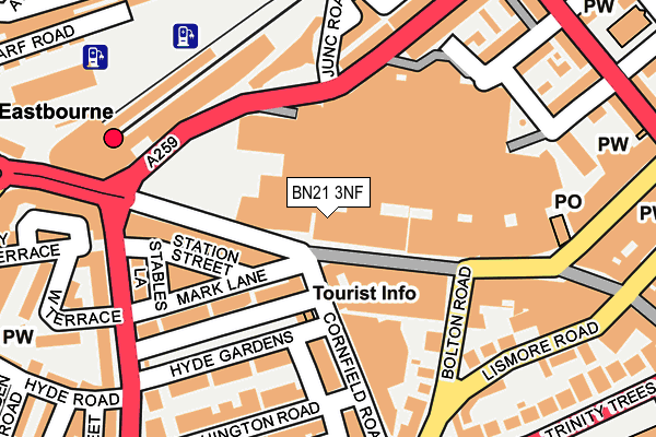
BN21 3NF is located in the Devonshire electoral ward, within the local authority district of Eastbourne and the English Parliamentary constituency of Eastbourne. The Sub Integrated Care Board (ICB) Location is NHS Sussex ICB - 97R and the police force is Sussex. This postcode has been in use since January 1980.


GetTheData
Source: OS OpenMap – Local (Ordnance Survey)
Source: OS VectorMap District (Ordnance Survey)
Licence: Open Government Licence (requires attribution)
| Easting | 561165 |
| Northing | 99064 |
| Latitude | 50.768780 |
| Longitude | 0.284140 |
GetTheData
Source: Open Postcode Geo
Licence: Open Government Licence
| Country | England |
| Postcode District | BN21 |
➜ See where BN21 is on a map ➜ Where is Eastbourne? | |
GetTheData
Source: Land Registry Price Paid Data
Licence: Open Government Licence
Elevation or altitude of BN21 3NF as distance above sea level:
| Metres | Feet | |
|---|---|---|
| Elevation | 10m | 33ft |
Elevation is measured from the approximate centre of the postcode, to the nearest point on an OS contour line from OS Terrain 50, which has contour spacing of ten vertical metres.
➜ How high above sea level am I? Find the elevation of your current position using your device's GPS.
GetTheData
Source: Open Postcode Elevation
Licence: Open Government Licence
| Ward | Devonshire |
| Constituency | Eastbourne |
GetTheData
Source: ONS Postcode Database
Licence: Open Government Licence
| Terminus Road (Cornfield Road) | Eastbourne Town Centre | 52m |
| Terminus Road Arrivals (Terminus Road) | Eastbourne Town Centre | 56m |
| Cornfield Road | Eastbourne Town Centre | 75m |
| Cornfield Road | Eastbourne Town Centre | 82m |
| Terminus Road | Eastbourne Town Centre | 88m |
| Eastbourne Station | 0.2km |
| Hampden Park (Sussex) Station | 3.1km |
GetTheData
Source: NaPTAN
Licence: Open Government Licence
GetTheData
Source: ONS Postcode Database
Licence: Open Government Licence


➜ Get more ratings from the Food Standards Agency
GetTheData
Source: Food Standards Agency
Licence: FSA terms & conditions
| Last Collection | |||
|---|---|---|---|
| Location | Mon-Fri | Sat | Distance |
| Cornfield Road | 18:30 | 12:00 | 79m |
| Cornfield Road | 18:30 | 82m | |
| Station | 18:30 | 12:00 | 215m |
GetTheData
Source: Dracos
Licence: Creative Commons Attribution-ShareAlike
The below table lists the International Territorial Level (ITL) codes (formerly Nomenclature of Territorial Units for Statistics (NUTS) codes) and Local Administrative Units (LAU) codes for BN21 3NF:
| ITL 1 Code | Name |
|---|---|
| TLJ | South East (England) |
| ITL 2 Code | Name |
| TLJ2 | Surrey, East and West Sussex |
| ITL 3 Code | Name |
| TLJ22 | East Sussex CC |
| LAU 1 Code | Name |
| E07000061 | Eastbourne |
GetTheData
Source: ONS Postcode Directory
Licence: Open Government Licence
The below table lists the Census Output Area (OA), Lower Layer Super Output Area (LSOA), and Middle Layer Super Output Area (MSOA) for BN21 3NF:
| Code | Name | |
|---|---|---|
| OA | E00106151 | |
| LSOA | E01020911 | Eastbourne 010B |
| MSOA | E02004365 | Eastbourne 010 |
GetTheData
Source: ONS Postcode Directory
Licence: Open Government Licence
| BN21 3NE | Terminus Road | 0m |
| BN21 3NW | Arndale Centre | 66m |
| BN21 4PJ | Cornfield Road | 67m |
| BN21 3NJ | Terminus Road | 77m |
| BN21 3QL | Terminus Road | 105m |
| BN21 4PN | Hyde Gardens | 105m |
| BN21 4QD | Cornfield Road | 120m |
| BN21 3LX | Terminus Road | 122m |
| BN21 4PY | Connaught Road | 123m |
| BN21 4QE | Cornfield Road | 136m |
GetTheData
Source: Open Postcode Geo; Land Registry Price Paid Data
Licence: Open Government Licence