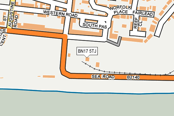
BN17 5TJ is located in the Beach electoral ward, within the local authority district of Arun and the English Parliamentary constituency of Bognor Regis and Littlehampton. The Sub Integrated Care Board (ICB) Location is NHS Sussex ICB - 70F and the police force is Sussex. This postcode has been in use since July 2017.


GetTheData
Source: OS OpenMap – Local (Ordnance Survey)
Source: OS VectorMap District (Ordnance Survey)
Licence: Open Government Licence (requires attribution)
| Easting | 503609 |
| Northing | 101430 |
| Latitude | 50.803166 |
| Longitude | -0.531016 |
GetTheData
Source: Open Postcode Geo
Licence: Open Government Licence
| Country | England |
| Postcode District | BN17 |
➜ See where BN17 is on a map ➜ Where is Littlehampton? | |
GetTheData
Source: Land Registry Price Paid Data
Licence: Open Government Licence
| Ward | Beach |
| Constituency | Bognor Regis And Littlehampton |
GetTheData
Source: ONS Postcode Database
Licence: Open Government Licence
| Norfolk Gardens (Sea Road) | Littlehampton | 75m |
| Norfolk Gardens (Sea Road) | Littlehampton | 87m |
| South Terrace | Littlehampton | 177m |
| South Terrace | Littlehampton | 180m |
| Swimming Centre (Sea Road) | Littlehampton | 363m |
| Littlehampton Station | 1.3km |
| Angmering Station | 3.3km |
| Ford Station | 4.4km |
GetTheData
Source: NaPTAN
Licence: Open Government Licence
GetTheData
Source: ONS Postcode Database
Licence: Open Government Licence


➜ Get more ratings from the Food Standards Agency
GetTheData
Source: Food Standards Agency
Licence: FSA terms & conditions
| Last Collection | |||
|---|---|---|---|
| Location | Mon-Fri | Sat | Distance |
| South Terrace | 17:15 | 12:00 | 274m |
| Fitzalan Road | 17:15 | 12:00 | 489m |
| Fairway | 17:00 | 12:15 | 491m |
GetTheData
Source: Dracos
Licence: Creative Commons Attribution-ShareAlike
The below table lists the International Territorial Level (ITL) codes (formerly Nomenclature of Territorial Units for Statistics (NUTS) codes) and Local Administrative Units (LAU) codes for BN17 5TJ:
| ITL 1 Code | Name |
|---|---|
| TLJ | South East (England) |
| ITL 2 Code | Name |
| TLJ2 | Surrey, East and West Sussex |
| ITL 3 Code | Name |
| TLJ27 | West Sussex (South West) |
| LAU 1 Code | Name |
| E07000224 | Arun |
GetTheData
Source: ONS Postcode Directory
Licence: Open Government Licence
The below table lists the Census Output Area (OA), Lower Layer Super Output Area (LSOA), and Middle Layer Super Output Area (MSOA) for BN17 5TJ:
| Code | Name | |
|---|---|---|
| OA | E00160107 | |
| LSOA | E01031400 | Arun 011A |
| MSOA | E02006552 | Arun 011 |
GetTheData
Source: ONS Postcode Directory
Licence: Open Government Licence
| BN17 5NZ | South Terrace | 85m |
| BN17 5PB | Norfolk Place | 116m |
| BN17 5PD | Norfolk Place | 124m |
| BN17 5PJ | South Passage | 125m |
| BN17 5PG | Western Road | 132m |
| BN17 5PA | South Terrace | 133m |
| BN17 5PS | Norfolk Mews | 136m |
| BN17 5PR | South Terrace | 150m |
| BN17 5NX | South Terrace | 153m |
| BN17 5PL | Norfolk Road | 156m |
GetTheData
Source: Open Postcode Geo; Land Registry Price Paid Data
Licence: Open Government Licence