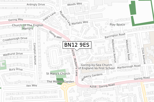
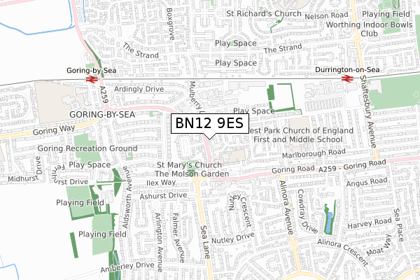
BN12 9ES is located in the Goring electoral ward, within the local authority district of Worthing and the English Parliamentary constituency of Worthing West. The Sub Integrated Care Board (ICB) Location is NHS Sussex ICB - 70F and the police force is Sussex. This postcode has been in use since November 2018.


GetTheData
Source: OS Open Zoomstack (Ordnance Survey)
Licence: Open Government Licence (requires attribution)
Attribution: Contains OS data © Crown copyright and database right 2024
Source: Open Postcode Geo
Licence: Open Government Licence (requires attribution)
Attribution: Contains OS data © Crown copyright and database right 2024; Contains Royal Mail data © Royal Mail copyright and database right 2024; Source: Office for National Statistics licensed under the Open Government Licence v.3.0
| Easting | 511188 |
| Northing | 102824 |
| Latitude | 50.814294 |
| Longitude | -0.423080 |
GetTheData
Source: Open Postcode Geo
Licence: Open Government Licence
| Country | England |
| Postcode District | BN12 |
➜ See where BN12 is on a map ➜ Where is Worthing? | |
GetTheData
Source: Land Registry Price Paid Data
Licence: Open Government Licence
| Ward | Goring |
| Constituency | Worthing West |
GetTheData
Source: ONS Postcode Database
Licence: Open Government Licence
| Mulberry Lane | Goring By Sea | 50m |
| Mulberry Lane | Goring By Sea | 61m |
| Goring Church (Mulberry Lane) | Goring By Sea | 145m |
| Goring Church (Goring Road) | Goring By Sea | 225m |
| Goring Church (Ilex Way) | Goring By Sea | 232m |
| Goring-by-Sea Station | 0.8km |
| Durrington-on-Sea Station | 0.9km |
| West Worthing Station | 2.2km |
GetTheData
Source: NaPTAN
Licence: Open Government Licence
GetTheData
Source: ONS Postcode Database
Licence: Open Government Licence


➜ Get more ratings from the Food Standards Agency
GetTheData
Source: Food Standards Agency
Licence: FSA terms & conditions
| Last Collection | |||
|---|---|---|---|
| Location | Mon-Fri | Sat | Distance |
| Goring By Sea T.s.o. | 17:45 | 12:00 | 32m |
| Goring By Sea Post Office | 17:00 | 11:45 | 238m |
| Aldsworth Parade | 17:30 | 12:30 | 600m |
GetTheData
Source: Dracos
Licence: Creative Commons Attribution-ShareAlike
The below table lists the International Territorial Level (ITL) codes (formerly Nomenclature of Territorial Units for Statistics (NUTS) codes) and Local Administrative Units (LAU) codes for BN12 9ES:
| ITL 1 Code | Name |
|---|---|
| TLJ | South East (England) |
| ITL 2 Code | Name |
| TLJ2 | Surrey, East and West Sussex |
| ITL 3 Code | Name |
| TLJ27 | West Sussex (South West) |
| LAU 1 Code | Name |
| E07000229 | Worthing |
GetTheData
Source: ONS Postcode Directory
Licence: Open Government Licence
The below table lists the Census Output Area (OA), Lower Layer Super Output Area (LSOA), and Middle Layer Super Output Area (MSOA) for BN12 9ES:
| Code | Name | |
|---|---|---|
| OA | E00162171 | |
| LSOA | E01031803 | Worthing 013B |
| MSOA | E02006633 | Worthing 013 |
GetTheData
Source: ONS Postcode Directory
Licence: Open Government Licence
| BN12 4NP | Mulberry Lane | 17m |
| BN12 4QT | Mulberry Lane | 46m |
| BN12 4QU | Mulberry Lane | 65m |
| BN12 4RL | Barrington Road | 67m |
| BN12 4RW | The Terrace | 68m |
| BN12 4NS | Mulberry Lane | 93m |
| BN12 4NR | Mulberry Lane | 102m |
| BN12 4RH | Barrington Road | 102m |
| BN12 4RN | Palmerston Avenue | 137m |
| BN12 4RJ | Barrington Close | 143m |
GetTheData
Source: Open Postcode Geo; Land Registry Price Paid Data
Licence: Open Government Licence