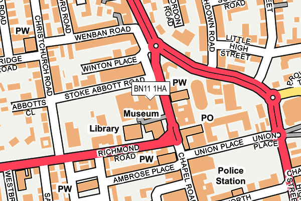
BN11 1HA is located in the Central electoral ward, within the local authority district of Worthing and the English Parliamentary constituency of Worthing West. The Sub Integrated Care Board (ICB) Location is NHS Sussex ICB - 70F and the police force is Sussex. This postcode has been in use since January 1980.


GetTheData
Source: OS OpenMap – Local (Ordnance Survey)
Source: OS VectorMap District (Ordnance Survey)
Licence: Open Government Licence (requires attribution)
| Easting | 514799 |
| Northing | 102950 |
| Latitude | 50.814731 |
| Longitude | -0.371830 |
GetTheData
Source: Open Postcode Geo
Licence: Open Government Licence
| Country | England |
| Postcode District | BN11 |
➜ See where BN11 is on a map ➜ Where is Worthing? | |
GetTheData
Source: Land Registry Price Paid Data
Licence: Open Government Licence
Elevation or altitude of BN11 1HA as distance above sea level:
| Metres | Feet | |
|---|---|---|
| Elevation | 10m | 33ft |
Elevation is measured from the approximate centre of the postcode, to the nearest point on an OS contour line from OS Terrain 50, which has contour spacing of ten vertical metres.
➜ How high above sea level am I? Find the elevation of your current position using your device's GPS.
GetTheData
Source: Open Postcode Elevation
Licence: Open Government Licence
| Ward | Central |
| Constituency | Worthing West |
GetTheData
Source: ONS Postcode Database
Licence: Open Government Licence
| Town Hall (Chapel Road) | Worthing | 26m |
| Town Hall (Chapel Road) | Worthing | 48m |
| Library (Richmond Road) | Worthing | 82m |
| Library (Richmond Road) | Worthing | 99m |
| Lennox Road (Chapel Road) | Worthing | 186m |
| Worthing Station | 0.5km |
| East Worthing Station | 1.4km |
| West Worthing Station | 1.5km |
GetTheData
Source: NaPTAN
Licence: Open Government Licence
GetTheData
Source: ONS Postcode Database
Licence: Open Government Licence


➜ Get more ratings from the Food Standards Agency
GetTheData
Source: Food Standards Agency
Licence: FSA terms & conditions
| Last Collection | |||
|---|---|---|---|
| Location | Mon-Fri | Sat | Distance |
| Chapel Road Post Office | 18:30 | 13:00 | 96m |
| Chapel Road | 18:00 | 12:00 | 158m |
| Upper High Street | 18:00 | 10:00 | 244m |
GetTheData
Source: Dracos
Licence: Creative Commons Attribution-ShareAlike
The below table lists the International Territorial Level (ITL) codes (formerly Nomenclature of Territorial Units for Statistics (NUTS) codes) and Local Administrative Units (LAU) codes for BN11 1HA:
| ITL 1 Code | Name |
|---|---|
| TLJ | South East (England) |
| ITL 2 Code | Name |
| TLJ2 | Surrey, East and West Sussex |
| ITL 3 Code | Name |
| TLJ27 | West Sussex (South West) |
| LAU 1 Code | Name |
| E07000229 | Worthing |
GetTheData
Source: ONS Postcode Directory
Licence: Open Government Licence
The below table lists the Census Output Area (OA), Lower Layer Super Output Area (LSOA), and Middle Layer Super Output Area (MSOA) for BN11 1HA:
| Code | Name | |
|---|---|---|
| OA | E00162114 | |
| LSOA | E01031787 | Worthing 011A |
| MSOA | E02006631 | Worthing 011 |
GetTheData
Source: ONS Postcode Directory
Licence: Open Government Licence
| BN11 1BN | Chapel Road | 58m |
| BN11 1HJ | Stoke Abbott Road | 76m |
| BN11 1DG | Chapel Road | 78m |
| BN11 1HN | Winton Place | 126m |
| BN11 1DU | North Street | 133m |
| BN11 1DX | North Street | 138m |
| BN11 1PZ | Ambrose Place | 145m |
| BN11 1AH | Union Place | 161m |
| BN11 1HY | Wenban Road | 164m |
| BN11 1RY | Liverpool Gardens | 167m |
GetTheData
Source: Open Postcode Geo; Land Registry Price Paid Data
Licence: Open Government Licence