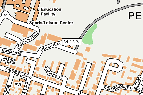
BN10 8LW is located in the Peacehaven West electoral ward, within the local authority district of Lewes and the English Parliamentary constituency of Brighton, Kemptown. The Sub Integrated Care Board (ICB) Location is NHS Sussex ICB - 97R and the police force is Sussex. This postcode has been in use since July 1990.


GetTheData
Source: OS OpenMap – Local (Ordnance Survey)
Source: OS VectorMap District (Ordnance Survey)
Licence: Open Government Licence (requires attribution)
| Easting | 541482 |
| Northing | 101335 |
| Latitude | 50.794314 |
| Longitude | 0.006108 |
GetTheData
Source: Open Postcode Geo
Licence: Open Government Licence
| Country | England |
| Postcode District | BN10 |
➜ See where BN10 is on a map ➜ Where is Peacehaven? | |
GetTheData
Source: Land Registry Price Paid Data
Licence: Open Government Licence
Elevation or altitude of BN10 8LW as distance above sea level:
| Metres | Feet | |
|---|---|---|
| Elevation | 40m | 131ft |
Elevation is measured from the approximate centre of the postcode, to the nearest point on an OS contour line from OS Terrain 50, which has contour spacing of ten vertical metres.
➜ How high above sea level am I? Find the elevation of your current position using your device's GPS.
GetTheData
Source: Open Postcode Elevation
Licence: Open Government Licence
| Ward | Peacehaven West |
| Constituency | Brighton, Kemptown |
GetTheData
Source: ONS Postcode Database
Licence: Open Government Licence
| Meridian Centre (Sutton Avenue) | Peacehaven | 465m |
| Bramber Avenue (South Coast Road) | Peacehaven | 483m |
| Bramber Avenue (South Coast Road) | Peacehaven | 484m |
| Mayfield Avenue (South Coast Road) | Peacehaven Heights | 488m |
| Slindon Avenue (South Coast Road) | Peacehaven Heights | 508m |
| Newhaven Town Station | 3.4km |
| Newhaven Harbour Station | 3.5km |
| Southease Station | 4.5km |
GetTheData
Source: NaPTAN
Licence: Open Government Licence
| Median download speed | 55.7Mbps |
| Average download speed | 49.0Mbps |
| Maximum download speed | 66.84Mbps |
| Median upload speed | 16.4Mbps |
| Average upload speed | 11.7Mbps |
| Maximum upload speed | 19.25Mbps |
GetTheData
Source: Ofcom
Licence: Ofcom Terms of Use (requires attribution)
Estimated total energy consumption in BN10 8LW by fuel type, 2015.
| Consumption (kWh) | 154,791 |
|---|---|
| Meter count | 6 |
| Mean (kWh/meter) | 25,798 |
| Median (kWh/meter) | 10,075 |
GetTheData
Source: Postcode level gas estimates: 2015 (experimental)
Source: Postcode level electricity estimates: 2015 (experimental)
Licence: Open Government Licence
GetTheData
Source: ONS Postcode Database
Licence: Open Government Licence


➜ Get more ratings from the Food Standards Agency
GetTheData
Source: Food Standards Agency
Licence: FSA terms & conditions
| Last Collection | |||
|---|---|---|---|
| Location | Mon-Fri | Sat | Distance |
| Meridian Centre | 18:15 | 11:45 | 415m |
| Firle Road | 16:15 | 11:15 | 734m |
| The Annexe | 16:15 | 11:15 | 769m |
GetTheData
Source: Dracos
Licence: Creative Commons Attribution-ShareAlike
The below table lists the International Territorial Level (ITL) codes (formerly Nomenclature of Territorial Units for Statistics (NUTS) codes) and Local Administrative Units (LAU) codes for BN10 8LW:
| ITL 1 Code | Name |
|---|---|
| TLJ | South East (England) |
| ITL 2 Code | Name |
| TLJ2 | Surrey, East and West Sussex |
| ITL 3 Code | Name |
| TLJ22 | East Sussex CC |
| LAU 1 Code | Name |
| E07000063 | Lewes |
GetTheData
Source: ONS Postcode Directory
Licence: Open Government Licence
The below table lists the Census Output Area (OA), Lower Layer Super Output Area (LSOA), and Middle Layer Super Output Area (MSOA) for BN10 8LW:
| Code | Name | |
|---|---|---|
| OA | E00106958 | |
| LSOA | E01021058 | Lewes 010A |
| MSOA | E02004388 | Lewes 010 |
GetTheData
Source: ONS Postcode Directory
Licence: Open Government Licence
| BN10 8JW | Damon Close | 94m |
| BN10 8HD | Capel Avenue | 111m |
| BN10 8JY | Rayford Close | 112m |
| BN10 8HL | Steyning Avenue | 161m |
| BN10 8HH | Arundel Road | 164m |
| BN10 8HE | Arundel Road | 167m |
| BN10 8EX | Keymer Avenue | 184m |
| BN10 8LF | Steyning Avenue | 207m |
| BN10 8EY | Arundel Road | 243m |
| BN10 8DH | Bramber Close | 248m |
GetTheData
Source: Open Postcode Geo; Land Registry Price Paid Data
Licence: Open Government Licence