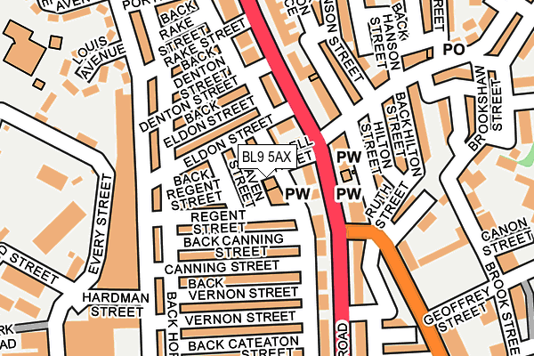
BL9 5AX is located in the Moorside electoral ward, within the metropolitan district of Bury and the English Parliamentary constituency of Bury North. The Sub Integrated Care Board (ICB) Location is NHS Greater Manchester ICB - 00V and the police force is Greater Manchester. This postcode has been in use since June 1996.


GetTheData
Source: OS OpenMap – Local (Ordnance Survey)
Source: OS VectorMap District (Ordnance Survey)
Licence: Open Government Licence (requires attribution)
| Easting | 380832 |
| Northing | 411677 |
| Latitude | 53.601304 |
| Longitude | -2.291124 |
GetTheData
Source: Open Postcode Geo
Licence: Open Government Licence
| Country | England |
| Postcode District | BL9 |
➜ See where BL9 is on a map ➜ Where is Bury? | |
GetTheData
Source: Land Registry Price Paid Data
Licence: Open Government Licence
Elevation or altitude of BL9 5AX as distance above sea level:
| Metres | Feet | |
|---|---|---|
| Elevation | 100m | 328ft |
Elevation is measured from the approximate centre of the postcode, to the nearest point on an OS contour line from OS Terrain 50, which has contour spacing of ten vertical metres.
➜ How high above sea level am I? Find the elevation of your current position using your device's GPS.
GetTheData
Source: Open Postcode Elevation
Licence: Open Government Licence
| Ward | Moorside |
| Constituency | Bury North |
GetTheData
Source: ONS Postcode Database
Licence: Open Government Licence
| Walmersley Rd/Chesham Rd (Walmersley Rd) | Fernhill | 73m |
| Walmersley Rd/Chesham Rd (Walmersley Rd) | Fernhill | 105m |
| Chesham Rd/Hilton St (Chesham Road) | Fernhill | 119m |
| Hornby St/Eldon St (Hornby St) | Fernhill | 136m |
| Chesham Rd/Walmersley Rd (Chesham Rd) | Fernhill | 137m |
| Bury Bolton Street (East Lancashire Railway) | Bury | 1,034m |
| Bury (Manchester Metrolink) (The Haymarket) | Bury | 1,217m |
GetTheData
Source: NaPTAN
Licence: Open Government Licence
GetTheData
Source: ONS Postcode Database
Licence: Open Government Licence


➜ Get more ratings from the Food Standards Agency
GetTheData
Source: Food Standards Agency
Licence: FSA terms & conditions
| Last Collection | |||
|---|---|---|---|
| Location | Mon-Fri | Sat | Distance |
| Hornby Buildings | 18:30 | 11:00 | 754m |
| Bolton Street Station | 18:40 | 11:20 | 1,050m |
| Brandle Avenue | 18:30 | 11:10 | 1,300m |
GetTheData
Source: Dracos
Licence: Creative Commons Attribution-ShareAlike
The below table lists the International Territorial Level (ITL) codes (formerly Nomenclature of Territorial Units for Statistics (NUTS) codes) and Local Administrative Units (LAU) codes for BL9 5AX:
| ITL 1 Code | Name |
|---|---|
| TLD | North West (England) |
| ITL 2 Code | Name |
| TLD3 | Greater Manchester |
| ITL 3 Code | Name |
| TLD37 | Greater Manchester North East |
| LAU 1 Code | Name |
| E08000002 | Bury |
GetTheData
Source: ONS Postcode Directory
Licence: Open Government Licence
The below table lists the Census Output Area (OA), Lower Layer Super Output Area (LSOA), and Middle Layer Super Output Area (MSOA) for BL9 5AX:
| Code | Name | |
|---|---|---|
| OA | E00025209 | |
| LSOA | E01004979 | Bury 008C |
| MSOA | E02001026 | Bury 008 |
GetTheData
Source: ONS Postcode Directory
Licence: Open Government Licence
| BL9 5AU | Raven Street | 34m |
| BL9 5AY | Walmersley Road | 47m |
| BL9 5AT | Regent Street | 71m |
| BL9 5AZ | Eldon Street | 81m |
| BL9 5EJ | Denton Street | 104m |
| BL9 5AS | Canning Street | 120m |
| BL9 6EE | St Marks Square | 128m |
| BL9 6LU | Ruth Street | 128m |
| BL9 6LL | Walmersley Road | 130m |
| BL9 5BA | Hornby Street | 136m |
GetTheData
Source: Open Postcode Geo; Land Registry Price Paid Data
Licence: Open Government Licence