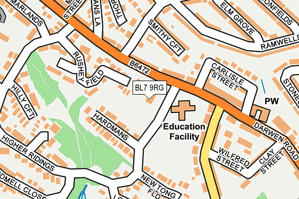
BL7 9RG is located in the Bromley Cross electoral ward, within the metropolitan district of Bolton and the English Parliamentary constituency of Bolton North East. The Sub Integrated Care Board (ICB) Location is NHS Greater Manchester ICB - 00T and the police force is Greater Manchester. This postcode has been in use since July 1983.


GetTheData
Source: OS OpenMap – Local (Ordnance Survey)
Source: OS VectorMap District (Ordnance Survey)
Licence: Open Government Licence (requires attribution)
| Easting | 371892 |
| Northing | 413534 |
| Latitude | 53.617589 |
| Longitude | -2.426383 |
GetTheData
Source: Open Postcode Geo
Licence: Open Government Licence
| Country | England |
| Postcode District | BL7 |
➜ See where BL7 is on a map ➜ Where is Bolton? | |
GetTheData
Source: Land Registry Price Paid Data
Licence: Open Government Licence
Elevation or altitude of BL7 9RG as distance above sea level:
| Metres | Feet | |
|---|---|---|
| Elevation | 150m | 492ft |
Elevation is measured from the approximate centre of the postcode, to the nearest point on an OS contour line from OS Terrain 50, which has contour spacing of ten vertical metres.
➜ How high above sea level am I? Find the elevation of your current position using your device's GPS.
GetTheData
Source: Open Postcode Elevation
Licence: Open Government Licence
| Ward | Bromley Cross |
| Constituency | Bolton North East |
GetTheData
Source: ONS Postcode Database
Licence: Open Government Licence
| Darwen Road/Hospital Road (Darwen Road) | Eagley | 55m |
| Darwen Road/Hospital Road (Darwen Road) | Eagley | 111m |
| Darwen Road/Hough Lane (Darwen Road) | Eagley | 162m |
| Darwen Road/Hough Lane (Darwen Road) | Eagley | 173m |
| Hospital Road (W Bnd) (Hospital Road) | Cox Green | 267m |
| Bromley Cross Station | 1.1km |
| Hall i' th' Wood Station | 2.4km |
| Entwistle Station | 4.3km |
GetTheData
Source: NaPTAN
Licence: Open Government Licence
GetTheData
Source: ONS Postcode Database
Licence: Open Government Licence


➜ Get more ratings from the Food Standards Agency
GetTheData
Source: Food Standards Agency
Licence: FSA terms & conditions
| Last Collection | |||
|---|---|---|---|
| Location | Mon-Fri | Sat | Distance |
| Last Drop (Village) | 17:30 | 07:15 | 420m |
| Toppings | 17:30 | 12:15 | 551m |
| Bromley Cross P O | 18:45 | 12:15 | 669m |
GetTheData
Source: Dracos
Licence: Creative Commons Attribution-ShareAlike
The below table lists the International Territorial Level (ITL) codes (formerly Nomenclature of Territorial Units for Statistics (NUTS) codes) and Local Administrative Units (LAU) codes for BL7 9RG:
| ITL 1 Code | Name |
|---|---|
| TLD | North West (England) |
| ITL 2 Code | Name |
| TLD3 | Greater Manchester |
| ITL 3 Code | Name |
| TLD36 | Greater Manchester North West |
| LAU 1 Code | Name |
| E08000001 | Bolton |
GetTheData
Source: ONS Postcode Directory
Licence: Open Government Licence
The below table lists the Census Output Area (OA), Lower Layer Super Output Area (LSOA), and Middle Layer Super Output Area (MSOA) for BL7 9RG:
| Code | Name | |
|---|---|---|
| OA | E00024364 | |
| LSOA | E01004809 | Bolton 003E |
| MSOA | E02000986 | Bolton 003 |
GetTheData
Source: ONS Postcode Directory
Licence: Open Government Licence
| BL7 9JD | Darwen Road | 67m |
| BL7 9JH | Back Darwen Road | 76m |
| BL7 9JE | Blair Street | 113m |
| BL7 9XR | Hardmans | 114m |
| BL7 9DA | Hough Lane | 125m |
| BL7 9HQ | Rushey Field | 129m |
| BL7 9JB | Smithy Croft | 136m |
| BL7 9BZ | Darwen Road | 141m |
| BL7 9XS | Higher Ridings | 157m |
| BL7 9JF | Carlisle Street | 163m |
GetTheData
Source: Open Postcode Geo; Land Registry Price Paid Data
Licence: Open Government Licence