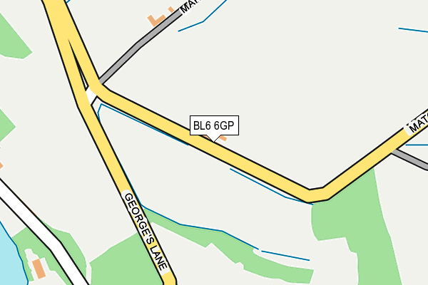
BL6 6GP is located in the Horwich North electoral ward, within the metropolitan district of Bolton and the English Parliamentary constituency of Bolton West. The Sub Integrated Care Board (ICB) Location is NHS Greater Manchester ICB - 00T and the police force is Greater Manchester. This postcode has been in use since April 2017.


GetTheData
Source: OS OpenMap – Local (Ordnance Survey)
Source: OS VectorMap District (Ordnance Survey)
Licence: Open Government Licence (requires attribution)
| Easting | 365993 |
| Northing | 411676 |
| Latitude | 53.600555 |
| Longitude | -2.515350 |
GetTheData
Source: Open Postcode Geo
Licence: Open Government Licence
| Country | England |
| Postcode District | BL6 |
➜ See where BL6 is on a map | |
GetTheData
Source: Land Registry Price Paid Data
Licence: Open Government Licence
| Ward | Horwich North |
| Constituency | Bolton West |
GetTheData
Source: ONS Postcode Database
Licence: Open Government Licence
| Chorley Old Road/Georges Lane (Chorley Old Rd) | Bottom O'th' Moor | 322m |
| Chorley Old Road/Georges Lane (Chorley Old Rd) | Bottom O'th' Moor | 340m |
| Chorley Old Road/Ridgemont Close (Chorley Old Rd) | Wallsuches | 404m |
| Chorley Old Road/Ridgemont Close (Chorley Old Rd) | Wallsuches | 407m |
| Chorley Old Road/Bottom O'th' Moor (Chorley Old Rd) | Bottom O'th' Moor | 584m |
| Horwich Parkway Station | 3km |
| Lostock Station | 3.4km |
| Blackrod Station | 3.7km |
GetTheData
Source: NaPTAN
Licence: Open Government Licence
GetTheData
Source: ONS Postcode Database
Licence: Open Government Licence


➜ Get more ratings from the Food Standards Agency
GetTheData
Source: Food Standards Agency
Licence: FSA terms & conditions
| Last Collection | |||
|---|---|---|---|
| Location | Mon-Fri | Sat | Distance |
| Chapel Lane Post Office | 17:00 | 11:15 | 346m |
| Hartshouses | 14:35 | 07:45 | 1,354m |
| Lower Brazeley P O | 17:15 | 12:10 | 1,717m |
GetTheData
Source: Dracos
Licence: Creative Commons Attribution-ShareAlike
The below table lists the International Territorial Level (ITL) codes (formerly Nomenclature of Territorial Units for Statistics (NUTS) codes) and Local Administrative Units (LAU) codes for BL6 6GP:
| ITL 1 Code | Name |
|---|---|
| TLD | North West (England) |
| ITL 2 Code | Name |
| TLD3 | Greater Manchester |
| ITL 3 Code | Name |
| TLD36 | Greater Manchester North West |
| LAU 1 Code | Name |
| E08000001 | Bolton |
GetTheData
Source: ONS Postcode Directory
Licence: Open Government Licence
The below table lists the Census Output Area (OA), Lower Layer Super Output Area (LSOA), and Middle Layer Super Output Area (MSOA) for BL6 6GP:
| Code | Name | |
|---|---|---|
| OA | E00024724 | |
| LSOA | E01004884 | Bolton 007E |
| MSOA | E02000990 | Bolton 007 |
GetTheData
Source: ONS Postcode Directory
Licence: Open Government Licence
| BL6 6PP | Top Oth'wallsuches | 290m |
| BL6 6QH | Bottom O Th Moor | 373m |
| BL6 6QS | New Chapel Lane | 389m |
| BL6 6PS | Chorley Old Road | 412m |
| BL6 6RP | Greenway | 417m |
| BL6 6NZ | Barncroft Drive | 443m |
| BL6 6QG | Nevy Fold Avenue | 484m |
| BL6 6RG | Ridgmont Close | 494m |
| BL6 6QY | New Chapel Lane | 497m |
| BL6 6RR | Ridgmont Drive | 501m |
GetTheData
Source: Open Postcode Geo; Land Registry Price Paid Data
Licence: Open Government Licence