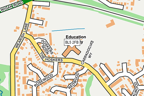
BL5 2FB is located in the Westhoughton South electoral ward, within the metropolitan district of Bolton and the English Parliamentary constituency of Bolton West. The Sub Integrated Care Board (ICB) Location is NHS Greater Manchester ICB - 00T and the police force is Greater Manchester. This postcode has been in use since June 1996.


GetTheData
Source: OS OpenMap – Local (Ordnance Survey)
Source: OS VectorMap District (Ordnance Survey)
Licence: Open Government Licence (requires attribution)
| Easting | 364640 |
| Northing | 405071 |
| Latitude | 53.541084 |
| Longitude | -2.535045 |
GetTheData
Source: Open Postcode Geo
Licence: Open Government Licence
| Country | England |
| Postcode District | BL5 |
➜ See where BL5 is on a map ➜ Where is Westhoughton? | |
GetTheData
Source: Land Registry Price Paid Data
Licence: Open Government Licence
Elevation or altitude of BL5 2FB as distance above sea level:
| Metres | Feet | |
|---|---|---|
| Elevation | 80m | 262ft |
Elevation is measured from the approximate centre of the postcode, to the nearest point on an OS contour line from OS Terrain 50, which has contour spacing of ten vertical metres.
➜ How high above sea level am I? Find the elevation of your current position using your device's GPS.
GetTheData
Source: Open Postcode Elevation
Licence: Open Government Licence
| Ward | Westhoughton South |
| Constituency | Bolton West |
GetTheData
Source: ONS Postcode Database
Licence: Open Government Licence
| The Hoskers/Redwood (The Hoskers) | Hosker's Nook | 71m |
| Wearish Lane (Wearish Ln) | Hosker's Nook | 228m |
| Wigan Road/Wearish Lane (Wigan Road) | Dobb Brow | 287m |
| Wigan Road/Dobb Brow Road (Wigan Road) | Dobb Brow | 308m |
| Wigan Road/Dobb Brow Road (Wigan Road) | Dobb Brow | 321m |
| Daisy Hill Station | 1.3km |
| Westhoughton Station | 1.8km |
| Hindley Station | 2.7km |
GetTheData
Source: NaPTAN
Licence: Open Government Licence
GetTheData
Source: ONS Postcode Database
Licence: Open Government Licence


➜ Get more ratings from the Food Standards Agency
GetTheData
Source: Food Standards Agency
Licence: FSA terms & conditions
| Last Collection | |||
|---|---|---|---|
| Location | Mon-Fri | Sat | Distance |
| 13 Wearish Lane | 17:10 | 11:40 | 208m |
| Sanderlings | 17:10 | 11:45 | 365m |
| 113 Southfield Drive | 16:50 | 11:25 | 933m |
GetTheData
Source: Dracos
Licence: Creative Commons Attribution-ShareAlike
The below table lists the International Territorial Level (ITL) codes (formerly Nomenclature of Territorial Units for Statistics (NUTS) codes) and Local Administrative Units (LAU) codes for BL5 2FB:
| ITL 1 Code | Name |
|---|---|
| TLD | North West (England) |
| ITL 2 Code | Name |
| TLD3 | Greater Manchester |
| ITL 3 Code | Name |
| TLD36 | Greater Manchester North West |
| LAU 1 Code | Name |
| E08000001 | Bolton |
GetTheData
Source: ONS Postcode Directory
Licence: Open Government Licence
The below table lists the Census Output Area (OA), Lower Layer Super Output Area (LSOA), and Middle Layer Super Output Area (MSOA) for BL5 2FB:
| Code | Name | |
|---|---|---|
| OA | E00024971 | |
| LSOA | E01004937 | Bolton 035D |
| MSOA | E02001018 | Bolton 035 |
GetTheData
Source: ONS Postcode Directory
Licence: Open Government Licence
| BL5 2DW | The Hoskers | 82m |
| BL5 2RS | Hoskers Nook | 96m |
| BL5 2AU | Oakhurst Grove | 157m |
| BL5 2RT | Bellwood | 165m |
| BL5 2RU | Redwood | 180m |
| BL5 2AN | Cunningham Road | 208m |
| BL5 2AW | Wearish Lane | 222m |
| BL5 2RX | Rosewood | 225m |
| BL5 2AX | Wearish Lane | 227m |
| BL5 2RW | Sandalwood | 266m |
GetTheData
Source: Open Postcode Geo; Land Registry Price Paid Data
Licence: Open Government Licence