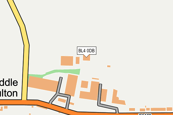
BL4 0DB is located in the Hulton electoral ward, within the metropolitan district of Bolton and the English Parliamentary constituency of Bolton South East. The Sub Integrated Care Board (ICB) Location is NHS Greater Manchester ICB - 00T and the police force is Greater Manchester. This postcode has been in use since April 2010.


GetTheData
Source: OS OpenMap – Local (Ordnance Survey)
Source: OS VectorMap District (Ordnance Survey)
Licence: Open Government Licence (requires attribution)
| Easting | 369990 |
| Northing | 406151 |
| Latitude | 53.551141 |
| Longitude | -2.454420 |
GetTheData
Source: Open Postcode Geo
Licence: Open Government Licence
| Country | England |
| Postcode District | BL4 |
➜ See where BL4 is on a map ➜ Where is Middle Hulton? | |
GetTheData
Source: Land Registry Price Paid Data
Licence: Open Government Licence
Elevation or altitude of BL4 0DB as distance above sea level:
| Metres | Feet | |
|---|---|---|
| Elevation | 150m | 492ft |
Elevation is measured from the approximate centre of the postcode, to the nearest point on an OS contour line from OS Terrain 50, which has contour spacing of ten vertical metres.
➜ How high above sea level am I? Find the elevation of your current position using your device's GPS.
GetTheData
Source: Open Postcode Elevation
Licence: Open Government Licence
| Ward | Hulton |
| Constituency | Bolton South East |
GetTheData
Source: ONS Postcode Database
Licence: Open Government Licence
| Plodder Lane/Watergate Lane (Plodder Lane) | Hulton Lane Ends | 195m |
| Plodder Lane/Watergate Lane (Plodder Lane) | Hulton Lane Ends | 200m |
| Sapling Road/Smethurst Lane (Sapling Road) | Morris Green | 587m |
| Sapling Road/Smethurst Lane (Sapling Road) | Morris Green | 588m |
| Smethurst Lane (Nwbnd) (Smethurst Lane) | Morris Green | 592m |
| Atherton Station | 2.9km |
| Bolton Station | 3.2km |
| Hag Fold Station | 3.3km |
GetTheData
Source: NaPTAN
Licence: Open Government Licence
GetTheData
Source: ONS Postcode Database
Licence: Open Government Licence


➜ Get more ratings from the Food Standards Agency
GetTheData
Source: Food Standards Agency
Licence: FSA terms & conditions
| Last Collection | |||
|---|---|---|---|
| Location | Mon-Fri | Sat | Distance |
| Higher Swan Lane | 17:30 | 11:30 | 1,718m |
| Lever Street Little Lever | 17:30 | 11:05 | 1,902m |
| Great Lever P O | 18:30 | 11:40 | 1,973m |
GetTheData
Source: Dracos
Licence: Creative Commons Attribution-ShareAlike
The below table lists the International Territorial Level (ITL) codes (formerly Nomenclature of Territorial Units for Statistics (NUTS) codes) and Local Administrative Units (LAU) codes for BL4 0DB:
| ITL 1 Code | Name |
|---|---|
| TLD | North West (England) |
| ITL 2 Code | Name |
| TLD3 | Greater Manchester |
| ITL 3 Code | Name |
| TLD36 | Greater Manchester North West |
| LAU 1 Code | Name |
| E08000001 | Bolton |
GetTheData
Source: ONS Postcode Directory
Licence: Open Government Licence
The below table lists the Census Output Area (OA), Lower Layer Super Output Area (LSOA), and Middle Layer Super Output Area (MSOA) for BL4 0DB:
| Code | Name | |
|---|---|---|
| OA | E00024480 | |
| LSOA | E01004833 | Bolton 026C |
| MSOA | E02001009 | Bolton 026 |
GetTheData
Source: ONS Postcode Directory
Licence: Open Government Licence
| BL4 0LW | Edge Fold | 166m |
| BL5 1AN | Plodder Lane | 297m |
| BL4 0LN | Plodder Lane | 451m |
| BL5 1AW | Plodder Lane | 510m |
| BL3 3RY | Eastmoor Grove | 539m |
| BL3 3QJ | Smethurst Lane | 546m |
| BL5 1AJ | Plodder Lane | 561m |
| BL3 3QG | Sapling Road | 602m |
| BL3 3RU | Heathfield Drive | 609m |
| BL4 0LJ | Slack Fold Lane | 613m |
GetTheData
Source: Open Postcode Geo; Land Registry Price Paid Data
Licence: Open Government Licence