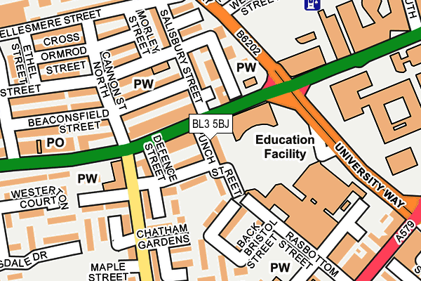
BL3 5BJ is located in the Rumworth electoral ward, within the metropolitan district of Bolton and the English Parliamentary constituency of Bolton South East. The Sub Integrated Care Board (ICB) Location is NHS Greater Manchester ICB - 00T and the police force is Greater Manchester. This postcode has been in use since January 1983.


GetTheData
Source: OS OpenMap – Local (Ordnance Survey)
Source: OS VectorMap District (Ordnance Survey)
Licence: Open Government Licence (requires attribution)
| Easting | 370919 |
| Northing | 408589 |
| Latitude | 53.573090 |
| Longitude | -2.440628 |
GetTheData
Source: Open Postcode Geo
Licence: Open Government Licence
| Country | England |
| Postcode District | BL3 |
➜ See where BL3 is on a map ➜ Where is Bolton? | |
GetTheData
Source: Land Registry Price Paid Data
Licence: Open Government Licence
Elevation or altitude of BL3 5BJ as distance above sea level:
| Metres | Feet | |
|---|---|---|
| Elevation | 100m | 328ft |
Elevation is measured from the approximate centre of the postcode, to the nearest point on an OS contour line from OS Terrain 50, which has contour spacing of ten vertical metres.
➜ How high above sea level am I? Find the elevation of your current position using your device's GPS.
GetTheData
Source: Open Postcode Elevation
Licence: Open Government Licence
| Ward | Rumworth |
| Constituency | Bolton South East |
GetTheData
Source: ONS Postcode Database
Licence: Open Government Licence
| Deane Road/College Way (Deane Road) | Gilnow | 29m |
| Deane Road/College Way (Deane Road) | Gilnow | 55m |
| Deane Road/Cannon Street (Deane Road) | Gilnow | 113m |
| Cannon Street/Chatham Gardens (Cannon Street) | Gilnow | 145m |
| Cannon Street/Chatham Gardens (Cannon Street) | Gilnow | 158m |
| Bolton Station | 1km |
| Moses Gate Station | 3.2km |
| Hall i' th' Wood Station | 3.3km |
GetTheData
Source: NaPTAN
Licence: Open Government Licence
GetTheData
Source: ONS Postcode Database
Licence: Open Government Licence


➜ Get more ratings from the Food Standards Agency
GetTheData
Source: Food Standards Agency
Licence: FSA terms & conditions
| Last Collection | |||
|---|---|---|---|
| Location | Mon-Fri | Sat | Distance |
| Spa Road | 17:15 | 11:05 | 431m |
| Raikes Lane Ind Estate | 18:30 | 12:20 | 521m |
| Blackshaw Lane | 16:45 | 11:25 | 721m |
GetTheData
Source: Dracos
Licence: Creative Commons Attribution-ShareAlike
The below table lists the International Territorial Level (ITL) codes (formerly Nomenclature of Territorial Units for Statistics (NUTS) codes) and Local Administrative Units (LAU) codes for BL3 5BJ:
| ITL 1 Code | Name |
|---|---|
| TLD | North West (England) |
| ITL 2 Code | Name |
| TLD3 | Greater Manchester |
| ITL 3 Code | Name |
| TLD36 | Greater Manchester North West |
| LAU 1 Code | Name |
| E08000001 | Bolton |
GetTheData
Source: ONS Postcode Directory
Licence: Open Government Licence
The below table lists the Census Output Area (OA), Lower Layer Super Output Area (LSOA), and Middle Layer Super Output Area (MSOA) for BL3 5BJ:
| Code | Name | |
|---|---|---|
| OA | E00024540 | |
| LSOA | E01004849 | Bolton 021B |
| MSOA | E02001004 | Bolton 021 |
GetTheData
Source: ONS Postcode Directory
Licence: Open Government Licence
| BL3 5AG | Deane Road | 25m |
| BL3 5AJ | Stanway Avenue | 47m |
| BL3 5DL | Deane Road | 68m |
| BL3 5AL | Evesham Close | 71m |
| BL3 5DU | Mayor Street | 77m |
| BL3 5AH | Deane Road | 100m |
| BL3 5DW | Beaconsfield Street | 117m |
| BL3 5AZ | Evesham Walk | 119m |
| BL3 5AY | Garfield Grove | 139m |
| BL3 5DY | Gibraltar Street | 141m |
GetTheData
Source: Open Postcode Geo; Land Registry Price Paid Data
Licence: Open Government Licence