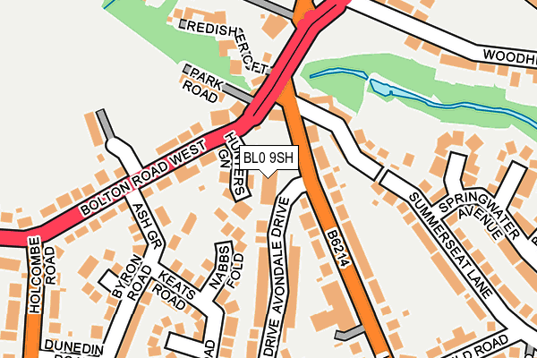
BL0 9SH is located in the North Manor electoral ward, within the metropolitan district of Bury and the English Parliamentary constituency of Bury North. The Sub Integrated Care Board (ICB) Location is NHS Greater Manchester ICB - 00V and the police force is Greater Manchester. This postcode has been in use since January 1980.


GetTheData
Source: OS OpenMap – Local (Ordnance Survey)
Source: OS VectorMap District (Ordnance Survey)
Licence: Open Government Licence (requires attribution)
| Easting | 377969 |
| Northing | 415150 |
| Latitude | 53.632422 |
| Longitude | -2.334632 |
GetTheData
Source: Open Postcode Geo
Licence: Open Government Licence
| Country | England |
| Postcode District | BL0 |
➜ See where BL0 is on a map ➜ Where is Ramsbottom? | |
GetTheData
Source: Land Registry Price Paid Data
Licence: Open Government Licence
Elevation or altitude of BL0 9SH as distance above sea level:
| Metres | Feet | |
|---|---|---|
| Elevation | 160m | 525ft |
Elevation is measured from the approximate centre of the postcode, to the nearest point on an OS contour line from OS Terrain 50, which has contour spacing of ten vertical metres.
➜ How high above sea level am I? Find the elevation of your current position using your device's GPS.
GetTheData
Source: Open Postcode Elevation
Licence: Open Government Licence
| Ward | North Manor |
| Constituency | Bury North |
GetTheData
Source: ONS Postcode Database
Licence: Open Government Licence
| Longsight Rd/Avondale Dr (Longsight Rd) | Holcombe Brook | 62m |
| Longsight Rd/Avondale Dr (Longsight Rd) | Holcombe Brook | 93m |
| Bolton Rd West/Hare & Hounds (Bolton Rd West) | Holcombe Brook | 145m |
| Bolton Rd West/Ash Gr (Bolton Rd West) | Holcombe Brook | 170m |
| Bolton Rd West/Ash Gr (Bolton Rd West) | Holcombe Brook | 182m |
GetTheData
Source: NaPTAN
Licence: Open Government Licence
GetTheData
Source: ONS Postcode Database
Licence: Open Government Licence


➜ Get more ratings from the Food Standards Agency
GetTheData
Source: Food Standards Agency
Licence: FSA terms & conditions
| Last Collection | |||
|---|---|---|---|
| Location | Mon-Fri | Sat | Distance |
| Chiltern Road | 18:30 | 11:15 | 1,450m |
| Nuttall Lane P O | 18:35 | 11:00 | 1,487m |
| Spring Street | 17:40 | 11:05 | 1,696m |
GetTheData
Source: Dracos
Licence: Creative Commons Attribution-ShareAlike
The below table lists the International Territorial Level (ITL) codes (formerly Nomenclature of Territorial Units for Statistics (NUTS) codes) and Local Administrative Units (LAU) codes for BL0 9SH:
| ITL 1 Code | Name |
|---|---|
| TLD | North West (England) |
| ITL 2 Code | Name |
| TLD3 | Greater Manchester |
| ITL 3 Code | Name |
| TLD37 | Greater Manchester North East |
| LAU 1 Code | Name |
| E08000002 | Bury |
GetTheData
Source: ONS Postcode Directory
Licence: Open Government Licence
The below table lists the Census Output Area (OA), Lower Layer Super Output Area (LSOA), and Middle Layer Super Output Area (MSOA) for BL0 9SH:
| Code | Name | |
|---|---|---|
| OA | E00025536 | |
| LSOA | E01005048 | Bury 002D |
| MSOA | E02001020 | Bury 002 |
GetTheData
Source: ONS Postcode Directory
Licence: Open Government Licence
| BL0 9TH | Hunters Green | 48m |
| BL0 9RN | Bolton Road West | 83m |
| BL0 9RY | Bolton Road West | 83m |
| BL0 9SL | Longsight Road | 93m |
| BL0 9RW | Ivy Street | 98m |
| BL8 4EH | Nabbs Fold | 98m |
| BL0 9RG | Pot Green | 103m |
| BL0 9TD | Longsight Road | 123m |
| BL0 9RZ | Park Road | 124m |
| BL0 9RS | Ash Grove | 125m |
GetTheData
Source: Open Postcode Geo; Land Registry Price Paid Data
Licence: Open Government Licence