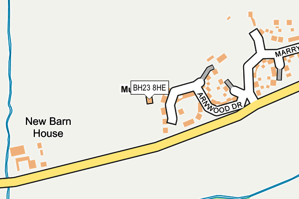
BH23 8HE is located in the Bransgore, Burley, Sopley & Ringwood East electoral ward, within the local authority district of New Forest and the English Parliamentary constituency of New Forest West. The Sub Integrated Care Board (ICB) Location is NHS Hampshire and Isle of Wight ICB - D9Y0V and the police force is Hampshire. This postcode has been in use since April 2017.


GetTheData
Source: OS OpenMap – Local (Ordnance Survey)
Source: OS VectorMap District (Ordnance Survey)
Licence: Open Government Licence (requires attribution)
| Easting | 417461 |
| Northing | 97948 |
| Latitude | 50.780837 |
| Longitude | -1.753691 |
GetTheData
Source: Open Postcode Geo
Licence: Open Government Licence
| Country | England |
| Postcode District | BH23 |
➜ See where BH23 is on a map ➜ Where is Bransgore? | |
GetTheData
Source: Land Registry Price Paid Data
Licence: Open Government Licence
| Ward | Bransgore, Burley, Sopley & Ringwood East |
| Constituency | New Forest West |
GetTheData
Source: ONS Postcode Database
Licence: Open Government Licence
| New Barn Farm (Derritt Lane) | Bransgore | 287m |
| New Barn Farm (Derritt Lane) | Bransgore | 288m |
| Burley Road | North Bockhampton | 710m |
| Burley Road | North Bockhampton | 716m |
| Bockhampton Corner (Burley Road) | Bransgore | 805m |
| Hinton Admiral Station | 4.2km |
| Christchurch Station | 5.2km |
GetTheData
Source: NaPTAN
Licence: Open Government Licence
GetTheData
Source: ONS Postcode Database
Licence: Open Government Licence

➜ Get more ratings from the Food Standards Agency
GetTheData
Source: Food Standards Agency
Licence: FSA terms & conditions
| Last Collection | |||
|---|---|---|---|
| Location | Mon-Fri | Sat | Distance |
| Lower Bransgore | 16:00 | 09:45 | 937m |
| Bransgore Road | 16:45 | 11:30 | 1,256m |
| Elmers Way | 16:30 | 09:00 | 1,427m |
GetTheData
Source: Dracos
Licence: Creative Commons Attribution-ShareAlike
The below table lists the International Territorial Level (ITL) codes (formerly Nomenclature of Territorial Units for Statistics (NUTS) codes) and Local Administrative Units (LAU) codes for BH23 8HE:
| ITL 1 Code | Name |
|---|---|
| TLJ | South East (England) |
| ITL 2 Code | Name |
| TLJ3 | Hampshire and Isle of Wight |
| ITL 3 Code | Name |
| TLJ36 | Central Hampshire |
| LAU 1 Code | Name |
| E07000091 | New Forest |
GetTheData
Source: ONS Postcode Directory
Licence: Open Government Licence
The below table lists the Census Output Area (OA), Lower Layer Super Output Area (LSOA), and Middle Layer Super Output Area (MSOA) for BH23 8HE:
| Code | Name | |
|---|---|---|
| OA | E00117198 | |
| LSOA | E01023063 | New Forest 016E |
| MSOA | E02004794 | New Forest 016 |
GetTheData
Source: ONS Postcode Directory
Licence: Open Government Licence
| BH23 8AX | Derritt Lane | 267m |
| BH23 8BJ | Wiltshire Gardens | 560m |
| BH23 8BH | Wiltshire Road | 561m |
| BH23 8AT | Derritt Lane | 581m |
| BH23 8BS | Merryfield Close | 619m |
| BH23 8EN | West Lane | 635m |
| BH23 8HJ | Wiltshire Road | 677m |
| BH23 8AR | Derritt Lane | 684m |
| BH23 8BE | West Road | 698m |
| BH23 8FB | Foxgloves | 700m |
GetTheData
Source: Open Postcode Geo; Land Registry Price Paid Data
Licence: Open Government Licence