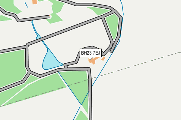
BH23 7EJ is located in the Bransgore, Burley, Sopley & Ringwood East electoral ward, within the local authority district of New Forest and the English Parliamentary constituency of New Forest West. The Sub Integrated Care Board (ICB) Location is NHS Hampshire and Isle of Wight ICB - D9Y0V and the police force is Hampshire. This postcode has been in use since December 1998.


GetTheData
Source: OS OpenMap – Local (Ordnance Survey)
Source: OS VectorMap District (Ordnance Survey)
Licence: Open Government Licence (requires attribution)
| Easting | 421913 |
| Northing | 95348 |
| Latitude | 50.757318 |
| Longitude | -1.690706 |
GetTheData
Source: Open Postcode Geo
Licence: Open Government Licence
| Country | England |
| Postcode District | BH23 |
➜ See where BH23 is on a map | |
GetTheData
Source: Land Registry Price Paid Data
Licence: Open Government Licence
Elevation or altitude of BH23 7EJ as distance above sea level:
| Metres | Feet | |
|---|---|---|
| Elevation | 40m | 131ft |
Elevation is measured from the approximate centre of the postcode, to the nearest point on an OS contour line from OS Terrain 50, which has contour spacing of ten vertical metres.
➜ How high above sea level am I? Find the elevation of your current position using your device's GPS.
GetTheData
Source: Open Postcode Elevation
Licence: Open Government Licence
| Ward | Bransgore, Burley, Sopley & Ringwood East |
| Constituency | New Forest West |
GetTheData
Source: ONS Postcode Database
Licence: Open Government Licence
| Walkford Hotel (Walkford Road) | Walkford | 806m |
| Chewton Farm Road (Walkford Road) | Walkford | 832m |
| Chewton Farm Road (Walkford Road) | Walkford | 868m |
| Dark Lane (A35 Lyndhurst Road) | Hinton | 868m |
| Walkford Hotel (Walkford Road) | Walkford | 882m |
| Hinton Admiral Station | 1.7km |
| New Milton Station | 2.3km |
GetTheData
Source: NaPTAN
Licence: Open Government Licence
GetTheData
Source: ONS Postcode Database
Licence: Open Government Licence


➜ Get more ratings from the Food Standards Agency
GetTheData
Source: Food Standards Agency
Licence: FSA terms & conditions
| Last Collection | |||
|---|---|---|---|
| Location | Mon-Fri | Sat | Distance |
| Walkford Road | 17:15 | 12:00 | 818m |
| Walkford P.o. | 17:00 | 12:00 | 917m |
| Chewton Farm Road | 17:15 | 12:00 | 1,028m |
GetTheData
Source: Dracos
Licence: Creative Commons Attribution-ShareAlike
The below table lists the International Territorial Level (ITL) codes (formerly Nomenclature of Territorial Units for Statistics (NUTS) codes) and Local Administrative Units (LAU) codes for BH23 7EJ:
| ITL 1 Code | Name |
|---|---|
| TLJ | South East (England) |
| ITL 2 Code | Name |
| TLJ3 | Hampshire and Isle of Wight |
| ITL 3 Code | Name |
| TLJ36 | Central Hampshire |
| LAU 1 Code | Name |
| E07000091 | New Forest |
GetTheData
Source: ONS Postcode Directory
Licence: Open Government Licence
The below table lists the Census Output Area (OA), Lower Layer Super Output Area (LSOA), and Middle Layer Super Output Area (MSOA) for BH23 7EJ:
| Code | Name | |
|---|---|---|
| OA | E00116842 | |
| LSOA | E01022996 | New Forest 016C |
| MSOA | E02004794 | New Forest 016 |
GetTheData
Source: ONS Postcode Directory
Licence: Open Government Licence
| BH23 7EA | Dark Lane | 410m |
| BH23 5QQ | Holly Lane | 638m |
| BH23 5FE | Forest View | 648m |
| BH23 5PU | Glenville Close | 683m |
| BH23 5QA | Broadlands Close | 690m |
| BH23 5QU | Hurst Close | 723m |
| BH23 5QF | Walkford Road | 734m |
| BH23 5SG | Plantation Drive | 739m |
| BH23 5QX | Wyndham Close | 745m |
| BH23 5PX | Glenville Road | 746m |
GetTheData
Source: Open Postcode Geo; Land Registry Price Paid Data
Licence: Open Government Licence