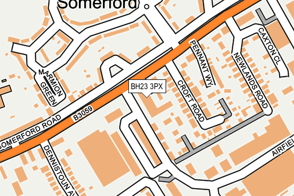
BH23 3PX is located in the Burton & Grange electoral ward, within the unitary authority of Bournemouth, Christchurch and Poole and the English Parliamentary constituency of Christchurch. The Sub Integrated Care Board (ICB) Location is NHS Dorset ICB - 11J and the police force is Dorset. This postcode has been in use since January 1980.


GetTheData
Source: OS OpenMap – Local (Ordnance Survey)
Source: OS VectorMap District (Ordnance Survey)
Licence: Open Government Licence (requires attribution)
| Easting | 417755 |
| Northing | 93228 |
| Latitude | 50.738395 |
| Longitude | -1.749755 |
GetTheData
Source: Open Postcode Geo
Licence: Open Government Licence
| Country | England |
| Postcode District | BH23 |
➜ See where BH23 is on a map ➜ Where is Christchurch? | |
GetTheData
Source: Land Registry Price Paid Data
Licence: Open Government Licence
Elevation or altitude of BH23 3PX as distance above sea level:
| Metres | Feet | |
|---|---|---|
| Elevation | 10m | 33ft |
Elevation is measured from the approximate centre of the postcode, to the nearest point on an OS contour line from OS Terrain 50, which has contour spacing of ten vertical metres.
➜ How high above sea level am I? Find the elevation of your current position using your device's GPS.
GetTheData
Source: Open Postcode Elevation
Licence: Open Government Licence
| Ward | Burton & Grange |
| Constituency | Christchurch |
GetTheData
Source: ONS Postcode Database
Licence: Open Government Licence
| Airfield Way (Somerford Road) | Somerford | 51m |
| Airfield Way (Somerford Road) | Somerford | 87m |
| Dennistoun Avenue (Somerford Road) | Somerford | 204m |
| Dennistoun Avenue (Somerford Road) | Somerford | 254m |
| Revvo Castor (Somerford Road) | Somerford | 285m |
| Christchurch Station | 2.5km |
| Hinton Admiral Station | 3km |
GetTheData
Source: NaPTAN
Licence: Open Government Licence
Estimated total energy consumption in BH23 3PX by fuel type, 2015.
| Consumption (kWh) | 58,050 |
|---|---|
| Meter count | 13 |
| Mean (kWh/meter) | 4,465 |
| Median (kWh/meter) | 4,139 |
GetTheData
Source: Postcode level gas estimates: 2015 (experimental)
Source: Postcode level electricity estimates: 2015 (experimental)
Licence: Open Government Licence
GetTheData
Source: ONS Postcode Database
Licence: Open Government Licence


➜ Get more ratings from the Food Standards Agency
GetTheData
Source: Food Standards Agency
Licence: FSA terms & conditions
| Last Collection | |||
|---|---|---|---|
| Location | Mon-Fri | Sat | Distance |
| Airfield Way | 18:00 | 12:00 | 38m |
| Southey Road | 17:00 | 12:00 | 178m |
| Airfield Way | 18:00 | 12:00 | 208m |
GetTheData
Source: Dracos
Licence: Creative Commons Attribution-ShareAlike
The below table lists the International Territorial Level (ITL) codes (formerly Nomenclature of Territorial Units for Statistics (NUTS) codes) and Local Administrative Units (LAU) codes for BH23 3PX:
| ITL 1 Code | Name |
|---|---|
| TLK | South West (England) |
| ITL 2 Code | Name |
| TLK2 | Dorset and Somerset |
| ITL 3 Code | Name |
| TLK24 | Bournemouth, Christchurch and Poole |
| LAU 1 Code | Name |
| E06000058 | Bournemouth, Christchurch and Poole |
GetTheData
Source: ONS Postcode Directory
Licence: Open Government Licence
The below table lists the Census Output Area (OA), Lower Layer Super Output Area (LSOA), and Middle Layer Super Output Area (MSOA) for BH23 3PX:
| Code | Name | |
|---|---|---|
| OA | E00103096 | |
| LSOA | E01020347 | Christchurch 005B |
| MSOA | E02004240 | Christchurch 005 |
GetTheData
Source: ONS Postcode Directory
Licence: Open Government Licence
| BH23 3FG | Fisher Mews | 26m |
| BH23 3FD | Wilmar Close | 62m |
| BH23 3QQ | Croft Road | 98m |
| BH23 3QE | Somerford Road | 120m |
| BH23 3PW | Pennant Way | 149m |
| BH23 3ED | Amethyst Road | 159m |
| BH23 3EQ | Southey Road | 169m |
| BH23 3QJ | Newlands Road | 197m |
| BH23 3QB | Newlands Road | 207m |
| BH23 3QL | Dennistoun Avenue | 218m |
GetTheData
Source: Open Postcode Geo; Land Registry Price Paid Data
Licence: Open Government Licence