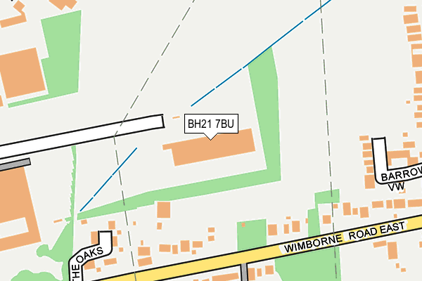
BH21 7BU is located in the Ferndown North electoral ward, within the unitary authority of Dorset and the English Parliamentary constituency of Christchurch. The Sub Integrated Care Board (ICB) Location is NHS Dorset ICB - 11J and the police force is Dorset. This postcode has been in use since February 2017.


GetTheData
Source: OS OpenMap – Local (Ordnance Survey)
Source: OS VectorMap District (Ordnance Survey)
Licence: Open Government Licence (requires attribution)
| Easting | 406191 |
| Northing | 100960 |
| Latitude | 50.808153 |
| Longitude | -1.913495 |
GetTheData
Source: Open Postcode Geo
Licence: Open Government Licence
| Country | England |
| Postcode District | BH21 |
➜ See where BH21 is on a map ➜ Where is Ferndown? | |
GetTheData
Source: Land Registry Price Paid Data
Licence: Open Government Licence
| Ward | Ferndown North |
| Constituency | Christchurch |
GetTheData
Source: ONS Postcode Database
Licence: Open Government Licence
| Hill Top Garage (Wimborne Road East) | Stapehill | 274m |
| Hill Top Garage (Wimborne Road East) | Stapehill | 289m |
| Ferndown Industrial Estate | Stapehill | 362m |
| Cedar Park (Cobham Road) | Stapehill | 369m |
| Cedar Park (Cobham Road) | Stapehill | 381m |
GetTheData
Source: NaPTAN
Licence: Open Government Licence
GetTheData
Source: ONS Postcode Database
Licence: Open Government Licence


➜ Get more ratings from the Food Standards Agency
GetTheData
Source: Food Standards Agency
Licence: FSA terms & conditions
| Last Collection | |||
|---|---|---|---|
| Location | Mon-Fri | Sat | Distance |
| Award Road | 16:00 | 08:30 | 357m |
| Ferndown Business Box | 18:30 | 399m | |
| Ferndown Industrial Estate | 17:45 | 09:00 | 400m |
GetTheData
Source: Dracos
Licence: Creative Commons Attribution-ShareAlike
The below table lists the International Territorial Level (ITL) codes (formerly Nomenclature of Territorial Units for Statistics (NUTS) codes) and Local Administrative Units (LAU) codes for BH21 7BU:
| ITL 1 Code | Name |
|---|---|
| TLK | South West (England) |
| ITL 2 Code | Name |
| TLK2 | Dorset and Somerset |
| ITL 3 Code | Name |
| TLK25 | Dorset |
| LAU 1 Code | Name |
| E06000059 | Dorset |
GetTheData
Source: ONS Postcode Directory
Licence: Open Government Licence
The below table lists the Census Output Area (OA), Lower Layer Super Output Area (LSOA), and Middle Layer Super Output Area (MSOA) for BH21 7BU:
| Code | Name | |
|---|---|---|
| OA | E00103416 | |
| LSOA | E01020408 | East Dorset 009E |
| MSOA | E02004251 | East Dorset 009 |
GetTheData
Source: ONS Postcode Directory
Licence: Open Government Licence
| BH21 7RL | Whittle Road | 203m |
| BH22 9LZ | Wimborne Road East | 214m |
| BH22 9DH | Brickyard Lane | 219m |
| BH22 9NB | Wimborne Road East | 270m |
| BH21 7NU | Forest View Drive | 285m |
| BH21 7RU | Whittle Road | 306m |
| BH22 9NZ | St James Road | 330m |
| BH22 9NY | St James Road | 336m |
| BH21 7RF | Haviland Road | 340m |
| BH21 7SA | Haviland Road | 358m |
GetTheData
Source: Open Postcode Geo; Land Registry Price Paid Data
Licence: Open Government Licence