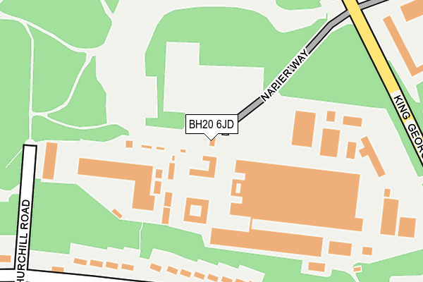
BH20 6JD is located in the West Purbeck electoral ward, within the unitary authority of Dorset and the English Parliamentary constituency of South Dorset. The Sub Integrated Care Board (ICB) Location is NHS Dorset ICB - 11J and the police force is Dorset. This postcode has been in use since June 1998.


GetTheData
Source: OS OpenMap – Local (Ordnance Survey)
Source: OS VectorMap District (Ordnance Survey)
Licence: Open Government Licence (requires attribution)
| Easting | 382733 |
| Northing | 89509 |
| Latitude | 50.704959 |
| Longitude | -2.245885 |
GetTheData
Source: Open Postcode Geo
Licence: Open Government Licence
| Country | England |
| Postcode District | BH20 |
➜ See where BH20 is on a map | |
GetTheData
Source: Land Registry Price Paid Data
Licence: Open Government Licence
Elevation or altitude of BH20 6JD as distance above sea level:
| Metres | Feet | |
|---|---|---|
| Elevation | 50m | 164ft |
Elevation is measured from the approximate centre of the postcode, to the nearest point on an OS contour line from OS Terrain 50, which has contour spacing of ten vertical metres.
➜ How high above sea level am I? Find the elevation of your current position using your device's GPS.
GetTheData
Source: Open Postcode Elevation
Licence: Open Government Licence
| Ward | West Purbeck |
| Constituency | South Dorset |
GetTheData
Source: ONS Postcode Database
Licence: Open Government Licence
| Swinton Avenue Terminus | Bovington Camp | 427m |
| The Spar (King George V Road) | Bovington Camp | 495m |
| Shopping Centre | Bovington Camp | 608m |
| Shopping Centre (King George V Road) | Bovington Camp | 615m |
| Bovington First School (Holt Road) | Bovington Camp | 689m |
| Wool Station | 3.1km |
| Moreton (Dorset) Station | 4.8km |
GetTheData
Source: NaPTAN
Licence: Open Government Licence
GetTheData
Source: ONS Postcode Database
Licence: Open Government Licence


➜ Get more ratings from the Food Standards Agency
GetTheData
Source: Food Standards Agency
Licence: FSA terms & conditions
| Last Collection | |||
|---|---|---|---|
| Location | Mon-Fri | Sat | Distance |
| Swinton Ave | 16:45 | 08:30 | 401m |
| Bovington Camp P.o. | 16:45 | 09:30 | 476m |
| Andover Green | 16:45 | 08:30 | 930m |
GetTheData
Source: Dracos
Licence: Creative Commons Attribution-ShareAlike
The below table lists the International Territorial Level (ITL) codes (formerly Nomenclature of Territorial Units for Statistics (NUTS) codes) and Local Administrative Units (LAU) codes for BH20 6JD:
| ITL 1 Code | Name |
|---|---|
| TLK | South West (England) |
| ITL 2 Code | Name |
| TLK2 | Dorset and Somerset |
| ITL 3 Code | Name |
| TLK25 | Dorset |
| LAU 1 Code | Name |
| E06000059 | Dorset |
GetTheData
Source: ONS Postcode Directory
Licence: Open Government Licence
The below table lists the Census Output Area (OA), Lower Layer Super Output Area (LSOA), and Middle Layer Super Output Area (MSOA) for BH20 6JD:
| Code | Name | |
|---|---|---|
| OA | E00103888 | |
| LSOA | E01020493 | Purbeck 004E |
| MSOA | E02004266 | Purbeck 004 |
GetTheData
Source: ONS Postcode Directory
Licence: Open Government Licence
| BH20 6JN | Elles Road | 309m |
| BH20 6JY | Arras Road | 319m |
| BH20 6LA | St Julien Road | 351m |
| BH20 6JZ | New Road | 362m |
| BH20 6LD | Swinton Avenue | 385m |
| BH20 6LB | Gaza Road | 400m |
| BH20 6JQ | King George V Road | 639m |
| BH20 6HZ | Windsor Close | 658m |
| BH20 6HY | Victoria Close | 715m |
| BH20 6NG | Higher Wood | 764m |
GetTheData
Source: Open Postcode Geo; Land Registry Price Paid Data
Licence: Open Government Licence