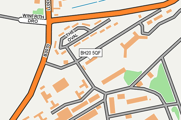
BH20 5QF is located in the West Purbeck electoral ward, within the unitary authority of Dorset and the English Parliamentary constituency of South Dorset. The Sub Integrated Care Board (ICB) Location is NHS Dorset ICB - 11J and the police force is Dorset. This postcode has been in use since January 1980.


GetTheData
Source: OS OpenMap – Local (Ordnance Survey)
Source: OS VectorMap District (Ordnance Survey)
Licence: Open Government Licence (requires attribution)
| Easting | 383652 |
| Northing | 81467 |
| Latitude | 50.632667 |
| Longitude | -2.232513 |
GetTheData
Source: Open Postcode Geo
Licence: Open Government Licence
| Country | England |
| Postcode District | BH20 |
➜ See where BH20 is on a map | |
GetTheData
Source: Land Registry Price Paid Data
Licence: Open Government Licence
Elevation or altitude of BH20 5QF as distance above sea level:
| Metres | Feet | |
|---|---|---|
| Elevation | 110m | 361ft |
Elevation is measured from the approximate centre of the postcode, to the nearest point on an OS contour line from OS Terrain 50, which has contour spacing of ten vertical metres.
➜ How high above sea level am I? Find the elevation of your current position using your device's GPS.
GetTheData
Source: Open Postcode Elevation
Licence: Open Government Licence
| Ward | West Purbeck |
| Constituency | South Dorset |
GetTheData
Source: ONS Postcode Database
Licence: Open Government Licence
| Gunnery School (B3070) | Lulworth Camp | 159m |
| Gunnery School (B3070) | Lulworth Camp | 169m |
| Castle Inn (Main Road) | West Lulworth | 1,194m |
| Castle Inn | West Lulworth | 1,200m |
| War Memorial (Main Road) | West Lulworth | 1,332m |
GetTheData
Source: NaPTAN
Licence: Open Government Licence
GetTheData
Source: ONS Postcode Database
Licence: Open Government Licence


➜ Get more ratings from the Food Standards Agency
GetTheData
Source: Food Standards Agency
Licence: FSA terms & conditions
| Last Collection | |||
|---|---|---|---|
| Location | Mon-Fri | Sat | Distance |
| Castle Inn | 17:00 | 08:30 | 1,061m |
| School Lane | 16:45 | 08:00 | 1,089m |
| West Lulworth P.o. | 16:50 | 08:00 | 1,606m |
GetTheData
Source: Dracos
Licence: Creative Commons Attribution-ShareAlike
The below table lists the International Territorial Level (ITL) codes (formerly Nomenclature of Territorial Units for Statistics (NUTS) codes) and Local Administrative Units (LAU) codes for BH20 5QF:
| ITL 1 Code | Name |
|---|---|
| TLK | South West (England) |
| ITL 2 Code | Name |
| TLK2 | Dorset and Somerset |
| ITL 3 Code | Name |
| TLK25 | Dorset |
| LAU 1 Code | Name |
| E06000059 | Dorset |
GetTheData
Source: ONS Postcode Directory
Licence: Open Government Licence
The below table lists the Census Output Area (OA), Lower Layer Super Output Area (LSOA), and Middle Layer Super Output Area (MSOA) for BH20 5QF:
| Code | Name | |
|---|---|---|
| OA | E00103875 | |
| LSOA | E01020489 | Purbeck 004A |
| MSOA | E02004266 | Purbeck 004 |
GetTheData
Source: ONS Postcode Directory
Licence: Open Government Licence
| BH20 5PT | 280m | |
| BH20 5SL | Shepherds Way | 975m |
| BH20 5RP | The Triangle | 1000m |
| BH20 5RR | Rickyard Cottages | 1010m |
| BH20 5SH | Moreys Close | 1019m |
| BH20 5SN | School Lane | 1040m |
| BH20 5SP | Farm Lane | 1051m |
| BH20 5SA | School Lane | 1051m |
| BH20 5SJ | Farm Lane | 1075m |
| BH20 5SD | Redcliffe Villas | 1079m |
GetTheData
Source: Open Postcode Geo; Land Registry Price Paid Data
Licence: Open Government Licence