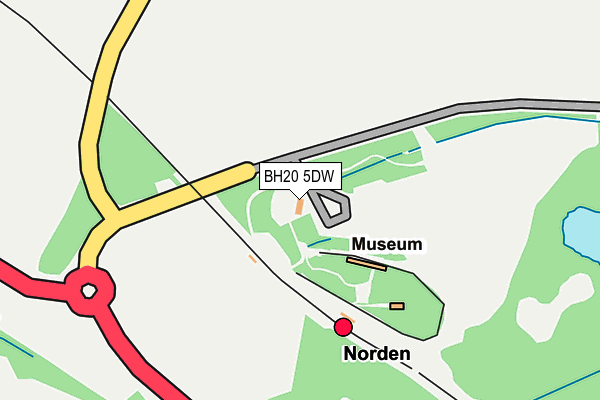
BH20 5DW is located in the South East Purbeck electoral ward, within the unitary authority of Dorset and the English Parliamentary constituency of South Dorset. The Sub Integrated Care Board (ICB) Location is NHS Dorset ICB - 11J and the police force is Dorset. This postcode has been in use since June 1999.


GetTheData
Source: OS OpenMap – Local (Ordnance Survey)
Source: OS VectorMap District (Ordnance Survey)
Licence: Open Government Licence (requires attribution)
| Easting | 395671 |
| Northing | 82891 |
| Latitude | 50.645688 |
| Longitude | -2.062588 |
GetTheData
Source: Open Postcode Geo
Licence: Open Government Licence
| Country | England |
| Postcode District | BH20 |
➜ See where BH20 is on a map | |
GetTheData
Source: Land Registry Price Paid Data
Licence: Open Government Licence
Elevation or altitude of BH20 5DW as distance above sea level:
| Metres | Feet | |
|---|---|---|
| Elevation | 20m | 66ft |
Elevation is measured from the approximate centre of the postcode, to the nearest point on an OS contour line from OS Terrain 50, which has contour spacing of ten vertical metres.
➜ How high above sea level am I? Find the elevation of your current position using your device's GPS.
GetTheData
Source: Open Postcode Elevation
Licence: Open Government Licence
| Ward | South East Purbeck |
| Constituency | South Dorset |
GetTheData
Source: ONS Postcode Database
Licence: Open Government Licence
| Norden P&r (Wych Farm Road) | Norden | 17m |
| Norden Farm (A351) | Norden | 398m |
| Norden Farm (A351) | Norden | 408m |
| Castle View Information Centre (A351) | Corfe Castle | 485m |
| Castle View Information Centre (A351) | Corfe Castle | 514m |
| Norden - Park And Ride (Swanage Railway) (Wych Farm Road) | Norden | 110m |
| Corfe Castle (Swanage Railway) (Station Approach) | Corfe Castle | 973m |
GetTheData
Source: NaPTAN
Licence: Open Government Licence
GetTheData
Source: ONS Postcode Database
Licence: Open Government Licence


➜ Get more ratings from the Food Standards Agency
GetTheData
Source: Food Standards Agency
Licence: FSA terms & conditions
| Last Collection | |||
|---|---|---|---|
| Location | Mon-Fri | Sat | Distance |
| Corfe Castle | 17:00 | 11:00 | 885m |
| Norden | 17:10 | 10:15 | 1,295m |
| East Street | 16:30 | 10:15 | 1,598m |
GetTheData
Source: Dracos
Licence: Creative Commons Attribution-ShareAlike
The below table lists the International Territorial Level (ITL) codes (formerly Nomenclature of Territorial Units for Statistics (NUTS) codes) and Local Administrative Units (LAU) codes for BH20 5DW:
| ITL 1 Code | Name |
|---|---|
| TLK | South West (England) |
| ITL 2 Code | Name |
| TLK2 | Dorset and Somerset |
| ITL 3 Code | Name |
| TLK25 | Dorset |
| LAU 1 Code | Name |
| E06000059 | Dorset |
GetTheData
Source: ONS Postcode Directory
Licence: Open Government Licence
The below table lists the Census Output Area (OA), Lower Layer Super Output Area (LSOA), and Middle Layer Super Output Area (MSOA) for BH20 5DW:
| Code | Name | |
|---|---|---|
| OA | E00103753 | |
| LSOA | E01020466 | Purbeck 005A |
| MSOA | E02004267 | Purbeck 005 |
GetTheData
Source: ONS Postcode Directory
Licence: Open Government Licence
| BH20 5DY | 751m | |
| BH20 5DS | 776m | |
| BH20 5ED | East Street | 838m |
| BH20 5DX | 921m | |
| BH20 5HD | West Street | 986m |
| BH20 5HA | West Street | 1034m |
| BH20 5JF | Sandy Hill Lane | 1103m |
| BH20 5HH | Toms Mead | 1114m |
| BH20 5EQ | East Street | 1151m |
| BH20 5EE | East Street | 1179m |
GetTheData
Source: Open Postcode Geo; Land Registry Price Paid Data
Licence: Open Government Licence