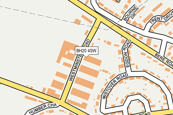
BH20 4SW is located in the Wareham electoral ward, within the unitary authority of Dorset and the English Parliamentary constituency of Mid Dorset and North Poole. The Sub Integrated Care Board (ICB) Location is NHS Dorset ICB - 11J and the police force is Dorset. This postcode has been in use since January 1980.


GetTheData
Source: OS OpenMap – Local (Ordnance Survey)
Source: OS VectorMap District (Ordnance Survey)
Licence: Open Government Licence (requires attribution)
| Easting | 391486 |
| Northing | 88308 |
| Latitude | 50.694344 |
| Longitude | -2.121899 |
GetTheData
Source: Open Postcode Geo
Licence: Open Government Licence
| Country | England |
| Postcode District | BH20 |
➜ See where BH20 is on a map ➜ Where is Wareham? | |
GetTheData
Source: Land Registry Price Paid Data
Licence: Open Government Licence
Elevation or altitude of BH20 4SW as distance above sea level:
| Metres | Feet | |
|---|---|---|
| Elevation | 20m | 66ft |
Elevation is measured from the approximate centre of the postcode, to the nearest point on an OS contour line from OS Terrain 50, which has contour spacing of ten vertical metres.
➜ How high above sea level am I? Find the elevation of your current position using your device's GPS.
GetTheData
Source: Open Postcode Elevation
Licence: Open Government Licence
| Ward | Wareham |
| Constituency | Mid Dorset And North Poole |
GetTheData
Source: ONS Postcode Database
Licence: Open Government Licence
| Westminster Road | Northport | 61m |
| Mistover Road | Wareham | 147m |
| Egdon Road | Wareham | 159m |
| Carey Road | Northport | 199m |
| Northmoor Way | Northport | 297m |
| Wareham Station | 0.5km |
| Holton Heath Station | 3.6km |
GetTheData
Source: NaPTAN
Licence: Open Government Licence
GetTheData
Source: ONS Postcode Database
Licence: Open Government Licence


➜ Get more ratings from the Food Standards Agency
GetTheData
Source: Food Standards Agency
Licence: FSA terms & conditions
| Last Collection | |||
|---|---|---|---|
| Location | Mon-Fri | Sat | Distance |
| Westminster Road | 18:00 | 12:30 | 152m |
| 29 Carey P.o. | 17:30 | 12:30 | 248m |
| Tantinoby Lane | 17:30 | 12:30 | 489m |
GetTheData
Source: Dracos
Licence: Creative Commons Attribution-ShareAlike
The below table lists the International Territorial Level (ITL) codes (formerly Nomenclature of Territorial Units for Statistics (NUTS) codes) and Local Administrative Units (LAU) codes for BH20 4SW:
| ITL 1 Code | Name |
|---|---|
| TLK | South West (England) |
| ITL 2 Code | Name |
| TLK2 | Dorset and Somerset |
| ITL 3 Code | Name |
| TLK25 | Dorset |
| LAU 1 Code | Name |
| E06000059 | Dorset |
GetTheData
Source: ONS Postcode Directory
Licence: Open Government Licence
The below table lists the Census Output Area (OA), Lower Layer Super Output Area (LSOA), and Middle Layer Super Output Area (MSOA) for BH20 4SW:
| Code | Name | |
|---|---|---|
| OA | E00103854 | |
| LSOA | E01020488 | Purbeck 003F |
| MSOA | E02004265 | Purbeck 003 |
GetTheData
Source: ONS Postcode Directory
Licence: Open Government Licence
| BH20 4BZ | Mistover Road | 99m |
| BH20 4SN | Westminster Road | 137m |
| BH20 4DA | Egdon Road | 155m |
| BH20 4AZ | Carey Road | 156m |
| BH20 4BX | Mellstock Crescent | 190m |
| BH20 4BH | Humber Chase | 198m |
| BH20 4BP | Wessex Oval | 216m |
| BH20 4AY | Carey Road | 218m |
| BH20 4BT | Wessex Oval | 230m |
| BH20 4SH | Northmoor Way | 244m |
GetTheData
Source: Open Postcode Geo; Land Registry Price Paid Data
Licence: Open Government Licence