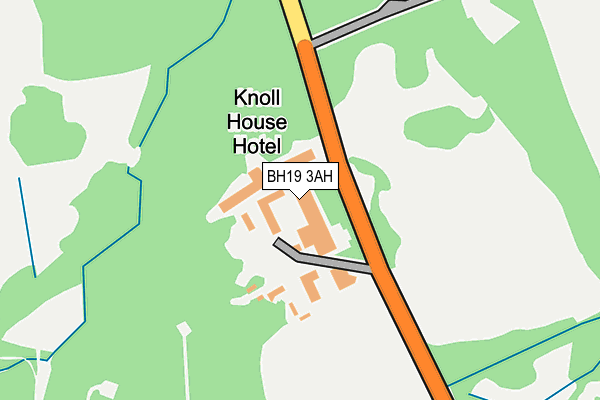
BH19 3AH is located in the South East Purbeck electoral ward, within the unitary authority of Dorset and the English Parliamentary constituency of South Dorset. The Sub Integrated Care Board (ICB) Location is NHS Dorset ICB - 11J and the police force is Dorset. This postcode has been in use since January 1980.


GetTheData
Source: OS OpenMap – Local (Ordnance Survey)
Source: OS VectorMap District (Ordnance Survey)
Licence: Open Government Licence (requires attribution)
| Easting | 403093 |
| Northing | 83314 |
| Latitude | 50.649501 |
| Longitude | -1.957613 |
GetTheData
Source: Open Postcode Geo
Licence: Open Government Licence
| Country | England |
| Postcode District | BH19 |
➜ See where BH19 is on a map | |
GetTheData
Source: Land Registry Price Paid Data
Licence: Open Government Licence
Elevation or altitude of BH19 3AH as distance above sea level:
| Metres | Feet | |
|---|---|---|
| Elevation | 20m | 66ft |
Elevation is measured from the approximate centre of the postcode, to the nearest point on an OS contour line from OS Terrain 50, which has contour spacing of ten vertical metres.
➜ How high above sea level am I? Find the elevation of your current position using your device's GPS.
GetTheData
Source: Open Postcode Elevation
Licence: Open Government Licence
| Ward | South East Purbeck |
| Constituency | South Dorset |
GetTheData
Source: ONS Postcode Database
Licence: Open Government Licence
| Knoll House Hotel (Ferry Road) | Studland | 64m |
| Knoll House Hotel (Ferry Road) | Studland | 71m |
| Pipley Bridge (Ferry Road) | Studland | 341m |
| Pipley Bridge (Ferry Road) | Studland | 347m |
| Studland Bay House (Ferry Road) | Studland | 432m |
GetTheData
Source: NaPTAN
Licence: Open Government Licence
GetTheData
Source: ONS Postcode Database
Licence: Open Government Licence


➜ Get more ratings from the Food Standards Agency
GetTheData
Source: Food Standards Agency
Licence: FSA terms & conditions
| Last Collection | |||
|---|---|---|---|
| Location | Mon-Fri | Sat | Distance |
| Studland P.o. | 16:30 | 10:30 | 900m |
| Agglestone Road | 16:15 | 09:30 | 916m |
| Banks Arms | 16:00 | 09:30 | 1,054m |
GetTheData
Source: Dracos
Licence: Creative Commons Attribution-ShareAlike
The below table lists the International Territorial Level (ITL) codes (formerly Nomenclature of Territorial Units for Statistics (NUTS) codes) and Local Administrative Units (LAU) codes for BH19 3AH:
| ITL 1 Code | Name |
|---|---|
| TLK | South West (England) |
| ITL 2 Code | Name |
| TLK2 | Dorset and Somerset |
| ITL 3 Code | Name |
| TLK25 | Dorset |
| LAU 1 Code | Name |
| E06000059 | Dorset |
GetTheData
Source: ONS Postcode Directory
Licence: Open Government Licence
The below table lists the Census Output Area (OA), Lower Layer Super Output Area (LSOA), and Middle Layer Super Output Area (MSOA) for BH19 3AH:
| Code | Name | |
|---|---|---|
| OA | E00103755 | |
| LSOA | E01020466 | Purbeck 005A |
| MSOA | E02004267 | Purbeck 005 |
GetTheData
Source: ONS Postcode Directory
Licence: Open Government Licence
| BH19 3AY | Wadmore | 325m |
| BH19 3AQ | Ferry Road | 545m |
| BH19 3AP | Beach Road | 728m |
| BH19 3DA | Heatherside | 813m |
| BH19 3BZ | Agglestone Road | 853m |
| BH19 3BT | The Green | 862m |
| BH19 3BX | Heathgreen Road | 887m |
| BH19 3BU | Heathgreen Road | 919m |
| BH19 3AU | Manor Road | 961m |
| BH19 3AG | Harmony Terrace | 985m |
GetTheData
Source: Open Postcode Geo; Land Registry Price Paid Data
Licence: Open Government Licence