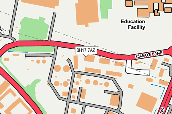
BH17 7AZ is located in the Creekmoor electoral ward, within the unitary authority of Bournemouth, Christchurch and Poole and the English Parliamentary constituency of Poole. The Sub Integrated Care Board (ICB) Location is NHS Dorset ICB - 11J and the police force is Dorset. This postcode has been in use since December 1997.


GetTheData
Source: OS OpenMap – Local (Ordnance Survey)
Source: OS VectorMap District (Ordnance Survey)
Licence: Open Government Licence (requires attribution)
| Easting | 400797 |
| Northing | 93829 |
| Latitude | 50.744067 |
| Longitude | -1.990069 |
GetTheData
Source: Open Postcode Geo
Licence: Open Government Licence
| Country | England |
| Postcode District | BH17 |
➜ See where BH17 is on a map ➜ Where is Poole? | |
GetTheData
Source: Land Registry Price Paid Data
Licence: Open Government Licence
Elevation or altitude of BH17 7AZ as distance above sea level:
| Metres | Feet | |
|---|---|---|
| Elevation | 10m | 33ft |
Elevation is measured from the approximate centre of the postcode, to the nearest point on an OS contour line from OS Terrain 50, which has contour spacing of ten vertical metres.
➜ How high above sea level am I? Find the elevation of your current position using your device's GPS.
GetTheData
Source: Open Postcode Elevation
Licence: Open Government Licence
| Ward | Creekmoor |
| Constituency | Poole |
GetTheData
Source: ONS Postcode Database
Licence: Open Government Licence
| Parkstone Grammar School | Waterloo Estate | 272m |
| Cabot Lane (Waterloo Road) | Waterloo Estate | 306m |
| Parkstone Grammar School (Sopers Lane) | Waterloo Estate | 310m |
| Hamworthy Engineering (Waterloo Road) | Waterloo Estate | 321m |
| French Road (Sopers Lane) | Waterloo Estate | 331m |
| Poole Station | 2.8km |
| Hamworthy Station | 2.9km |
| Parkstone (Dorset) Station | 3.8km |
GetTheData
Source: NaPTAN
Licence: Open Government Licence
GetTheData
Source: ONS Postcode Database
Licence: Open Government Licence

➜ Get more ratings from the Food Standards Agency
GetTheData
Source: Food Standards Agency
Licence: FSA terms & conditions
| Last Collection | |||
|---|---|---|---|
| Location | Mon-Fri | Sat | Distance |
| Cabot Lane | 18:30 | 12:15 | 151m |
| Balena Close | 18:30 | 12:00 | 512m |
| Waterloo P.o. | 17:15 | 12:15 | 529m |
GetTheData
Source: Dracos
Licence: Creative Commons Attribution-ShareAlike
The below table lists the International Territorial Level (ITL) codes (formerly Nomenclature of Territorial Units for Statistics (NUTS) codes) and Local Administrative Units (LAU) codes for BH17 7AZ:
| ITL 1 Code | Name |
|---|---|
| TLK | South West (England) |
| ITL 2 Code | Name |
| TLK2 | Dorset and Somerset |
| ITL 3 Code | Name |
| TLK24 | Bournemouth, Christchurch and Poole |
| LAU 1 Code | Name |
| E06000058 | Bournemouth, Christchurch and Poole |
GetTheData
Source: ONS Postcode Directory
Licence: Open Government Licence
The below table lists the Census Output Area (OA), Lower Layer Super Output Area (LSOA), and Middle Layer Super Output Area (MSOA) for BH17 7AZ:
| Code | Name | |
|---|---|---|
| OA | E00077958 | |
| LSOA | E01015421 | Poole 006E |
| MSOA | E02003199 | Poole 006 |
GetTheData
Source: ONS Postcode Directory
Licence: Open Government Licence
| BH17 7BX | Cabot Lane | 54m |
| BH17 7ET | Sopers Lane | 325m |
| BH17 7EW | Sopers Lane | 362m |
| BH17 7EY | Cavan Crescent | 404m |
| BH17 7ES | Sopers Lane | 419m |
| BH17 7JY | Waterloo Road | 426m |
| BH17 7HB | French Road | 434m |
| BH17 7LQ | Hatch Pond Road | 439m |
| BH17 7LJ | Holly Hedge Lane | 442m |
| BH17 7FH | Technology Road | 447m |
GetTheData
Source: Open Postcode Geo; Land Registry Price Paid Data
Licence: Open Government Licence