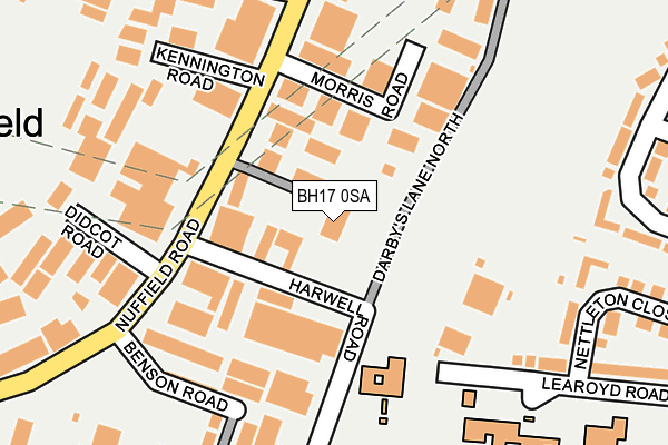
BH17 0SA is located in the Canford Heath electoral ward, within the unitary authority of Bournemouth, Christchurch and Poole and the English Parliamentary constituency of Mid Dorset and North Poole. The Sub Integrated Care Board (ICB) Location is NHS Dorset ICB - 11J and the police force is Dorset. This postcode has been in use since July 1995.


GetTheData
Source: OS OpenMap – Local (Ordnance Survey)
Source: OS VectorMap District (Ordnance Survey)
Licence: Open Government Licence (requires attribution)
| Easting | 401813 |
| Northing | 93490 |
| Latitude | 50.741016 |
| Longitude | -1.975671 |
GetTheData
Source: Open Postcode Geo
Licence: Open Government Licence
| Country | England |
| Postcode District | BH17 |
➜ See where BH17 is on a map ➜ Where is Poole? | |
GetTheData
Source: Land Registry Price Paid Data
Licence: Open Government Licence
Elevation or altitude of BH17 0SA as distance above sea level:
| Metres | Feet | |
|---|---|---|
| Elevation | 10m | 33ft |
Elevation is measured from the approximate centre of the postcode, to the nearest point on an OS contour line from OS Terrain 50, which has contour spacing of ten vertical metres.
➜ How high above sea level am I? Find the elevation of your current position using your device's GPS.
GetTheData
Source: Open Postcode Elevation
Licence: Open Government Licence
| Ward | Canford Heath |
| Constituency | Mid Dorset And North Poole |
GetTheData
Source: ONS Postcode Database
Licence: Open Government Licence
| Hatch Pond Road | Canford Heath | 343m |
| Gibson Road (Adastral Road) | Canford Heath | 347m |
| Cowley Road | Canford Heath | 400m |
| Bader Road (Adastral Road) | Canford Heath | 424m |
| Johnston Road | Oakdale | 432m |
| Poole Station | 2.5km |
| Parkstone (Dorset) Station | 2.8km |
| Hamworthy Station | 3.5km |
GetTheData
Source: NaPTAN
Licence: Open Government Licence
GetTheData
Source: ONS Postcode Database
Licence: Open Government Licence


➜ Get more ratings from the Food Standards Agency
GetTheData
Source: Food Standards Agency
Licence: FSA terms & conditions
| Last Collection | |||
|---|---|---|---|
| Location | Mon-Fri | Sat | Distance |
| Nuffield Industrial Estate | 18:30 | 12:30 | 324m |
| Bader Road | 17:30 | 12:15 | 345m |
| Hatchpond Road | 18:30 | 12:30 | 396m |
GetTheData
Source: Dracos
Licence: Creative Commons Attribution-ShareAlike
The below table lists the International Territorial Level (ITL) codes (formerly Nomenclature of Territorial Units for Statistics (NUTS) codes) and Local Administrative Units (LAU) codes for BH17 0SA:
| ITL 1 Code | Name |
|---|---|
| TLK | South West (England) |
| ITL 2 Code | Name |
| TLK2 | Dorset and Somerset |
| ITL 3 Code | Name |
| TLK24 | Bournemouth, Christchurch and Poole |
| LAU 1 Code | Name |
| E06000058 | Bournemouth, Christchurch and Poole |
GetTheData
Source: ONS Postcode Directory
Licence: Open Government Licence
The below table lists the Census Output Area (OA), Lower Layer Super Output Area (LSOA), and Middle Layer Super Output Area (MSOA) for BH17 0SA:
| Code | Name | |
|---|---|---|
| OA | E00077937 | |
| LSOA | E01015416 | Poole 004E |
| MSOA | E02003197 | Poole 004 |
GetTheData
Source: ONS Postcode Directory
Licence: Open Government Licence
| BH17 0RT | Nuffield Road | 89m |
| BH17 0GE | Harwell Road | 156m |
| BH17 0GB | Benson Road | 207m |
| BH17 0GD | Didcot Road | 212m |
| BH17 0RS | Nuffield Road | 221m |
| BH17 0GG | Morris Road | 232m |
| BH17 8PJ | Learoyd Road | 239m |
| BH17 8PL | Nettleton Close | 263m |
| BH17 8PN | Bader Road | 286m |
| BH17 0JZ | Hatch Pond Road | 301m |
GetTheData
Source: Open Postcode Geo; Land Registry Price Paid Data
Licence: Open Government Licence