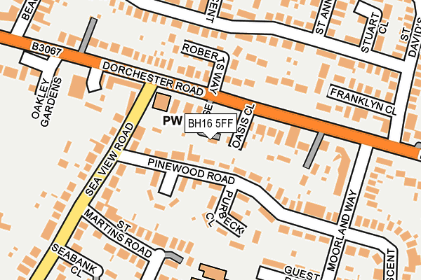
BH16 5FF is located in the Lytchett Matravers & Upton electoral ward, within the unitary authority of Dorset and the English Parliamentary constituency of Mid Dorset and North Poole. The Sub Integrated Care Board (ICB) Location is NHS Dorset ICB - 11J and the police force is Dorset. This postcode has been in use since October 2017.


GetTheData
Source: OS OpenMap – Local (Ordnance Survey)
Source: OS VectorMap District (Ordnance Survey)
Licence: Open Government Licence (requires attribution)
| Easting | 396784 |
| Northing | 93263 |
| Latitude | 50.738958 |
| Longitude | -2.046935 |
GetTheData
Source: Open Postcode Geo
Licence: Open Government Licence
| Country | England |
| Postcode District | BH16 |
➜ See where BH16 is on a map | |
GetTheData
Source: Land Registry Price Paid Data
Licence: Open Government Licence
| Ward | Lytchett Matravers & Upton |
| Constituency | Mid Dorset And North Poole |
GetTheData
Source: ONS Postcode Database
Licence: Open Government Licence
| South Lytchett Manor (Dorchester Road) | Lytchett Minster | 213m |
| South Lytchett Manor (Dorchester Road) | Lytchett Minster | 223m |
| Seymours Cottages (Randalls Hill) | Lytchett Minster | 260m |
| Seymours Cottages (Randalls Hill) | Lytchett Minster | 266m |
| Marsh Lane (Dorchester Road) | Upton | 417m |
| Hamworthy Station | 2.5km |
| Holton Heath Station | 3.8km |
| Poole Station | 5km |
GetTheData
Source: NaPTAN
Licence: Open Government Licence
| Percentage of properties with Next Generation Access | 100.0% |
| Percentage of properties with Superfast Broadband | 100.0% |
| Percentage of properties with Ultrafast Broadband | 100.0% |
| Percentage of properties with Full Fibre Broadband | 100.0% |
Superfast Broadband is between 30Mbps and 300Mbps
Ultrafast Broadband is > 300Mbps
| Percentage of properties unable to receive 2Mbps | 0.0% |
| Percentage of properties unable to receive 5Mbps | 0.0% |
| Percentage of properties unable to receive 10Mbps | 0.0% |
| Percentage of properties unable to receive 30Mbps | 0.0% |
GetTheData
Source: Ofcom
Licence: Ofcom Terms of Use (requires attribution)
GetTheData
Source: ONS Postcode Database
Licence: Open Government Licence


➜ Get more ratings from the Food Standards Agency
GetTheData
Source: Food Standards Agency
Licence: FSA terms & conditions
| Last Collection | |||
|---|---|---|---|
| Location | Mon-Fri | Sat | Distance |
| Marsh Lane | 17:30 | 11:00 | 444m |
| Sandy Lane | 17:30 | 11:00 | 506m |
| 34 Beacon Park Road | 17:30 | 10:45 | 747m |
GetTheData
Source: Dracos
Licence: Creative Commons Attribution-ShareAlike
The below table lists the International Territorial Level (ITL) codes (formerly Nomenclature of Territorial Units for Statistics (NUTS) codes) and Local Administrative Units (LAU) codes for BH16 5FF:
| ITL 1 Code | Name |
|---|---|
| TLK | South West (England) |
| ITL 2 Code | Name |
| TLK2 | Dorset and Somerset |
| ITL 3 Code | Name |
| TLK25 | Dorset |
| LAU 1 Code | Name |
| E06000059 | Dorset |
GetTheData
Source: ONS Postcode Directory
Licence: Open Government Licence
The below table lists the Census Output Area (OA), Lower Layer Super Output Area (LSOA), and Middle Layer Super Output Area (MSOA) for BH16 5FF:
| Code | Name | |
|---|---|---|
| OA | E00103805 | |
| LSOA | E01020475 | Purbeck 002E |
| MSOA | E02004264 | Purbeck 002 |
GetTheData
Source: ONS Postcode Directory
Licence: Open Government Licence
| BH16 5NE | Policemans Lane | 79m |
| BH16 5RF | Poppy Close | 158m |
| BH16 5RG | Hop Close | 222m |
| BH16 5RT | Frenchs Farm Road | 239m |
| BH16 5RH | Holly Close | 293m |
| BH16 5ND | Watery Lane | 344m |
| BH16 5NH | Marsh Lane | 357m |
| BH16 5RU | Greenway Crescent | 368m |
| BH16 5RX | Barn Close | 386m |
| BH16 5NX | Dorchester Road | 421m |
GetTheData
Source: Open Postcode Geo; Land Registry Price Paid Data
Licence: Open Government Licence