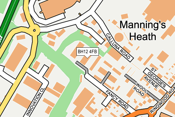
BH12 4FB is located in the Newtown & Heatherlands electoral ward, within the unitary authority of Bournemouth, Christchurch and Poole and the English Parliamentary constituency of Poole. The Sub Integrated Care Board (ICB) Location is NHS Dorset ICB - 11J and the police force is Dorset. This postcode has been in use since March 2017.


GetTheData
Source: OS OpenMap – Local (Ordnance Survey)
Source: OS VectorMap District (Ordnance Survey)
Licence: Open Government Licence (requires attribution)
| Easting | 403588 |
| Northing | 93858 |
| Latitude | 50.744307 |
| Longitude | -1.950505 |
GetTheData
Source: Open Postcode Geo
Licence: Open Government Licence
| Country | England |
| Postcode District | BH12 |
➜ See where BH12 is on a map ➜ Where is Poole? | |
GetTheData
Source: Land Registry Price Paid Data
Licence: Open Government Licence
| Ward | Newtown & Heatherlands |
| Constituency | Poole |
GetTheData
Source: ONS Postcode Database
Licence: Open Government Licence
| Old Wareham Road (Ringwood Road) | Alderney | 316m |
| Old Wareham Road (Ringwood Road) | Newtown | 332m |
| Chesil Gardens (Rossmore Road) | Newtown | 367m |
| Tesco | Canford Heath | 402m |
| Trinidad House (Rossmore Road) | Newtown | 459m |
| Parkstone (Dorset) Station | 2.4km |
| Branksome Station | 2.9km |
| Poole Station | 3.6km |
GetTheData
Source: NaPTAN
Licence: Open Government Licence
| Median download speed | 7.7Mbps |
| Average download speed | 7.8Mbps |
| Maximum download speed | 12.36Mbps |
| Median upload speed | 1.1Mbps |
| Average upload speed | 1.0Mbps |
| Maximum upload speed | 1.26Mbps |
GetTheData
Source: Ofcom
Licence: Ofcom Terms of Use (requires attribution)
GetTheData
Source: ONS Postcode Database
Licence: Open Government Licence


➜ Get more ratings from the Food Standards Agency
GetTheData
Source: Food Standards Agency
Licence: FSA terms & conditions
| Last Collection | |||
|---|---|---|---|
| Location | Mon-Fri | Sat | Distance |
| Ling Road | 18:30 | 12:45 | 126m |
| Ringwood Road | 17:30 | 12:15 | 450m |
| Mannings Heath Road | 18:30 | 12:45 | 582m |
GetTheData
Source: Dracos
Licence: Creative Commons Attribution-ShareAlike
The below table lists the International Territorial Level (ITL) codes (formerly Nomenclature of Territorial Units for Statistics (NUTS) codes) and Local Administrative Units (LAU) codes for BH12 4FB:
| ITL 1 Code | Name |
|---|---|
| TLK | South West (England) |
| ITL 2 Code | Name |
| TLK2 | Dorset and Somerset |
| ITL 3 Code | Name |
| TLK24 | Bournemouth, Christchurch and Poole |
| LAU 1 Code | Name |
| E06000058 | Bournemouth, Christchurch and Poole |
GetTheData
Source: ONS Postcode Directory
Licence: Open Government Licence
The below table lists the Census Output Area (OA), Lower Layer Super Output Area (LSOA), and Middle Layer Super Output Area (MSOA) for BH12 4FB:
| Code | Name | |
|---|---|---|
| OA | E00078072 | |
| LSOA | E01015439 | Poole 008B |
| MSOA | E02003201 | Poole 008 |
GetTheData
Source: ONS Postcode Directory
Licence: Open Government Licence
| BH12 4NZ | Ling Road | 129m |
| BH12 4QZ | Fancy Road | 146m |
| BH12 4QD | Innovation Close | 164m |
| BH12 4ND | St Georges Avenue | 210m |
| BH12 4QR | Old Wareham Road | 228m |
| BH12 4QN | Old Wareham Road | 262m |
| BH12 4PY | Ling Road | 291m |
| BH12 4LY | Ringwood Road | 374m |
| BH12 3JN | Ringwood Road | 379m |
| BH12 4LS | Ringwood Road | 385m |
GetTheData
Source: Open Postcode Geo; Land Registry Price Paid Data
Licence: Open Government Licence