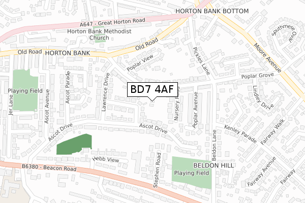
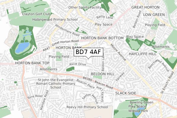
BD7 4AF is located in the Royds electoral ward, within the metropolitan district of Bradford and the English Parliamentary constituency of Bradford South. The Sub Integrated Care Board (ICB) Location is NHS West Yorkshire ICB - 36J and the police force is West Yorkshire. This postcode has been in use since August 2019.


GetTheData
Source: OS Open Zoomstack (Ordnance Survey)
Licence: Open Government Licence (requires attribution)
Attribution: Contains OS data © Crown copyright and database right 2025
Source: Open Postcode Geo
Licence: Open Government Licence (requires attribution)
Attribution: Contains OS data © Crown copyright and database right 2025; Contains Royal Mail data © Royal Mail copyright and database right 2025; Source: Office for National Statistics licensed under the Open Government Licence v.3.0
| Easting | 413525 |
| Northing | 430748 |
| Latitude | 53.772913 |
| Longitude | -1.796272 |
GetTheData
Source: Open Postcode Geo
Licence: Open Government Licence
| Country | England |
| Postcode District | BD7 |
➜ See where BD7 is on a map ➜ Where is Bradford? | |
GetTheData
Source: Land Registry Price Paid Data
Licence: Open Government Licence
| Ward | Royds |
| Constituency | Bradford South |
GetTheData
Source: ONS Postcode Database
Licence: Open Government Licence
5, POPLAR GARDENS, BRADFORD, BD7 4AF 2021 12 MAR £300,000 |
3, POPLAR GARDENS, BRADFORD, BD7 4AF 2021 5 FEB £300,000 |
9, POPLAR GARDENS, BRADFORD, BD7 4AF 2020 28 OCT £300,000 |
11, POPLAR GARDENS, BRADFORD, BD7 4AF 2020 28 AUG £320,000 |
6, POPLAR GARDENS, BRADFORD, BD7 4AF 2019 3 JUN £249,995 |
1, POPLAR GARDENS, BRADFORD, BD7 4AF 2019 11 FEB £85,000 |
GetTheData
Source: HM Land Registry Price Paid Data
Licence: Contains HM Land Registry data © Crown copyright and database right 2025. This data is licensed under the Open Government Licence v3.0.
| Poplar Grove Nursery Road (Poplar Grove) | Horton Bank | 96m |
| Poplar Grove Old Road (Poplar Grove) | Horton Bank | 207m |
| Beldon Lane Poplar Grove (Beldon Lane) | Horton Bank | 210m |
| Great Horton Road Windermere Rd (Great Horton Road) | Horton Bank | 274m |
| Beacon Road Beacon Place (Beacon Road) | Horton Bank | 277m |
| Bradford Interchange Station | 3.7km |
| Low Moor Station | 3.8km |
| Bradford Forster Square Station | 3.9km |
GetTheData
Source: NaPTAN
Licence: Open Government Licence
GetTheData
Source: ONS Postcode Database
Licence: Open Government Licence


➜ Get more ratings from the Food Standards Agency
GetTheData
Source: Food Standards Agency
Licence: FSA terms & conditions
| Last Collection | |||
|---|---|---|---|
| Location | Mon-Fri | Sat | Distance |
| 1 Hollybank Road | 17:30 | 12:45 | 403m |
| 39 Shelf Moor Road | 17:15 | 11:00 | 974m |
| Wibsey P.o. Box | 18:30 | 10:15 | 1,131m |
GetTheData
Source: Dracos
Licence: Creative Commons Attribution-ShareAlike
The below table lists the International Territorial Level (ITL) codes (formerly Nomenclature of Territorial Units for Statistics (NUTS) codes) and Local Administrative Units (LAU) codes for BD7 4AF:
| ITL 1 Code | Name |
|---|---|
| TLE | Yorkshire and The Humber |
| ITL 2 Code | Name |
| TLE4 | West Yorkshire |
| ITL 3 Code | Name |
| TLE41 | Bradford |
| LAU 1 Code | Name |
| E08000032 | Bradford |
GetTheData
Source: ONS Postcode Directory
Licence: Open Government Licence
The below table lists the Census Output Area (OA), Lower Layer Super Output Area (LSOA), and Middle Layer Super Output Area (MSOA) for BD7 4AF:
| Code | Name | |
|---|---|---|
| OA | E00054244 | |
| LSOA | E01010763 | Bradford 055D |
| MSOA | E02002237 | Bradford 055 |
GetTheData
Source: ONS Postcode Directory
Licence: Open Government Licence
| BD7 4LJ | Poplar Grove | 43m |
| BD7 4PG | Gregory Crescent | 75m |
| BD7 4LH | Nursery Road | 96m |
| BD7 4LL | Poplar Grove | 107m |
| BD7 4PN | Ascot Drive | 130m |
| BD7 4LQ | Poplar Avenue | 130m |
| BD7 4LG | Poplar Grove | 141m |
| BD7 4PQ | Poplar Grove | 158m |
| BD7 4PH | Poplar View | 168m |
| BD6 3DS | Stephen Road | 170m |
GetTheData
Source: Open Postcode Geo; Land Registry Price Paid Data
Licence: Open Government Licence