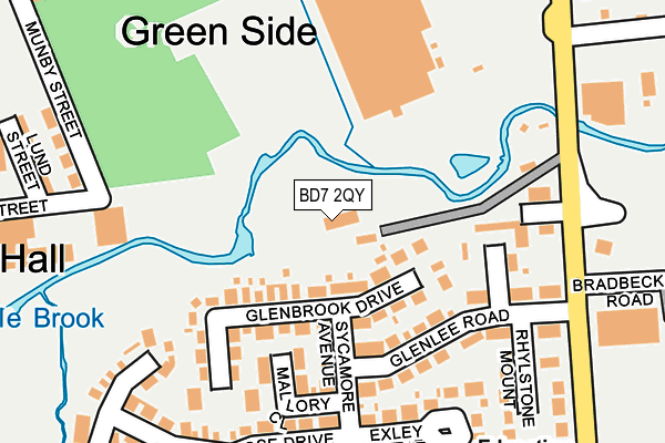
BD7 2QY is located in the Great Horton electoral ward, within the metropolitan district of Bradford and the English Parliamentary constituency of Bradford South. The Sub Integrated Care Board (ICB) Location is NHS West Yorkshire ICB - 36J and the police force is West Yorkshire. This postcode has been in use since June 2011.


GetTheData
Source: OS OpenMap – Local (Ordnance Survey)
Source: OS VectorMap District (Ordnance Survey)
Licence: Open Government Licence (requires attribution)
| Easting | 413594 |
| Northing | 433134 |
| Latitude | 53.794342 |
| Longitude | -1.795118 |
GetTheData
Source: Open Postcode Geo
Licence: Open Government Licence
| Country | England |
| Postcode District | BD7 |
➜ See where BD7 is on a map ➜ Where is Bradford? | |
GetTheData
Source: Land Registry Price Paid Data
Licence: Open Government Licence
Elevation or altitude of BD7 2QY as distance above sea level:
| Metres | Feet | |
|---|---|---|
| Elevation | 130m | 427ft |
Elevation is measured from the approximate centre of the postcode, to the nearest point on an OS contour line from OS Terrain 50, which has contour spacing of ten vertical metres.
➜ How high above sea level am I? Find the elevation of your current position using your device's GPS.
GetTheData
Source: Open Postcode Elevation
Licence: Open Government Licence
| Ward | Great Horton |
| Constituency | Bradford South |
GetTheData
Source: ONS Postcode Database
Licence: Open Government Licence
| Cemetery Rd Nicholas Close (Cemetery Road) | Four Lane Ends | 209m |
| Cemetery Rd Nicholas Close (Cemetery Road) | Four Lane Ends | 221m |
| Cemetery Road Wallis St (Cemetery Road) | Four Lane Ends | 356m |
| Cemetery Road Wallis St (Cemetery Road) | Four Lane Ends | 360m |
| Thornton Rd Olive Grove (Thornton Road) | Four Lane Ends | 378m |
| Bradford Forster Square Station | 2.8km |
| Bradford Interchange Station | 3km |
| Frizinghall Station | 3.4km |
GetTheData
Source: NaPTAN
Licence: Open Government Licence
| Percentage of properties with Next Generation Access | 100.0% |
| Percentage of properties with Superfast Broadband | 100.0% |
| Percentage of properties with Ultrafast Broadband | 0.0% |
| Percentage of properties with Full Fibre Broadband | 0.0% |
Superfast Broadband is between 30Mbps and 300Mbps
Ultrafast Broadband is > 300Mbps
| Percentage of properties unable to receive 2Mbps | 0.0% |
| Percentage of properties unable to receive 5Mbps | 0.0% |
| Percentage of properties unable to receive 10Mbps | 0.0% |
| Percentage of properties unable to receive 30Mbps | 0.0% |
GetTheData
Source: Ofcom
Licence: Ofcom Terms of Use (requires attribution)
GetTheData
Source: ONS Postcode Database
Licence: Open Government Licence


➜ Get more ratings from the Food Standards Agency
GetTheData
Source: Food Standards Agency
Licence: FSA terms & conditions
| Last Collection | |||
|---|---|---|---|
| Location | Mon-Fri | Sat | Distance |
| Lidget Green P.o. Box | 18:00 | 11:45 | 1,012m |
| Paradise Green P.o. Box | 17:00 | 11:45 | 1,081m |
| 71 Whetley Lane | 18:00 | 12:30 | 1,246m |
GetTheData
Source: Dracos
Licence: Creative Commons Attribution-ShareAlike
The below table lists the International Territorial Level (ITL) codes (formerly Nomenclature of Territorial Units for Statistics (NUTS) codes) and Local Administrative Units (LAU) codes for BD7 2QY:
| ITL 1 Code | Name |
|---|---|
| TLE | Yorkshire and The Humber |
| ITL 2 Code | Name |
| TLE4 | West Yorkshire |
| ITL 3 Code | Name |
| TLE41 | Bradford |
| LAU 1 Code | Name |
| E08000032 | Bradford |
GetTheData
Source: ONS Postcode Directory
Licence: Open Government Licence
The below table lists the Census Output Area (OA), Lower Layer Super Output Area (LSOA), and Middle Layer Super Output Area (MSOA) for BD7 2QY:
| Code | Name | |
|---|---|---|
| OA | E00053803 | |
| LSOA | E01010658 | Bradford 041A |
| MSOA | E02002223 | Bradford 041 |
GetTheData
Source: ONS Postcode Directory
Licence: Open Government Licence
| BD7 2QF | Glenbrook Drive | 109m |
| BD7 2QE | Sycamore Avenue | 116m |
| BD7 2TB | Mallory Close | 133m |
| BD7 2QA | Glenlee Road | 163m |
| BD7 2QD | Glenstone Grove | 165m |
| BD7 2TE | Nicholas Close | 190m |
| BD7 2QG | Exley Mount | 223m |
| BD7 2QQ | Glenrose Drive | 234m |
| BD7 2QB | Rhylstone Mount | 234m |
| BD7 2QP | Robinson Court | 256m |
GetTheData
Source: Open Postcode Geo; Land Registry Price Paid Data
Licence: Open Government Licence