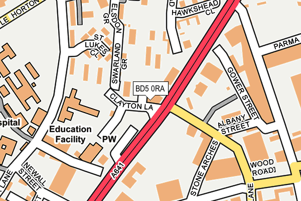
BD5 0RA is located in the City electoral ward, within the metropolitan district of Bradford and the English Parliamentary constituency of Bradford West. The Sub Integrated Care Board (ICB) Location is NHS West Yorkshire ICB - 36J and the police force is West Yorkshire. This postcode has been in use since January 1980.


GetTheData
Source: OS OpenMap – Local (Ordnance Survey)
Source: OS VectorMap District (Ordnance Survey)
Licence: Open Government Licence (requires attribution)
| Easting | 416120 |
| Northing | 431936 |
| Latitude | 53.783503 |
| Longitude | -1.756834 |
GetTheData
Source: Open Postcode Geo
Licence: Open Government Licence
| Country | England |
| Postcode District | BD5 |
➜ See where BD5 is on a map ➜ Where is Bradford? | |
GetTheData
Source: Land Registry Price Paid Data
Licence: Open Government Licence
Elevation or altitude of BD5 0RA as distance above sea level:
| Metres | Feet | |
|---|---|---|
| Elevation | 130m | 427ft |
Elevation is measured from the approximate centre of the postcode, to the nearest point on an OS contour line from OS Terrain 50, which has contour spacing of ten vertical metres.
➜ How high above sea level am I? Find the elevation of your current position using your device's GPS.
GetTheData
Source: Open Postcode Elevation
Licence: Open Government Licence
| Ward | City |
| Constituency | Bradford West |
GetTheData
Source: ONS Postcode Database
Licence: Open Government Licence
| Manchester Rd Bowling Old Lane (Manchester Road) | West Bowling | 60m |
| Manchester Rd Clayton Lane (Manchester Road) | West Bowling | 86m |
| Park Lane Otterburn Clo (Park Lane) | Shearbridge | 180m |
| Manchester Rd Spring Mill Street (Manchester Road) | Bradford City Centre | 183m |
| Manchester Rd Spring Mill Street (Manchester Road) | Bradford City Centre | 204m |
| Bradford Interchange Station | 1km |
| Bradford Forster Square Station | 1.5km |
| Low Moor Station | 3.7km |
GetTheData
Source: NaPTAN
Licence: Open Government Licence
GetTheData
Source: ONS Postcode Database
Licence: Open Government Licence


➜ Get more ratings from the Food Standards Agency
GetTheData
Source: Food Standards Agency
Licence: FSA terms & conditions
| Last Collection | |||
|---|---|---|---|
| Location | Mon-Fri | Sat | Distance |
| Burnett Avenue | 18:15 | 13:00 | 100m |
| Chapel Green | 17:30 | 12:30 | 266m |
| Park Lane | 17:45 | 11:45 | 290m |
GetTheData
Source: Dracos
Licence: Creative Commons Attribution-ShareAlike
The below table lists the International Territorial Level (ITL) codes (formerly Nomenclature of Territorial Units for Statistics (NUTS) codes) and Local Administrative Units (LAU) codes for BD5 0RA:
| ITL 1 Code | Name |
|---|---|
| TLE | Yorkshire and The Humber |
| ITL 2 Code | Name |
| TLE4 | West Yorkshire |
| ITL 3 Code | Name |
| TLE41 | Bradford |
| LAU 1 Code | Name |
| E08000032 | Bradford |
GetTheData
Source: ONS Postcode Directory
Licence: Open Government Licence
The below table lists the Census Output Area (OA), Lower Layer Super Output Area (LSOA), and Middle Layer Super Output Area (MSOA) for BD5 0RA:
| Code | Name | |
|---|---|---|
| OA | E00176130 | |
| LSOA | E01010732 | Bradford 048B |
| MSOA | E02002230 | Bradford 048 |
GetTheData
Source: ONS Postcode Directory
Licence: Open Government Licence
| BD5 7RA | Manchester Road | 58m |
| BD5 0TW | Hawkshead Walk | 120m |
| BD5 0XA | St Lukes Close | 152m |
| BD5 0TN | Hawkshead Way | 169m |
| BD5 7JF | Gower Street | 180m |
| BD5 0TH | Hawkshead Close | 189m |
| BD5 0JL | Park Lane | 191m |
| BD5 0TJ | Hawkshead Drive | 202m |
| BD5 7HF | Springmill Street | 213m |
| BD5 0JQ | Mary Seacole Close | 217m |
GetTheData
Source: Open Postcode Geo; Land Registry Price Paid Data
Licence: Open Government Licence