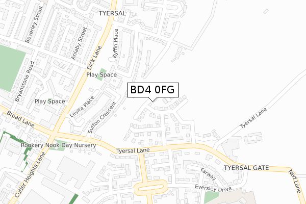
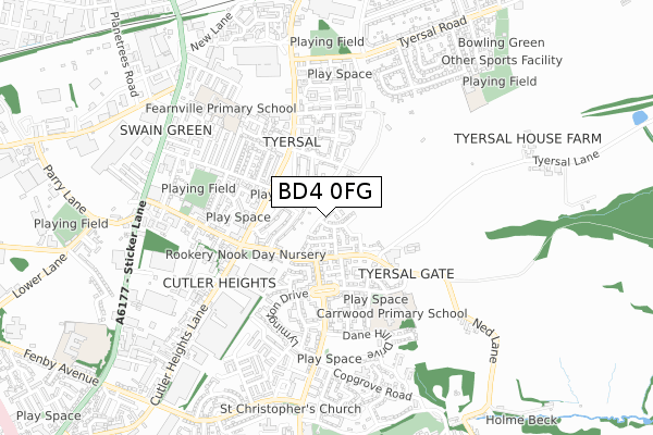
BD4 0FG is located in the Pudsey electoral ward, within the metropolitan district of Leeds and the English Parliamentary constituency of Pudsey. The Sub Integrated Care Board (ICB) Location is NHS West Yorkshire ICB - 15F and the police force is West Yorkshire. This postcode has been in use since March 2019.


GetTheData
Source: OS Open Zoomstack (Ordnance Survey)
Licence: Open Government Licence (requires attribution)
Attribution: Contains OS data © Crown copyright and database right 2024
Source: Open Postcode Geo
Licence: Open Government Licence (requires attribution)
Attribution: Contains OS data © Crown copyright and database right 2024; Contains Royal Mail data © Royal Mail copyright and database right 2024; Source: Office for National Statistics licensed under the Open Government Licence v.3.0
| Easting | 419280 |
| Northing | 432072 |
| Latitude | 53.784633 |
| Longitude | -1.708872 |
GetTheData
Source: Open Postcode Geo
Licence: Open Government Licence
| Country | England |
| Postcode District | BD4 |
➜ See where BD4 is on a map ➜ Where is Bradford? | |
GetTheData
Source: Land Registry Price Paid Data
Licence: Open Government Licence
| Ward | Pudsey |
| Constituency | Pudsey |
GetTheData
Source: ONS Postcode Database
Licence: Open Government Licence
2023 24 FEB £225,000 |
60, TURNER GROVE, BRADFORD, BD4 0FG 2021 23 AUG £191,995 |
56, TURNER GROVE, BRADFORD, BD4 0FG 2021 29 JUL £163,995 |
54, TURNER GROVE, BRADFORD, BD4 0FG 2021 1 JUL £169,995 |
50, TURNER GROVE, BRADFORD, BD4 0FG 2021 30 JUN £203,995 |
58, TURNER GROVE, BRADFORD, BD4 0FG 2021 30 JUN £169,995 |
52, TURNER GROVE, BRADFORD, BD4 0FG 2021 30 JUN £159,995 |
48, TURNER GROVE, BRADFORD, BD4 0FG 2021 29 JAN £146,995 |
44, TURNER GROVE, BRADFORD, BD4 0FG 2020 23 DEC £181,995 |
46, TURNER GROVE, BRADFORD, BD4 0FG 2020 23 DEC £158,995 |
GetTheData
Source: HM Land Registry Price Paid Data
Licence: Contains HM Land Registry data © Crown copyright and database right 2024. This data is licensed under the Open Government Licence v3.0.
| Tyersal Lane Broadstone Wy (Tyersal Lane) | Cutler Heights | 231m |
| Broadstone Way Tyersal Ln (Broadstone Way) | Cutler Heights | 238m |
| Dick Lane Parsonage Rd (Dick Lane) | Cutler Heights | 264m |
| Dick Lane Parsonage Rd (Dick Lane) | Cutler Heights | 266m |
| Dick Lane Parsonage Rd (Dick Lane) | Cutler Heights | 279m |
| Bradford Interchange Station | 2.8km |
| New Pudsey Station | 2.9km |
| Bradford Forster Square Station | 3.2km |
GetTheData
Source: NaPTAN
Licence: Open Government Licence
| Percentage of properties with Next Generation Access | 0.0% |
| Percentage of properties with Superfast Broadband | 0.0% |
| Percentage of properties with Ultrafast Broadband | 0.0% |
| Percentage of properties with Full Fibre Broadband | 0.0% |
Superfast Broadband is between 30Mbps and 300Mbps
Ultrafast Broadband is > 300Mbps
| Percentage of properties unable to receive 2Mbps | 0.0% |
| Percentage of properties unable to receive 5Mbps | 0.0% |
| Percentage of properties unable to receive 10Mbps | 0.0% |
| Percentage of properties unable to receive 30Mbps | 100.0% |
GetTheData
Source: Ofcom
Licence: Ofcom Terms of Use (requires attribution)
GetTheData
Source: ONS Postcode Database
Licence: Open Government Licence


➜ Get more ratings from the Food Standards Agency
GetTheData
Source: Food Standards Agency
Licence: FSA terms & conditions
| Last Collection | |||
|---|---|---|---|
| Location | Mon-Fri | Sat | Distance |
| 59 - 61 Dick Lane | 18:00 | 10:45 | 271m |
| 7 Lymington Drive | 17:45 | 10:00 | 353m |
| Tyersal | 17:30 | 10:45 | 579m |
GetTheData
Source: Dracos
Licence: Creative Commons Attribution-ShareAlike
The below table lists the International Territorial Level (ITL) codes (formerly Nomenclature of Territorial Units for Statistics (NUTS) codes) and Local Administrative Units (LAU) codes for BD4 0FG:
| ITL 1 Code | Name |
|---|---|
| TLE | Yorkshire and The Humber |
| ITL 2 Code | Name |
| TLE4 | West Yorkshire |
| ITL 3 Code | Name |
| TLE42 | Leeds |
| LAU 1 Code | Name |
| E08000035 | Leeds |
GetTheData
Source: ONS Postcode Directory
Licence: Open Government Licence
The below table lists the Census Output Area (OA), Lower Layer Super Output Area (LSOA), and Middle Layer Super Output Area (MSOA) for BD4 0FG:
| Code | Name | |
|---|---|---|
| OA | E00058497 | |
| LSOA | E01011606 | Leeds 076D |
| MSOA | E02002405 | Leeds 076 |
GetTheData
Source: ONS Postcode Directory
Licence: Open Government Licence
| BD4 8LY | Sutton Crescent | 117m |
| BD4 8LU | Whinney Hill | 123m |
| BD4 0ER | Tyersal Lane | 217m |
| BD4 8NQ | Levita Place | 250m |
| BD4 0ES | Faversham Walk | 256m |
| BD4 0HB | Tyersal Lane | 261m |
| BD4 0HA | Broadstone Way | 274m |
| BD4 0EG | Farway | 275m |
| BD4 8LR | Dence Green | 285m |
| BD4 8HX | Dick Lane | 287m |
GetTheData
Source: Open Postcode Geo; Land Registry Price Paid Data
Licence: Open Government Licence