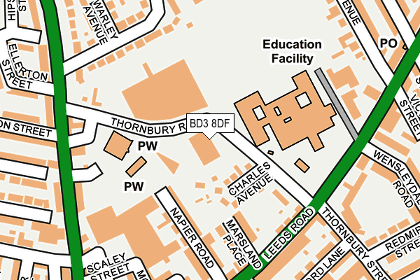
BD3 8DF is located in the Bradford Moor electoral ward, within the metropolitan district of Bradford and the English Parliamentary constituency of Bradford East. The Sub Integrated Care Board (ICB) Location is NHS West Yorkshire ICB - 36J and the police force is West Yorkshire. This postcode has been in use since May 2007.


GetTheData
Source: OS OpenMap – Local (Ordnance Survey)
Source: OS VectorMap District (Ordnance Survey)
Licence: Open Government Licence (requires attribution)
| Easting | 418775 |
| Northing | 433341 |
| Latitude | 53.796042 |
| Longitude | -1.716456 |
GetTheData
Source: Open Postcode Geo
Licence: Open Government Licence
| Country | England |
| Postcode District | BD3 |
➜ See where BD3 is on a map ➜ Where is Bradford? | |
GetTheData
Source: Land Registry Price Paid Data
Licence: Open Government Licence
Elevation or altitude of BD3 8DF as distance above sea level:
| Metres | Feet | |
|---|---|---|
| Elevation | 180m | 591ft |
Elevation is measured from the approximate centre of the postcode, to the nearest point on an OS contour line from OS Terrain 50, which has contour spacing of ten vertical metres.
➜ How high above sea level am I? Find the elevation of your current position using your device's GPS.
GetTheData
Source: Open Postcode Elevation
Licence: Open Government Licence
| Ward | Bradford Moor |
| Constituency | Bradford East |
GetTheData
Source: ONS Postcode Database
Licence: Open Government Licence
| Leeds Rd Thornbury Street (Leeds Road) | Laisterdyke | 180m |
| Leeds Road Marsland Place (Leeds Road) | Laisterdyke | 181m |
| Leeds Rd Wensleydale Road (Leeds Road) | Thornbury | 183m |
| Killinghall Rd Thornbury Road (Killinghall Road) | Bradford Moor | 211m |
| Killinghall Road Daniel St (Killinghall Road) | Laisterdyke | 216m |
| Bradford Interchange Station | 2.3km |
| Bradford Forster Square Station | 2.4km |
| New Pudsey Station | 2.5km |
GetTheData
Source: NaPTAN
Licence: Open Government Licence
GetTheData
Source: ONS Postcode Database
Licence: Open Government Licence


➜ Get more ratings from the Food Standards Agency
GetTheData
Source: Food Standards Agency
Licence: FSA terms & conditions
| Last Collection | |||
|---|---|---|---|
| Location | Mon-Fri | Sat | Distance |
| Bradford Moor | 17:30 | 11:45 | 385m |
| Roundwood Glen | 17:45 | 12:00 | 704m |
| Tyersal | 17:30 | 10:45 | 806m |
GetTheData
Source: Dracos
Licence: Creative Commons Attribution-ShareAlike
The below table lists the International Territorial Level (ITL) codes (formerly Nomenclature of Territorial Units for Statistics (NUTS) codes) and Local Administrative Units (LAU) codes for BD3 8DF:
| ITL 1 Code | Name |
|---|---|
| TLE | Yorkshire and The Humber |
| ITL 2 Code | Name |
| TLE4 | West Yorkshire |
| ITL 3 Code | Name |
| TLE41 | Bradford |
| LAU 1 Code | Name |
| E08000032 | Bradford |
GetTheData
Source: ONS Postcode Directory
Licence: Open Government Licence
The below table lists the Census Output Area (OA), Lower Layer Super Output Area (LSOA), and Middle Layer Super Output Area (MSOA) for BD3 8DF:
| Code | Name | |
|---|---|---|
| OA | E00053629 | |
| LSOA | E01010620 | Bradford 042A |
| MSOA | E02002224 | Bradford 042 |
GetTheData
Source: ONS Postcode Directory
Licence: Open Government Licence
| BD3 8HE | Thornbury Road | 63m |
| BD3 8HF | Charles Avenue | 63m |
| BD3 8DA | Napier Road | 130m |
| BD3 8BX | Marsland Place | 132m |
| BD3 8HL | School Square | 184m |
| BD3 8BY | Leeds Road | 192m |
| BD3 8LF | Leeds Road | 196m |
| BD3 8DT | Killinghall Road | 200m |
| BD3 8HP | Warley Drive | 203m |
| BD3 8DB | Napier Terrace | 206m |
GetTheData
Source: Open Postcode Geo; Land Registry Price Paid Data
Licence: Open Government Licence