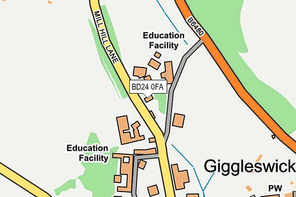
BD24 0FA is located in the Settle & Penyghent electoral ward, within the unitary authority of North Yorkshire and the English Parliamentary constituency of Skipton and Ripon. The Sub Integrated Care Board (ICB) Location is NHS West Yorkshire ICB - 36J and the police force is North Yorkshire. This postcode has been in use since September 2015.


GetTheData
Source: OS OpenMap – Local (Ordnance Survey)
Source: OS VectorMap District (Ordnance Survey)
Licence: Open Government Licence (requires attribution)
| Easting | 380901 |
| Northing | 464287 |
| Latitude | 54.074153 |
| Longitude | -2.293371 |
GetTheData
Source: Open Postcode Geo
Licence: Open Government Licence
| Country | England |
| Postcode District | BD24 |
➜ See where BD24 is on a map ➜ Where is Giggleswick? | |
GetTheData
Source: Land Registry Price Paid Data
Licence: Open Government Licence
Elevation or altitude of BD24 0FA as distance above sea level:
| Metres | Feet | |
|---|---|---|
| Elevation | 150m | 492ft |
Elevation is measured from the approximate centre of the postcode, to the nearest point on an OS contour line from OS Terrain 50, which has contour spacing of ten vertical metres.
➜ How high above sea level am I? Find the elevation of your current position using your device's GPS.
GetTheData
Source: Open Postcode Elevation
Licence: Open Government Licence
| Ward | Settle & Penyghent |
| Constituency | Skipton And Ripon |
GetTheData
Source: ONS Postcode Database
Licence: Open Government Licence
| Belle Hill (Church Street) | Giggleswick | 439m |
| Belle Hill (Bankwell Road) | Giggleswick | 447m |
| The Mains Drive (Belle Hill) | Giggleswick | 465m |
| The Mains Drive (Belle Hill) | Giggleswick | 483m |
| Bankwell Road | Giggleswick | 560m |
| Settle Station | 1.2km |
| Giggleswick Station | 1.5km |
GetTheData
Source: NaPTAN
Licence: Open Government Licence
GetTheData
Source: ONS Postcode Database
Licence: Open Government Licence


➜ Get more ratings from the Food Standards Agency
GetTheData
Source: Food Standards Agency
Licence: FSA terms & conditions
| Last Collection | |||
|---|---|---|---|
| Location | Mon-Fri | Sat | Distance |
| Giggleswick P.o. Box | 17:15 | 11:30 | 401m |
| Bridge End | 17:30 | 11:45 | 863m |
| Mill Close | 17:30 | 11:30 | 909m |
GetTheData
Source: Dracos
Licence: Creative Commons Attribution-ShareAlike
The below table lists the International Territorial Level (ITL) codes (formerly Nomenclature of Territorial Units for Statistics (NUTS) codes) and Local Administrative Units (LAU) codes for BD24 0FA:
| ITL 1 Code | Name |
|---|---|
| TLE | Yorkshire and The Humber |
| ITL 2 Code | Name |
| TLE2 | North Yorkshire |
| ITL 3 Code | Name |
| TLE22 | North Yorkshire CC |
| LAU 1 Code | Name |
| E07000163 | Craven |
GetTheData
Source: ONS Postcode Directory
Licence: Open Government Licence
The below table lists the Census Output Area (OA), Lower Layer Super Output Area (LSOA), and Middle Layer Super Output Area (MSOA) for BD24 0FA:
| Code | Name | |
|---|---|---|
| OA | E00140350 | |
| LSOA | E01027571 | Craven 003B |
| MSOA | E02005744 | Craven 003 |
GetTheData
Source: ONS Postcode Directory
Licence: Open Government Licence
| BD24 0BJ | 308m | |
| BD24 0DQ | Mill Hill Lane | 359m |
| BD24 0BE | Church Street | 371m |
| BD24 0AZ | 371m | |
| BD24 0BG | Parkers Yard | 381m |
| BD24 0AX | The Mains | 387m |
| BD24 0BD | Garstangs Yard | 399m |
| BD24 0BT | Tems Street | 424m |
| BD24 0BA | Belle Hill | 446m |
| BD24 0BY | Raines Road | 474m |
GetTheData
Source: Open Postcode Geo; Land Registry Price Paid Data
Licence: Open Government Licence