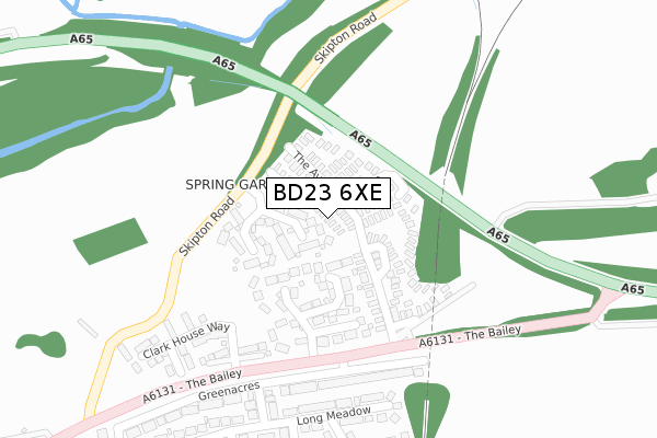
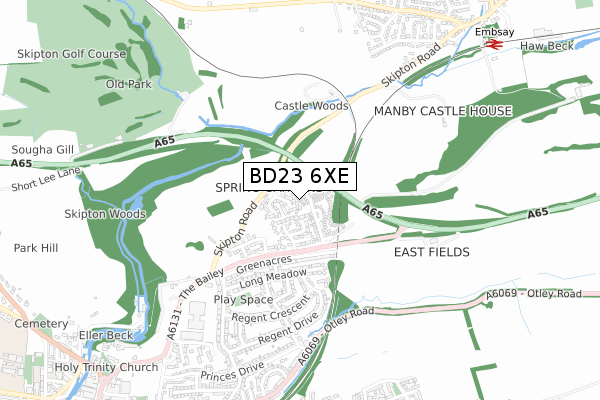
BD23 6XE is located in the Skipton North & Embsay-with-Eastby electoral ward, within the unitary authority of North Yorkshire and the English Parliamentary constituency of Skipton and Ripon. The Sub Integrated Care Board (ICB) Location is NHS West Yorkshire ICB - 36J and the police force is North Yorkshire. This postcode has been in use since December 1995.


GetTheData
Source: OS Open Zoomstack (Ordnance Survey)
Licence: Open Government Licence (requires attribution)
Attribution: Contains OS data © Crown copyright and database right 2025
Source: Open Postcode Geo
Licence: Open Government Licence (requires attribution)
Attribution: Contains OS data © Crown copyright and database right 2025; Contains Royal Mail data © Royal Mail copyright and database right 2025; Source: Office for National Statistics licensed under the Open Government Licence v.3.0
| Easting | 399853 |
| Northing | 452603 |
| Latitude | 53.969500 |
| Longitude | -2.003729 |
GetTheData
Source: Open Postcode Geo
Licence: Open Government Licence
| Country | England |
| Postcode District | BD23 |
➜ See where BD23 is on a map ➜ Where is Skipton? | |
GetTheData
Source: Land Registry Price Paid Data
Licence: Open Government Licence
Elevation or altitude of BD23 6XE as distance above sea level:
| Metres | Feet | |
|---|---|---|
| Elevation | 150m | 492ft |
Elevation is measured from the approximate centre of the postcode, to the nearest point on an OS contour line from OS Terrain 50, which has contour spacing of ten vertical metres.
➜ How high above sea level am I? Find the elevation of your current position using your device's GPS.
GetTheData
Source: Open Postcode Elevation
Licence: Open Government Licence
| Ward | Skipton North & Embsay-with-eastby |
| Constituency | Skipton And Ripon |
GetTheData
Source: ONS Postcode Database
Licence: Open Government Licence
| Overdale Park (A6131) | Skipton | 208m |
| Overdale Park (A6131) | Skipton | 218m |
| Greenacres (Meadow Rise) | Skipton | 299m |
| Pasture Close (Uplands) | Skipton | 419m |
| Long Meadow (Regent Road) | Skipton | 475m |
| Embsay (Embsay & Bolton Abbey Railway) | Embsay | 1,042m |
| Skipton Station | 1.9km |
GetTheData
Source: NaPTAN
Licence: Open Government Licence
| Percentage of properties with Next Generation Access | 100.0% |
| Percentage of properties with Superfast Broadband | 100.0% |
| Percentage of properties with Ultrafast Broadband | 0.0% |
| Percentage of properties with Full Fibre Broadband | 0.0% |
Superfast Broadband is between 30Mbps and 300Mbps
Ultrafast Broadband is > 300Mbps
| Percentage of properties unable to receive 2Mbps | 0.0% |
| Percentage of properties unable to receive 5Mbps | 0.0% |
| Percentage of properties unable to receive 10Mbps | 0.0% |
| Percentage of properties unable to receive 30Mbps | 0.0% |
GetTheData
Source: Ofcom
Licence: Ofcom Terms of Use (requires attribution)
GetTheData
Source: ONS Postcode Database
Licence: Open Government Licence


➜ Get more ratings from the Food Standards Agency
GetTheData
Source: Food Standards Agency
Licence: FSA terms & conditions
| Last Collection | |||
|---|---|---|---|
| Location | Mon-Fri | Sat | Distance |
| Cross Bank | 16:45 | 11:30 | 133m |
| Overdale Trailer Park | 17:30 | 12:30 | 205m |
| 39 Long Meadow | 17:30 | 12:30 | 314m |
GetTheData
Source: Dracos
Licence: Creative Commons Attribution-ShareAlike
The below table lists the International Territorial Level (ITL) codes (formerly Nomenclature of Territorial Units for Statistics (NUTS) codes) and Local Administrative Units (LAU) codes for BD23 6XE:
| ITL 1 Code | Name |
|---|---|
| TLE | Yorkshire and The Humber |
| ITL 2 Code | Name |
| TLE2 | North Yorkshire |
| ITL 3 Code | Name |
| TLE22 | North Yorkshire CC |
| LAU 1 Code | Name |
| E07000163 | Craven |
GetTheData
Source: ONS Postcode Directory
Licence: Open Government Licence
The below table lists the Census Output Area (OA), Lower Layer Super Output Area (LSOA), and Middle Layer Super Output Area (MSOA) for BD23 6XE:
| Code | Name | |
|---|---|---|
| OA | E00140384 | |
| LSOA | E01027576 | Craven 004C |
| MSOA | E02005745 | Craven 004 |
GetTheData
Source: ONS Postcode Directory
Licence: Open Government Licence
| BD23 6AH | Cross Bank | 77m |
| BD23 6AZ | New Laithe Close | 113m |
| BD23 6AG | Overdale Grange | 148m |
| BD23 6AY | Skibeden Court | 180m |
| BD23 1BU | Greenacres | 248m |
| BD23 1BP | Long Meadow | 282m |
| BD23 1BT | Meadow Rise | 297m |
| BD23 1BW | Long Meadow | 310m |
| BD23 1BS | Long Meadow | 347m |
| BD23 1BY | Haw Bank Court | 350m |
GetTheData
Source: Open Postcode Geo; Land Registry Price Paid Data
Licence: Open Government Licence