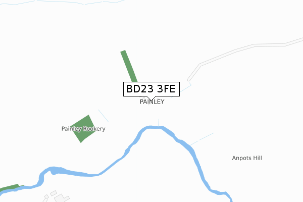
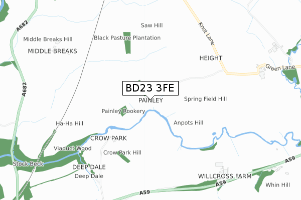
BD23 3FE is located in the Gisburn & Rimington electoral ward, within the local authority district of Ribble Valley and the English Parliamentary constituency of Ribble Valley. The Sub Integrated Care Board (ICB) Location is NHS Lancashire and South Cumbria ICB - 01A and the police force is Lancashire. This postcode has been in use since January 2020.


GetTheData
Source: OS Open Zoomstack (Ordnance Survey)
Licence: Open Government Licence (requires attribution)
Attribution: Contains OS data © Crown copyright and database right 2025
Source: Open Postcode Geo
Licence: Open Government Licence (requires attribution)
Attribution: Contains OS data © Crown copyright and database right 2025; Contains Royal Mail data © Royal Mail copyright and database right 2025; Source: Office for National Statistics licensed under the Open Government Licence v.3.0
| Easting | 384154 |
| Northing | 450028 |
| Latitude | 53.946125 |
| Longitude | -2.242912 |
GetTheData
Source: Open Postcode Geo
Licence: Open Government Licence
| Country | England |
| Postcode District | BD23 |
➜ See where BD23 is on a map | |
GetTheData
Source: Land Registry Price Paid Data
Licence: Open Government Licence
| Ward | Gisburn & Rimington |
| Constituency | Ribble Valley |
GetTheData
Source: ONS Postcode Database
Licence: Open Government Licence
| Travellers Court (Main Street) | Gisburn | 1,526m |
| Travellers Court (Main Street) | Gisburn | 1,537m |
| White Bull (Main Street) | Gisburn | 1,734m |
| Post Office (Main Street) | Gisburn | 1,805m |
| Primary School (Burnley Road) | Gisburn | 1,871m |
GetTheData
Source: NaPTAN
Licence: Open Government Licence
GetTheData
Source: ONS Postcode Database
Licence: Open Government Licence


➜ Get more ratings from the Food Standards Agency
GetTheData
Source: Food Standards Agency
Licence: FSA terms & conditions
| Last Collection | |||
|---|---|---|---|
| Location | Mon-Fri | Sat | Distance |
| Ghyll Meadows | 17:30 | 11:30 | 4,929m |
| Barnoldswick Post Office | 18:30 | 12:00 | 4,997m |
| Salterforth Post Office | 17:30 | 11:15 | 6,662m |
GetTheData
Source: Dracos
Licence: Creative Commons Attribution-ShareAlike
The below table lists the International Territorial Level (ITL) codes (formerly Nomenclature of Territorial Units for Statistics (NUTS) codes) and Local Administrative Units (LAU) codes for BD23 3FE:
| ITL 1 Code | Name |
|---|---|
| TLD | North West (England) |
| ITL 2 Code | Name |
| TLD4 | Lancashire |
| ITL 3 Code | Name |
| TLD45 | Mid Lancashire |
| LAU 1 Code | Name |
| E07000124 | Ribble Valley |
GetTheData
Source: ONS Postcode Directory
Licence: Open Government Licence
The below table lists the Census Output Area (OA), Lower Layer Super Output Area (LSOA), and Middle Layer Super Output Area (MSOA) for BD23 3FE:
| Code | Name | |
|---|---|---|
| OA | E00128569 | |
| LSOA | E01025331 | Ribble Valley 001C |
| MSOA | E02005270 | Ribble Valley 001 |
GetTheData
Source: ONS Postcode Directory
Licence: Open Government Licence
| BB7 4HP | Skipton Road | 896m |
| BD23 3JT | 1375m | |
| BB7 4JE | Settle Road | 1411m |
| BB7 4HN | Police Houses | 1431m |
| BB7 4HL | Main Street | 1464m |
| BB7 4HS | 1510m | |
| BB7 4NF | Travellers Court | 1535m |
| BB7 4HH | Main Street | 1578m |
| BB7 4HR | Main Street | 1581m |
| BB7 4HQ | Hellifield Road | 1597m |
GetTheData
Source: Open Postcode Geo; Land Registry Price Paid Data
Licence: Open Government Licence