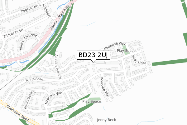
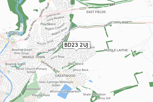
BD23 2UJ is located in the Skipton East & South electoral ward, within the unitary authority of North Yorkshire and the English Parliamentary constituency of Skipton and Ripon. The Sub Integrated Care Board (ICB) Location is NHS West Yorkshire ICB - 36J and the police force is North Yorkshire. This postcode has been in use since May 2018.


GetTheData
Source: OS Open Zoomstack (Ordnance Survey)
Licence: Open Government Licence (requires attribution)
Attribution: Contains OS data © Crown copyright and database right 2024
Source: Open Postcode Geo
Licence: Open Government Licence (requires attribution)
Attribution: Contains OS data © Crown copyright and database right 2024; Contains Royal Mail data © Royal Mail copyright and database right 2024; Source: Office for National Statistics licensed under the Open Government Licence v.3.0
| Easting | 400083 |
| Northing | 451747 |
| Latitude | 53.961821 |
| Longitude | -2.000227 |
GetTheData
Source: Open Postcode Geo
Licence: Open Government Licence
| Country | England |
| Postcode District | BD23 |
➜ See where BD23 is on a map ➜ Where is Skipton? | |
GetTheData
Source: Land Registry Price Paid Data
Licence: Open Government Licence
| Ward | Skipton East & South |
| Constituency | Skipton And Ripon |
GetTheData
Source: ONS Postcode Database
Licence: Open Government Licence
| Moorview Way (Hurrs Road) | Skipton | 124m |
| Moorview Way (Hurrs Road) | Skipton | 130m |
| Kingsway (A6069) | Skipton | 283m |
| Kingsway (A6069) | Skipton | 304m |
| Regent Drive (Kingsway) | Skipton | 398m |
| Skipton Station | 1.7km |
| Cononley Station | 5km |
GetTheData
Source: NaPTAN
Licence: Open Government Licence
| Percentage of properties with Next Generation Access | 100.0% |
| Percentage of properties with Superfast Broadband | 100.0% |
| Percentage of properties with Ultrafast Broadband | 0.0% |
| Percentage of properties with Full Fibre Broadband | 0.0% |
Superfast Broadband is between 30Mbps and 300Mbps
Ultrafast Broadband is > 300Mbps
| Percentage of properties unable to receive 2Mbps | 0.0% |
| Percentage of properties unable to receive 5Mbps | 0.0% |
| Percentage of properties unable to receive 10Mbps | 0.0% |
| Percentage of properties unable to receive 30Mbps | 0.0% |
GetTheData
Source: Ofcom
Licence: Ofcom Terms of Use (requires attribution)
GetTheData
Source: ONS Postcode Database
Licence: Open Government Licence


➜ Get more ratings from the Food Standards Agency
GetTheData
Source: Food Standards Agency
Licence: FSA terms & conditions
| Last Collection | |||
|---|---|---|---|
| Location | Mon-Fri | Sat | Distance |
| 104 Moorview Way | 17:30 | 12:15 | 116m |
| 23 Otley Road | 17:30 | 12:30 | 342m |
| 26 Shortbank Road | 17:30 | 12:15 | 433m |
GetTheData
Source: Dracos
Licence: Creative Commons Attribution-ShareAlike
The below table lists the International Territorial Level (ITL) codes (formerly Nomenclature of Territorial Units for Statistics (NUTS) codes) and Local Administrative Units (LAU) codes for BD23 2UJ:
| ITL 1 Code | Name |
|---|---|
| TLE | Yorkshire and The Humber |
| ITL 2 Code | Name |
| TLE2 | North Yorkshire |
| ITL 3 Code | Name |
| TLE22 | North Yorkshire CC |
| LAU 1 Code | Name |
| E07000163 | Craven |
GetTheData
Source: ONS Postcode Directory
Licence: Open Government Licence
The below table lists the Census Output Area (OA), Lower Layer Super Output Area (LSOA), and Middle Layer Super Output Area (MSOA) for BD23 2UJ:
| Code | Name | |
|---|---|---|
| OA | E00140369 | |
| LSOA | E01027574 | Craven 005A |
| MSOA | E02005746 | Craven 005 |
GetTheData
Source: ONS Postcode Directory
Licence: Open Government Licence
| BD23 2UH | Hepworth Way | 96m |
| BD23 2TS | Wensleydale Avenue | 113m |
| BD23 2TN | Moorview Way | 116m |
| BD23 2JF | Hurrs Road | 122m |
| BD23 2LN | Moorview Way | 142m |
| BD23 2LL | Airedale Avenue | 188m |
| BD23 2TW | Moorview Way | 234m |
| BD23 2US | Asquith Drive | 248m |
| BD23 2WD | Elsey Close | 255m |
| BD23 2JW | Moorview Way | 267m |
GetTheData
Source: Open Postcode Geo; Land Registry Price Paid Data
Licence: Open Government Licence