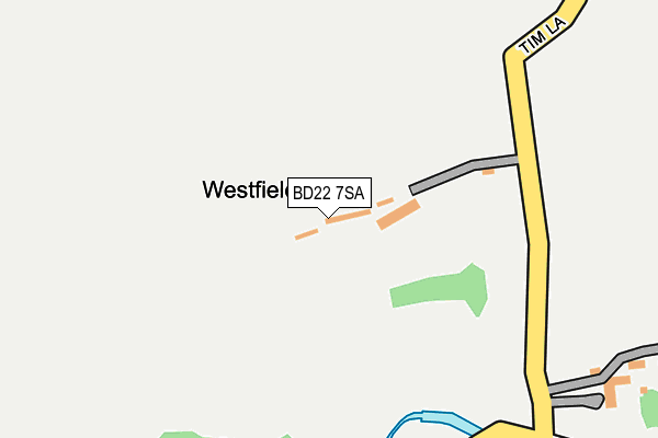
BD22 7SA lies on Tim Lane in Oakworth, Keighley. BD22 7SA is located in the Worth Valley electoral ward, within the metropolitan district of Bradford and the English Parliamentary constituency of Keighley. The Sub Integrated Care Board (ICB) Location is NHS West Yorkshire ICB - 36J and the police force is West Yorkshire. This postcode has been in use since January 1980.


GetTheData
Source: OS OpenMap – Local (Ordnance Survey)
Source: OS VectorMap District (Ordnance Survey)
Licence: Open Government Licence (requires attribution)
| Easting | 402673 |
| Northing | 438022 |
| Latitude | 53.838457 |
| Longitude | -1.960866 |
GetTheData
Source: Open Postcode Geo
Licence: Open Government Licence
| Street | Tim Lane |
| Locality | Oakworth |
| Town/City | Keighley |
| Country | England |
| Postcode District | BD22 |
➜ See where BD22 is on a map | |
GetTheData
Source: Land Registry Price Paid Data
Licence: Open Government Licence
Elevation or altitude of BD22 7SA as distance above sea level:
| Metres | Feet | |
|---|---|---|
| Elevation | 200m | 656ft |
Elevation is measured from the approximate centre of the postcode, to the nearest point on an OS contour line from OS Terrain 50, which has contour spacing of ten vertical metres.
➜ How high above sea level am I? Find the elevation of your current position using your device's GPS.
GetTheData
Source: Open Postcode Elevation
Licence: Open Government Licence
| Ward | Worth Valley |
| Constituency | Keighley |
GetTheData
Source: ONS Postcode Database
Licence: Open Government Licence
| Hob Cote Lane | Oakworth | 565m |
| Hob Cote Lane | Oakworth | 580m |
| Denby Hill Road | Oakworth | 583m |
| Bridge St Hillside Ave (Bridge Street) | Oakworth | 597m |
| Denby Hill Road | Oakworth | 600m |
| Haworth (Keighley & Worth Valley Railway) | Haworth | 1,125m |
| Oakworth (Keighley & Worth Valley Railway) | Oakworth | 1,293m |
| Keighley Station | 5.1km |
GetTheData
Source: NaPTAN
Licence: Open Government Licence
Estimated total energy consumption in BD22 7SA by fuel type, 2015.
| Consumption (kWh) | 57,236 |
|---|---|
| Meter count | 8 |
| Mean (kWh/meter) | 7,154 |
| Median (kWh/meter) | 3,599 |
GetTheData
Source: Postcode level gas estimates: 2015 (experimental)
Source: Postcode level electricity estimates: 2015 (experimental)
Licence: Open Government Licence
GetTheData
Source: ONS Postcode Database
Licence: Open Government Licence


➜ Get more ratings from the Food Standards Agency
GetTheData
Source: Food Standards Agency
Licence: FSA terms & conditions
| Last Collection | |||
|---|---|---|---|
| Location | Mon-Fri | Sat | Distance |
| Lane Ends Oakworth | 17:30 | 12:00 | 938m |
| Wheathead Lane | 17:45 | 12:30 | 953m |
| Haworth Brow P.o. Box | 17:15 | 11:15 | 1,135m |
GetTheData
Source: Dracos
Licence: Creative Commons Attribution-ShareAlike
The below table lists the International Territorial Level (ITL) codes (formerly Nomenclature of Territorial Units for Statistics (NUTS) codes) and Local Administrative Units (LAU) codes for BD22 7SA:
| ITL 1 Code | Name |
|---|---|
| TLE | Yorkshire and The Humber |
| ITL 2 Code | Name |
| TLE4 | West Yorkshire |
| ITL 3 Code | Name |
| TLE41 | Bradford |
| LAU 1 Code | Name |
| E08000032 | Bradford |
GetTheData
Source: ONS Postcode Directory
Licence: Open Government Licence
The below table lists the Census Output Area (OA), Lower Layer Super Output Area (LSOA), and Middle Layer Super Output Area (MSOA) for BD22 7SA:
| Code | Name | |
|---|---|---|
| OA | E00054743 | |
| LSOA | E01010855 | Bradford 023B |
| MSOA | E02002205 | Bradford 023 |
GetTheData
Source: ONS Postcode Directory
Licence: Open Government Licence
| BD22 7RX | Springhead | 301m |
| BD22 7SP | Tim Lane | 309m |
| BD22 7SU | Springhead Road | 385m |
| BD22 7RZ | Springhead Road | 424m |
| BD22 7SE | Tim Lane | 504m |
| BD22 7SG | 505m | |
| BD22 8QP | Lord Lane | 509m |
| BD22 7QA | Denby Mount | 548m |
| BD22 7SF | Denby Court | 551m |
| BD22 7PY | Hill Top Road | 566m |
GetTheData
Source: Open Postcode Geo; Land Registry Price Paid Data
Licence: Open Government Licence