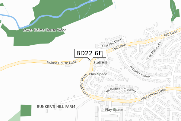
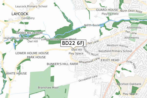
BD22 6FJ is located in the Keighley West electoral ward, within the metropolitan district of Bradford and the English Parliamentary constituency of Keighley. The Sub Integrated Care Board (ICB) Location is NHS West Yorkshire ICB - 36J and the police force is West Yorkshire. This postcode has been in use since December 2017.


GetTheData
Source: OS Open Zoomstack (Ordnance Survey)
Licence: Open Government Licence (requires attribution)
Attribution: Contains OS data © Crown copyright and database right 2025
Source: Open Postcode Geo
Licence: Open Government Licence (requires attribution)
Attribution: Contains OS data © Crown copyright and database right 2025; Contains Royal Mail data © Royal Mail copyright and database right 2025; Source: Office for National Statistics licensed under the Open Government Licence v.3.0
| Easting | 404046 |
| Northing | 440453 |
| Latitude | 53.860298 |
| Longitude | -1.939970 |
GetTheData
Source: Open Postcode Geo
Licence: Open Government Licence
| Country | England |
| Postcode District | BD22 |
➜ See where BD22 is on a map ➜ Where is Keighley? | |
GetTheData
Source: Land Registry Price Paid Data
Licence: Open Government Licence
| Ward | Keighley West |
| Constituency | Keighley |
GetTheData
Source: ONS Postcode Database
Licence: Open Government Licence
| Fell Lane Prospect Mount (Fell Lane) | Exley Head | 209m |
| Wheathead Cres Wheathead Lane (Wheathead Crescent) | Exley Head | 244m |
| Wheat Head Lane Wheat Head Crescent (Wheat Head Lane) | Exley Head | 261m |
| Prospect Mount Fell Lane (Prospect Mount) | Exley Head | 264m |
| Wheat Head Ln Brashaw Drive (Wheat Head Lane) | Exley Head | 381m |
| Keighley Station | 2.7km |
| Steeton & Silsden Station | 4.4km |
GetTheData
Source: NaPTAN
Licence: Open Government Licence
| Percentage of properties with Next Generation Access | 100.0% |
| Percentage of properties with Superfast Broadband | 0.0% |
| Percentage of properties with Ultrafast Broadband | 0.0% |
| Percentage of properties with Full Fibre Broadband | 0.0% |
Superfast Broadband is between 30Mbps and 300Mbps
Ultrafast Broadband is > 300Mbps
| Percentage of properties unable to receive 2Mbps | 0.0% |
| Percentage of properties unable to receive 5Mbps | 0.0% |
| Percentage of properties unable to receive 10Mbps | 0.0% |
| Percentage of properties unable to receive 30Mbps | 100.0% |
GetTheData
Source: Ofcom
Licence: Ofcom Terms of Use (requires attribution)
GetTheData
Source: ONS Postcode Database
Licence: Open Government Licence


➜ Get more ratings from the Food Standards Agency
GetTheData
Source: Food Standards Agency
Licence: FSA terms & conditions
| Last Collection | |||
|---|---|---|---|
| Location | Mon-Fri | Sat | Distance |
| Greenhill/The Ring | 17:30 | 11:00 | 1,169m |
| West Lane | 17:45 | 11:15 | 1,508m |
| Keighley Do Business Box | 19:00 | 1,805m | |
GetTheData
Source: Dracos
Licence: Creative Commons Attribution-ShareAlike
The below table lists the International Territorial Level (ITL) codes (formerly Nomenclature of Territorial Units for Statistics (NUTS) codes) and Local Administrative Units (LAU) codes for BD22 6FJ:
| ITL 1 Code | Name |
|---|---|
| TLE | Yorkshire and The Humber |
| ITL 2 Code | Name |
| TLE4 | West Yorkshire |
| ITL 3 Code | Name |
| TLE41 | Bradford |
| LAU 1 Code | Name |
| E08000032 | Bradford |
GetTheData
Source: ONS Postcode Directory
Licence: Open Government Licence
The below table lists the Census Output Area (OA), Lower Layer Super Output Area (LSOA), and Middle Layer Super Output Area (MSOA) for BD22 6FJ:
| Code | Name | |
|---|---|---|
| OA | E00054740 | |
| LSOA | E01010860 | Bradford 014B |
| MSOA | E02002196 | Bradford 014 |
GetTheData
Source: ONS Postcode Directory
Licence: Open Government Licence
| BD22 6DA | Stell Hill | 32m |
| BD22 6LG | Highfell Rise | 89m |
| BD22 6ER | Low Fell Close | 135m |
| BD22 6LQ | Browfield View | 146m |
| BD22 6JY | High Pastures | 186m |
| BD22 6LS | Prospect Mount | 248m |
| BD22 6LX | Wheathead Crescent | 274m |
| BD22 6DD | Prospect Drive | 280m |
| BD22 6SA | Byre Way | 297m |
| BD22 6NA | Bunkers Hill Lane | 328m |
GetTheData
Source: Open Postcode Geo; Land Registry Price Paid Data
Licence: Open Government Licence