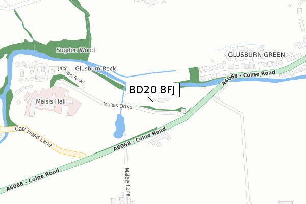
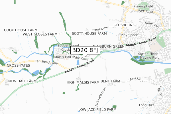
BD20 8FJ is located in the Glusburn, Cross Hills & Sutton-in-Craven electoral ward, within the unitary authority of North Yorkshire and the English Parliamentary constituency of Skipton and Ripon. The Sub Integrated Care Board (ICB) Location is NHS West Yorkshire ICB - 36J and the police force is North Yorkshire. This postcode has been in use since April 2020.


GetTheData
Source: OS Open Zoomstack (Ordnance Survey)
Licence: Open Government Licence (requires attribution)
Attribution: Contains OS data © Crown copyright and database right 2024
Source: Open Postcode Geo
Licence: Open Government Licence (requires attribution)
Attribution: Contains OS data © Crown copyright and database right 2024; Contains Royal Mail data © Royal Mail copyright and database right 2024; Source: Office for National Statistics licensed under the Open Government Licence v.3.0
| Easting | 399366 |
| Northing | 444574 |
| Latitude | 53.897351 |
| Longitude | -2.011136 |
GetTheData
Source: Open Postcode Geo
Licence: Open Government Licence
| Country | England |
| Postcode District | BD20 |
➜ See where BD20 is on a map ➜ Where is Cross Hills? | |
GetTheData
Source: Land Registry Price Paid Data
Licence: Open Government Licence
| Ward | Glusburn, Cross Hills & Sutton-in-craven |
| Constituency | Skipton And Ripon |
GetTheData
Source: ONS Postcode Database
Licence: Open Government Licence
10, MONTAGU CLOSE, GLUSBURN, KEIGHLEY, BD20 8FJ 2021 22 JAN £269,995 |
12, MONTAGU CLOSE, GLUSBURN, KEIGHLEY, BD20 8FJ 2021 14 JAN £575,995 |
4, MONTAGU CLOSE, GLUSBURN, KEIGHLEY, BD20 8FJ 2020 22 DEC £265,000 |
14, MONTAGU CLOSE, GLUSBURN, KEIGHLEY, BD20 8FJ 2020 11 DEC £430,000 |
16, MONTAGU CLOSE, GLUSBURN, KEIGHLEY, BD20 8FJ 2020 27 NOV £360,000 |
2, MONTAGU CLOSE, GLUSBURN, KEIGHLEY, BD20 8FJ 2020 17 NOV £319,995 |
18, MONTAGU CLOSE, GLUSBURN, KEIGHLEY, BD20 8FJ 2020 16 NOV £420,000 |
3, MONTAGU CLOSE, GLUSBURN, KEIGHLEY, BD20 8FJ 2020 5 OCT £429,995 |
1, MONTAGU CLOSE, GLUSBURN, KEIGHLEY, BD20 8FJ 2020 25 SEP £559,995 |
5, MONTAGU CLOSE, GLUSBURN, KEIGHLEY, BD20 8FJ 2020 4 SEP £355,000 |
GetTheData
Source: HM Land Registry Price Paid Data
Licence: Contains HM Land Registry data © Crown copyright and database right 2024. This data is licensed under the Open Government Licence v3.0.
| Dog And Gun Inn (Colne Road) | Glusburn | 125m |
| Dog & Gun Ph (Colne Road) | Glusburn | 150m |
| Old Hall Road (Colne Road) | Glusburn | 319m |
| Malsis School (Colne Road) | Glusburn | 346m |
| Bridge End (Colne Road) | Glusburn | 352m |
| Cononley Station | 2.3km |
| Steeton & Silsden Station | 4.4km |
GetTheData
Source: NaPTAN
Licence: Open Government Licence
GetTheData
Source: ONS Postcode Database
Licence: Open Government Licence


➜ Get more ratings from the Food Standards Agency
GetTheData
Source: Food Standards Agency
Licence: FSA terms & conditions
| Last Collection | |||
|---|---|---|---|
| Location | Mon-Fri | Sat | Distance |
| Collings Road | 17:00 | 11:45 | 2,108m |
| Priestbank Road | 17:00 | 10:30 | 2,221m |
| Cowling P.o. Box | 17:00 | 10:30 | 2,487m |
GetTheData
Source: Dracos
Licence: Creative Commons Attribution-ShareAlike
The below table lists the International Territorial Level (ITL) codes (formerly Nomenclature of Territorial Units for Statistics (NUTS) codes) and Local Administrative Units (LAU) codes for BD20 8FJ:
| ITL 1 Code | Name |
|---|---|
| TLE | Yorkshire and The Humber |
| ITL 2 Code | Name |
| TLE2 | North Yorkshire |
| ITL 3 Code | Name |
| TLE22 | North Yorkshire CC |
| LAU 1 Code | Name |
| E07000163 | Craven |
GetTheData
Source: ONS Postcode Directory
Licence: Open Government Licence
The below table lists the Census Output Area (OA), Lower Layer Super Output Area (LSOA), and Middle Layer Super Output Area (MSOA) for BD20 8FJ:
| Code | Name | |
|---|---|---|
| OA | E00140417 | |
| LSOA | E01027584 | Craven 008F |
| MSOA | E02005749 | Craven 008 |
GetTheData
Source: ONS Postcode Directory
Licence: Open Government Licence
| BD20 8DW | The Old Corn Mill | 135m |
| BD20 8DS | Malsis | 161m |
| BD20 8DP | Glusburn Bridge | 166m |
| BD20 8RB | Colne Road | 241m |
| BD20 8RA | Old Hall Way | 247m |
| BD20 8QY | Old Hall Road | 297m |
| BD20 8QX | Bridge End | 317m |
| BD20 8QZ | Old Hall Close | 329m |
| BD20 8RG | Colne Road | 350m |
| BD20 8RH | Colne Road | 379m |
GetTheData
Source: Open Postcode Geo; Land Registry Price Paid Data
Licence: Open Government Licence