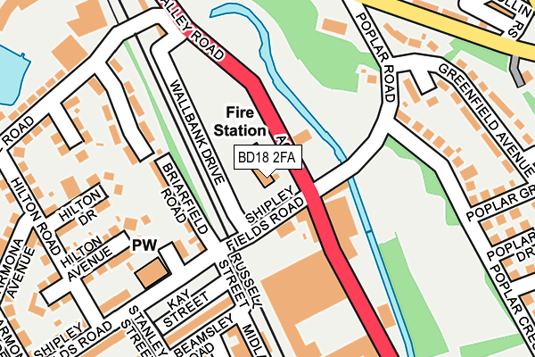
BD18 2FA is located in the Heaton electoral ward, within the metropolitan district of Bradford and the English Parliamentary constituency of Bradford West. The Sub Integrated Care Board (ICB) Location is NHS West Yorkshire ICB - 36J and the police force is West Yorkshire. This postcode has been in use since May 2017.


GetTheData
Source: OS OpenMap – Local (Ordnance Survey)
Source: OS VectorMap District (Ordnance Survey)
Licence: Open Government Licence (requires attribution)
| Easting | 415172 |
| Northing | 436485 |
| Latitude | 53.824432 |
| Longitude | -1.771003 |
GetTheData
Source: Open Postcode Geo
Licence: Open Government Licence
| Country | England |
| Postcode District | BD18 |
➜ See where BD18 is on a map ➜ Where is Shipley? | |
GetTheData
Source: Land Registry Price Paid Data
Licence: Open Government Licence
| Ward | Heaton |
| Constituency | Bradford West |
GetTheData
Source: ONS Postcode Database
Licence: Open Government Licence
| Valley Rd Shipley Fields Road (Valley Road) | Frizinghall | 70m |
| Valley Rd Poplar Road (Valley Road) | Frizinghall | 81m |
| Valley Rd Wallbank Drive (Valley Road) | Frizinghall | 149m |
| Poplar Rd Poplar Cresc (Poplar Road) | Bolton Woods | 161m |
| Poplar Rd Poplar Cresc (Poplar Road) | Bolton Woods | 165m |
| Frizinghall Station | 0.5km |
| Shipley Station | 1km |
| Saltaire Station | 2km |
GetTheData
Source: NaPTAN
Licence: Open Government Licence
GetTheData
Source: ONS Postcode Database
Licence: Open Government Licence

➜ Get more ratings from the Food Standards Agency
GetTheData
Source: Food Standards Agency
Licence: FSA terms & conditions
| Last Collection | |||
|---|---|---|---|
| Location | Mon-Fri | Sat | Distance |
| Branch | 17:45 | 12:45 | 724m |
| Wrose P.o. Box | 17:30 | 12:00 | 961m |
| Kirklees House | 18:30 | 12:30 | 997m |
GetTheData
Source: Dracos
Licence: Creative Commons Attribution-ShareAlike
The below table lists the International Territorial Level (ITL) codes (formerly Nomenclature of Territorial Units for Statistics (NUTS) codes) and Local Administrative Units (LAU) codes for BD18 2FA:
| ITL 1 Code | Name |
|---|---|
| TLE | Yorkshire and The Humber |
| ITL 2 Code | Name |
| TLE4 | West Yorkshire |
| ITL 3 Code | Name |
| TLE41 | Bradford |
| LAU 1 Code | Name |
| E08000032 | Bradford |
GetTheData
Source: ONS Postcode Directory
Licence: Open Government Licence
The below table lists the Census Output Area (OA), Lower Layer Super Output Area (LSOA), and Middle Layer Super Output Area (MSOA) for BD18 2FA:
| Code | Name | |
|---|---|---|
| OA | E00054373 | |
| LSOA | E01010777 | Bradford 021B |
| MSOA | E02002203 | Bradford 021 |
GetTheData
Source: ONS Postcode Directory
Licence: Open Government Licence
| BD18 2DD | Valley Road | 56m |
| BD18 2DQ | Briarfield Road | 111m |
| BD18 2DJ | St Margarets Road | 127m |
| BD18 2HG | Poplar Road | 187m |
| BD18 2BE | Briarfield Gardens | 194m |
| BD18 2AJ | Hilton Avenue | 202m |
| BD18 2AL | Hilton Drive | 203m |
| BD18 2DH | Shipleyfields Road | 208m |
| BD18 2AW | Wharncliffe Road | 232m |
| BD18 2AP | Wharncliffe Grove | 233m |
GetTheData
Source: Open Postcode Geo; Land Registry Price Paid Data
Licence: Open Government Licence