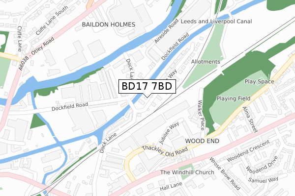
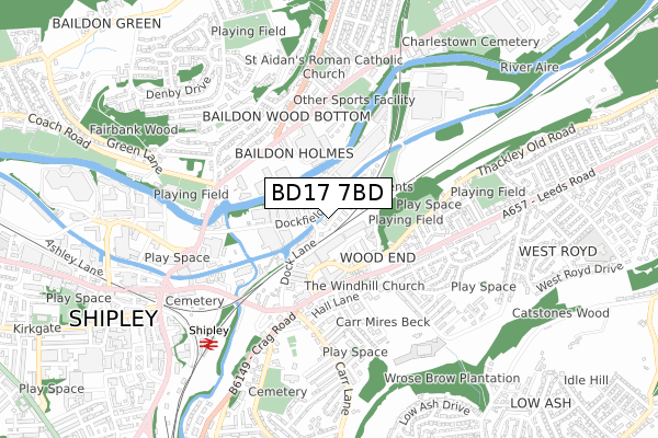
BD17 7BD is located in the Shipley electoral ward, within the metropolitan district of Bradford and the English Parliamentary constituency of Shipley. The Sub Integrated Care Board (ICB) Location is NHS West Yorkshire ICB - 36J and the police force is West Yorkshire. This postcode has been in use since May 2019.


GetTheData
Source: OS Open Zoomstack (Ordnance Survey)
Licence: Open Government Licence (requires attribution)
Attribution: Contains OS data © Crown copyright and database right 2024
Source: Open Postcode Geo
Licence: Open Government Licence (requires attribution)
Attribution: Contains OS data © Crown copyright and database right 2024; Contains Royal Mail data © Royal Mail copyright and database right 2024; Source: Office for National Statistics licensed under the Open Government Licence v.3.0
| Easting | 415487 |
| Northing | 437915 |
| Latitude | 53.837275 |
| Longitude | -1.766146 |
GetTheData
Source: Open Postcode Geo
Licence: Open Government Licence
| Country | England |
| Postcode District | BD17 |
➜ See where BD17 is on a map ➜ Where is Shipley? | |
GetTheData
Source: Land Registry Price Paid Data
Licence: Open Government Licence
| Ward | Shipley |
| Constituency | Shipley |
GetTheData
Source: ONS Postcode Database
Licence: Open Government Licence
| Leeds Rd Thackley Old Road (Leeds Road) | Windhill | 263m |
| Leeds Rd Wrose Brow Road (Leeds Road) | West Royd | 276m |
| Leeds Rd Wrose Brow Road (Leeds Road) | West Royd | 280m |
| Leeds Rd Thackley Old Road (Leeds Road) | Windhill | 301m |
| Wrose Brow Rd Leeds Road (Wrose Brow Road) | West Royd | 351m |
| Shipley Station | 0.7km |
| Saltaire Station | 1.6km |
| Baildon Station | 1.7km |
GetTheData
Source: NaPTAN
Licence: Open Government Licence
| Percentage of properties with Next Generation Access | 100.0% |
| Percentage of properties with Superfast Broadband | 100.0% |
| Percentage of properties with Ultrafast Broadband | 100.0% |
| Percentage of properties with Full Fibre Broadband | 100.0% |
Superfast Broadband is between 30Mbps and 300Mbps
Ultrafast Broadband is > 300Mbps
| Percentage of properties unable to receive 2Mbps | 0.0% |
| Percentage of properties unable to receive 5Mbps | 0.0% |
| Percentage of properties unable to receive 10Mbps | 0.0% |
| Percentage of properties unable to receive 30Mbps | 0.0% |
GetTheData
Source: Ofcom
Licence: Ofcom Terms of Use (requires attribution)
GetTheData
Source: ONS Postcode Database
Licence: Open Government Licence


➜ Get more ratings from the Food Standards Agency
GetTheData
Source: Food Standards Agency
Licence: FSA terms & conditions
| Last Collection | |||
|---|---|---|---|
| Location | Mon-Fri | Sat | Distance |
| New Close | 17:30 | 12:30 | 400m |
| Busy Lane P.o. Box | 17:45 | 12:00 | 659m |
| 1 Green Lane Baildon | 17:45 | 12:15 | 750m |
GetTheData
Source: Dracos
Licence: Creative Commons Attribution-ShareAlike
The below table lists the International Territorial Level (ITL) codes (formerly Nomenclature of Territorial Units for Statistics (NUTS) codes) and Local Administrative Units (LAU) codes for BD17 7BD:
| ITL 1 Code | Name |
|---|---|
| TLE | Yorkshire and The Humber |
| ITL 2 Code | Name |
| TLE4 | West Yorkshire |
| ITL 3 Code | Name |
| TLE41 | Bradford |
| LAU 1 Code | Name |
| E08000032 | Bradford |
GetTheData
Source: ONS Postcode Directory
Licence: Open Government Licence
The below table lists the Census Output Area (OA), Lower Layer Super Output Area (LSOA), and Middle Layer Super Output Area (MSOA) for BD17 7BD:
| Code | Name | |
|---|---|---|
| OA | E00054347 | |
| LSOA | E01010782 | Bradford 020B |
| MSOA | E02002202 | Bradford 020 |
GetTheData
Source: ONS Postcode Directory
Licence: Open Government Licence
| BD17 7AW | Dockfield Terrace | 133m |
| BD17 7BX | Dock Lane | 136m |
| BD17 7AQ | Dock Lane | 152m |
| BD17 7AJ | Dockfield Terrace | 177m |
| BD17 7AN | Dockfield Place | 179m |
| BD17 7AD | Dockfield Road | 200m |
| BD18 1QB | Thackley Old Road | 222m |
| BD18 1BZ | Leeds Road | 232m |
| BD18 1DD | Thackley Old Road | 286m |
| BD18 1BX | Leeds Road | 303m |
GetTheData
Source: Open Postcode Geo; Land Registry Price Paid Data
Licence: Open Government Licence