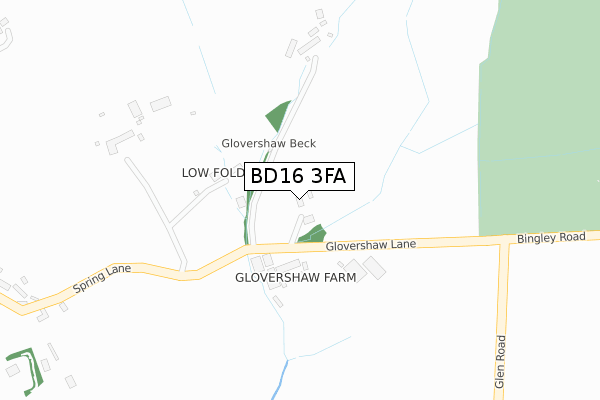
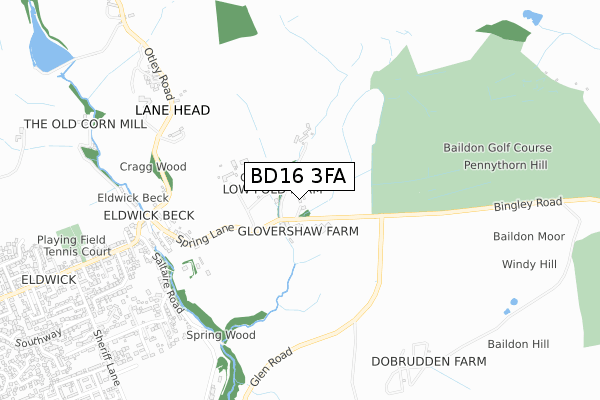
BD16 3FA is located in the Baildon electoral ward, within the metropolitan district of Bradford and the English Parliamentary constituency of Shipley. The Sub Integrated Care Board (ICB) Location is NHS West Yorkshire ICB - 36J and the police force is West Yorkshire. This postcode has been in use since December 2017.


GetTheData
Source: OS Open Zoomstack (Ordnance Survey)
Licence: Open Government Licence (requires attribution)
Attribution: Contains OS data © Crown copyright and database right 2025
Source: Open Postcode Geo
Licence: Open Government Licence (requires attribution)
Attribution: Contains OS data © Crown copyright and database right 2025; Contains Royal Mail data © Royal Mail copyright and database right 2025; Source: Office for National Statistics licensed under the Open Government Licence v.3.0
| Easting | 413227 |
| Northing | 440636 |
| Latitude | 53.861793 |
| Longitude | -1.800372 |
GetTheData
Source: Open Postcode Geo
Licence: Open Government Licence
| Country | England |
| Postcode District | BD16 |
➜ See where BD16 is on a map | |
GetTheData
Source: Land Registry Price Paid Data
Licence: Open Government Licence
| Ward | Baildon |
| Constituency | Shipley |
GetTheData
Source: ONS Postcode Database
Licence: Open Government Licence
| Otley Rd Spring Lane (Otley Road) | Eldwick | 631m |
| Otley Rd Spring Lane (Otley Road) | Eldwick | 631m |
| Otley Road Terminus (Otley Road) | Eldwick | 662m |
| Otley Rd Lyndale Road (Otley Road) | Eldwick | 770m |
| Otley Rd Lyndale Road (Otley Road) | Eldwick | 798m |
| Saltaire Station | 2.7km |
| Bingley Station | 2.8km |
| Crossflatts Station | 3km |
GetTheData
Source: NaPTAN
Licence: Open Government Licence
GetTheData
Source: ONS Postcode Database
Licence: Open Government Licence


➜ Get more ratings from the Food Standards Agency
GetTheData
Source: Food Standards Agency
Licence: FSA terms & conditions
| Last Collection | |||
|---|---|---|---|
| Location | Mon-Fri | Sat | Distance |
| Eldwick Beck | 17:00 | 12:15 | 718m |
| Eldwick P.o. Box | 17:00 | 12:15 | 1,010m |
| Otley Road | 17:00 | 12:30 | 1,522m |
GetTheData
Source: Dracos
Licence: Creative Commons Attribution-ShareAlike
The below table lists the International Territorial Level (ITL) codes (formerly Nomenclature of Territorial Units for Statistics (NUTS) codes) and Local Administrative Units (LAU) codes for BD16 3FA:
| ITL 1 Code | Name |
|---|---|
| TLE | Yorkshire and The Humber |
| ITL 2 Code | Name |
| TLE4 | West Yorkshire |
| ITL 3 Code | Name |
| TLE41 | Bradford |
| LAU 1 Code | Name |
| E08000032 | Bradford |
GetTheData
Source: ONS Postcode Directory
Licence: Open Government Licence
The below table lists the Census Output Area (OA), Lower Layer Super Output Area (LSOA), and Middle Layer Super Output Area (MSOA) for BD16 3FA:
| Code | Name | |
|---|---|---|
| OA | E00053353 | |
| LSOA | E01010573 | Bradford 013A |
| MSOA | E02002195 | Bradford 013 |
GetTheData
Source: ONS Postcode Directory
Licence: Open Government Licence
| BD16 3AU | Spring Lane | 146m |
| BD16 3AS | Spring Lane | 523m |
| BD16 3BW | Paddock Lane | 545m |
| BD16 3BN | Pennygate | 604m |
| BD16 3AX | Otley Road | 618m |
| BD16 3HA | Eldwick Beck | 633m |
| BD16 3EY | Saltaire Road | 651m |
| BD16 3HB | The Green | 663m |
| BD16 3EZ | Otley Road | 677m |
| BD16 3EX | Saltaire Road | 684m |
GetTheData
Source: Open Postcode Geo; Land Registry Price Paid Data
Licence: Open Government Licence