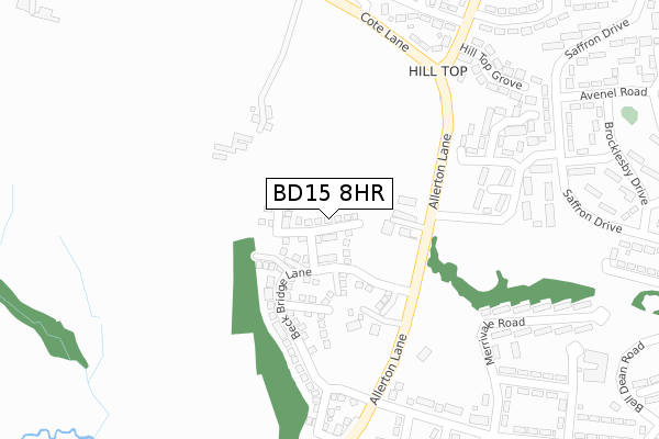
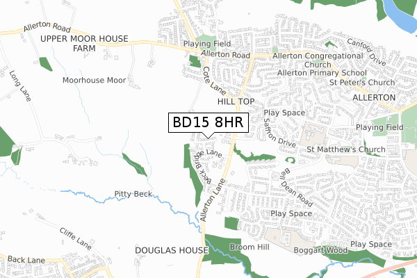
BD15 8HR is located in the Thornton and Allerton electoral ward, within the metropolitan district of Bradford and the English Parliamentary constituency of Bradford West. The Sub Integrated Care Board (ICB) Location is NHS West Yorkshire ICB - 36J and the police force is West Yorkshire. This postcode has been in use since February 2020.


GetTheData
Source: OS Open Zoomstack (Ordnance Survey)
Licence: Open Government Licence (requires attribution)
Attribution: Contains OS data © Crown copyright and database right 2025
Source: Open Postcode Geo
Licence: Open Government Licence (requires attribution)
Attribution: Contains OS data © Crown copyright and database right 2025; Contains Royal Mail data © Royal Mail copyright and database right 2025; Source: Office for National Statistics licensed under the Open Government Licence v.3.0
| Easting | 411228 |
| Northing | 434057 |
| Latitude | 53.802708 |
| Longitude | -1.831004 |
GetTheData
Source: Open Postcode Geo
Licence: Open Government Licence
| Country | England |
| Postcode District | BD15 |
➜ See where BD15 is on a map ➜ Where is Bradford? | |
GetTheData
Source: Land Registry Price Paid Data
Licence: Open Government Licence
| Ward | Thornton And Allerton |
| Constituency | Bradford West |
GetTheData
Source: ONS Postcode Database
Licence: Open Government Licence
6, THE PASTURES, ALLERTON, BRADFORD, BD15 8HR 2024 27 SEP £254,995 |
1, THE PASTURES, ALLERTON, BRADFORD, BD15 8HR 2024 28 MAR £299,995 |
3, THE PASTURES, ALLERTON, BRADFORD, BD15 8HR 2024 2 FEB £299,995 |
8, THE PASTURES, ALLERTON, BRADFORD, BD15 8HR 2023 31 OCT £300,000 |
GetTheData
Source: HM Land Registry Price Paid Data
Licence: Contains HM Land Registry data © Crown copyright and database right 2025. This data is licensed under the Open Government Licence v3.0.
| Saffron Drive Weymouth Ave (Saffron Drive) | Allerton | 255m |
| Saffron Drive Weymouth Ave (Saffron Drive) | Allerton | 276m |
| Allerton Road Ivy Ln (Allerton Road) | Allerton | 304m |
| Allerton Road Ivy Ln (Allerton Road) | Allerton | 329m |
| Saffron Drive Avenel Rd (Saffron Drive) | Allerton | 344m |
| Frizinghall Station | 4.5km |
| Saltaire Station | 4.8km |
| Shipley Station | 5.1km |
GetTheData
Source: NaPTAN
Licence: Open Government Licence
GetTheData
Source: ONS Postcode Database
Licence: Open Government Licence


➜ Get more ratings from the Food Standards Agency
GetTheData
Source: Food Standards Agency
Licence: FSA terms & conditions
| Last Collection | |||
|---|---|---|---|
| Location | Mon-Fri | Sat | Distance |
| Allerton Franchise P.o. Box | 17:15 | 12:15 | 682m |
| Town End Road Clayton | 17:15 | 12:00 | 2,105m |
| 61 The Avenue Clayton | 17:45 | 12:00 | 2,157m |
GetTheData
Source: Dracos
Licence: Creative Commons Attribution-ShareAlike
The below table lists the International Territorial Level (ITL) codes (formerly Nomenclature of Territorial Units for Statistics (NUTS) codes) and Local Administrative Units (LAU) codes for BD15 8HR:
| ITL 1 Code | Name |
|---|---|
| TLE | Yorkshire and The Humber |
| ITL 2 Code | Name |
| TLE4 | West Yorkshire |
| ITL 3 Code | Name |
| TLE41 | Bradford |
| LAU 1 Code | Name |
| E08000032 | Bradford |
GetTheData
Source: ONS Postcode Directory
Licence: Open Government Licence
The below table lists the Census Output Area (OA), Lower Layer Super Output Area (LSOA), and Middle Layer Super Output Area (MSOA) for BD15 8HR:
| Code | Name | |
|---|---|---|
| OA | E00054455 | |
| LSOA | E01010802 | Bradford 036F |
| MSOA | E02002218 | Bradford 036 |
GetTheData
Source: ONS Postcode Directory
Licence: Open Government Licence
| BD15 8HA | Hill Top Lane | 112m |
| BD15 7ES | Kildare Crescent | 147m |
| BD15 8LD | Cote Lane | 153m |
| BD15 7LF | Hill Top Grove | 162m |
| BD15 7EJ | Kildare Crescent | 175m |
| BD15 7EL | Colyton Mount | 179m |
| BD15 7JL | Woodford Close | 190m |
| BD15 7EH | Kildare Crescent | 198m |
| BD15 8AA | Bailey Fold | 217m |
| BD15 8HB | Allerton Lane | 217m |
GetTheData
Source: Open Postcode Geo; Land Registry Price Paid Data
Licence: Open Government Licence