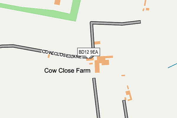
BD12 9EA is located in the Wyke electoral ward, within the metropolitan district of Bradford and the English Parliamentary constituency of Bradford South. The Sub Integrated Care Board (ICB) Location is NHS West Yorkshire ICB - 36J and the police force is West Yorkshire. This postcode has been in use since January 1980.


GetTheData
Source: OS OpenMap – Local (Ordnance Survey)
Source: OS VectorMap District (Ordnance Survey)
Licence: Open Government Licence (requires attribution)
| Easting | 416541 |
| Northing | 426778 |
| Latitude | 53.737130 |
| Longitude | -1.750720 |
GetTheData
Source: Open Postcode Geo
Licence: Open Government Licence
| Country | England |
| Postcode District | BD12 |
➜ See where BD12 is on a map | |
GetTheData
Source: Land Registry Price Paid Data
Licence: Open Government Licence
Elevation or altitude of BD12 9EA as distance above sea level:
| Metres | Feet | |
|---|---|---|
| Elevation | 150m | 492ft |
Elevation is measured from the approximate centre of the postcode, to the nearest point on an OS contour line from OS Terrain 50, which has contour spacing of ten vertical metres.
➜ How high above sea level am I? Find the elevation of your current position using your device's GPS.
GetTheData
Source: Open Postcode Elevation
Licence: Open Government Licence
| Ward | Wyke |
| Constituency | Bradford South |
GetTheData
Source: ONS Postcode Database
Licence: Open Government Licence
| Chemical Works (Wyke Lane) | Wyke | 633m |
| Westfield Lane Brookfields Rd (Westfield Lane) | Scholes | 674m |
| Westfield Lane Westfield Place (Westfield Lane) | Scholes | 683m |
| Westfield Lane Brookfields Rd (Westfield Lane) | Scholes | 685m |
| Westfield Lane Whitehall Rd (Westfield Lane) | Wyke | 692m |
| Low Moor Station | 1.4km |
| Brighouse Station | 4.7km |
GetTheData
Source: NaPTAN
Licence: Open Government Licence
GetTheData
Source: ONS Postcode Database
Licence: Open Government Licence


➜ Get more ratings from the Food Standards Agency
GetTheData
Source: Food Standards Agency
Licence: FSA terms & conditions
| Last Collection | |||
|---|---|---|---|
| Location | Mon-Fri | Sat | Distance |
| Scholes P.o. Box | 17:15 | 11:45 | 885m |
| 219 Whitechapel Road Scholes | 16:00 | 11:45 | 1,072m |
| 451 Cleckheaton Road | 17:45 | 11:45 | 1,344m |
GetTheData
Source: Dracos
Licence: Creative Commons Attribution-ShareAlike
The below table lists the International Territorial Level (ITL) codes (formerly Nomenclature of Territorial Units for Statistics (NUTS) codes) and Local Administrative Units (LAU) codes for BD12 9EA:
| ITL 1 Code | Name |
|---|---|
| TLE | Yorkshire and The Humber |
| ITL 2 Code | Name |
| TLE4 | West Yorkshire |
| ITL 3 Code | Name |
| TLE41 | Bradford |
| LAU 1 Code | Name |
| E08000032 | Bradford |
GetTheData
Source: ONS Postcode Directory
Licence: Open Government Licence
The below table lists the Census Output Area (OA), Lower Layer Super Output Area (LSOA), and Middle Layer Super Output Area (MSOA) for BD12 9EA:
| Code | Name | |
|---|---|---|
| OA | E00054803 | |
| LSOA | E01010870 | Bradford 061C |
| MSOA | E02002243 | Bradford 061 |
GetTheData
Source: ONS Postcode Directory
Licence: Open Government Licence
| BD12 9DX | Whitehall Road | 352m |
| BD12 9DT | Grasmere Road | 523m |
| BD12 9BG | Knowle Lane | 553m |
| BD12 9DU | Kentmere Avenue | 562m |
| BD19 6DT | Greenton Avenue | 571m |
| BD12 9DP | Whitehall Road | 579m |
| BD12 9DR | Langdale Avenue | 586m |
| BD12 9DS | Thirlmere Avenue | 614m |
| BD12 9DH | Greenacre Drive | 623m |
| BD19 6HB | Meadowlands | 633m |
GetTheData
Source: Open Postcode Geo; Land Registry Price Paid Data
Licence: Open Government Licence