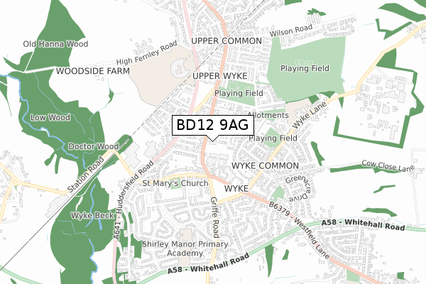
BD12 9AG is located in the Wyke electoral ward, within the metropolitan district of Bradford and the English Parliamentary constituency of Bradford South. The Sub Integrated Care Board (ICB) Location is NHS West Yorkshire ICB - 36J and the police force is West Yorkshire. This postcode has been in use since January 2020.


GetTheData
Source: OS Open Zoomstack (Ordnance Survey)
Licence: Open Government Licence (requires attribution)
Attribution: Contains OS data © Crown copyright and database right 2025
Source: Open Postcode Geo
Licence: Open Government Licence (requires attribution)
Attribution: Contains OS data © Crown copyright and database right 2025; Contains Royal Mail data © Royal Mail copyright and database right 2025; Source: Office for National Statistics licensed under the Open Government Licence v.3.0
| Easting | 415383 |
| Northing | 426945 |
| Latitude | 53.738681 |
| Longitude | -1.768269 |
GetTheData
Source: Open Postcode Geo
Licence: Open Government Licence
| Country | England |
| Postcode District | BD12 |
➜ See where BD12 is on a map ➜ Where is Bradford? | |
GetTheData
Source: Land Registry Price Paid Data
Licence: Open Government Licence
| Ward | Wyke |
| Constituency | Bradford South |
GetTheData
Source: ONS Postcode Database
Licence: Open Government Licence
| Oakenshaw Court (Town Gate) | Wyke | 64m |
| Oakenshaw Court (Town Gate) | Wyke | 76m |
| Town Gate Clare Road (Town Gate) | Wyke | 111m |
| Town Gate Albert Street (Town Gate) | Wyke | 165m |
| Huddersfield Road West Croft (Huddersfield Road) | Wyke | 209m |
| Low Moor Station | 1.6km |
| Brighouse Station | 4.6km |
GetTheData
Source: NaPTAN
Licence: Open Government Licence
GetTheData
Source: ONS Postcode Database
Licence: Open Government Licence


➜ Get more ratings from the Food Standards Agency
GetTheData
Source: Food Standards Agency
Licence: FSA terms & conditions
| Last Collection | |||
|---|---|---|---|
| Location | Mon-Fri | Sat | Distance |
| Carr Lane | 17:00 | 12:00 | 1,411m |
| Low Moor Business Box | 18:30 | 11:45 | 1,418m |
| Scholes P.o. Box | 17:15 | 11:45 | 1,627m |
GetTheData
Source: Dracos
Licence: Creative Commons Attribution-ShareAlike
The below table lists the International Territorial Level (ITL) codes (formerly Nomenclature of Territorial Units for Statistics (NUTS) codes) and Local Administrative Units (LAU) codes for BD12 9AG:
| ITL 1 Code | Name |
|---|---|
| TLE | Yorkshire and The Humber |
| ITL 2 Code | Name |
| TLE4 | West Yorkshire |
| ITL 3 Code | Name |
| TLE41 | Bradford |
| LAU 1 Code | Name |
| E08000032 | Bradford |
GetTheData
Source: ONS Postcode Directory
Licence: Open Government Licence
The below table lists the Census Output Area (OA), Lower Layer Super Output Area (LSOA), and Middle Layer Super Output Area (MSOA) for BD12 9AG:
| Code | Name | |
|---|---|---|
| OA | E00054764 | |
| LSOA | E01010871 | Bradford 061D |
| MSOA | E02002243 | Bradford 061 |
GetTheData
Source: ONS Postcode Directory
Licence: Open Government Licence
| BD12 9JB | Town Gate | 61m |
| BD12 9JD | Town Gate | 73m |
| BD12 9JH | Simon Fold | 75m |
| BD12 9JJ | Claremont | 86m |
| BD12 9JE | Oakenshaw Court | 86m |
| BD12 8JL | Wilkinson Fold | 92m |
| BD12 9JA | Town Gate | 116m |
| BD12 8JQ | Hanson Place | 130m |
| BD12 9NS | Daisy Hill | 132m |
| BD12 9JL | Town Gate | 133m |
GetTheData
Source: Open Postcode Geo; Land Registry Price Paid Data
Licence: Open Government Licence