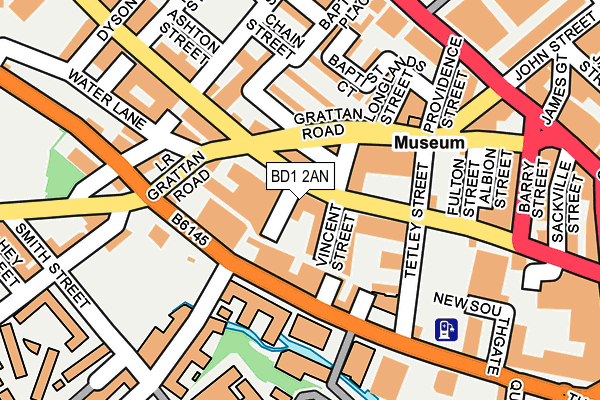
BD1 2AN is located in the City electoral ward, within the metropolitan district of Bradford and the English Parliamentary constituency of Bradford West. The Sub Integrated Care Board (ICB) Location is NHS West Yorkshire ICB - 36J and the police force is West Yorkshire. This postcode has been in use since July 2017.


GetTheData
Source: OS OpenMap – Local (Ordnance Survey)
Source: OS VectorMap District (Ordnance Survey)
Licence: Open Government Licence (requires attribution)
| Easting | 415841 |
| Northing | 433157 |
| Latitude | 53.794500 |
| Longitude | -1.761010 |
GetTheData
Source: Open Postcode Geo
Licence: Open Government Licence
| Country | England |
| Postcode District | BD1 |
➜ See where BD1 is on a map ➜ Where is Bradford? | |
GetTheData
Source: Land Registry Price Paid Data
Licence: Open Government Licence
| Ward | City |
| Constituency | Bradford West |
GetTheData
Source: ONS Postcode Database
Licence: Open Government Licence
| Arkwright Hall (Thornton Road) | Listerhills | 104m |
| Sunbridge Rd Wigan Street (Sunbridge Road) | Listerhills | 127m |
| Thornton Rd Westholme Street (Thornton Road) | Bradford City Centre | 136m |
| Sunbridge Rd Wigan Street (Sunbridge Road) | Listerhills | 155m |
| Sunbridge Rd (Sunbridge Road) | Bradford City Centre | 186m |
| Bradford Forster Square Station | 0.6km |
| Bradford Interchange Station | 0.8km |
| Frizinghall Station | 2.9km |
GetTheData
Source: NaPTAN
Licence: Open Government Licence
| Percentage of properties with Next Generation Access | 100.0% |
| Percentage of properties with Superfast Broadband | 100.0% |
| Percentage of properties with Ultrafast Broadband | 100.0% |
| Percentage of properties with Full Fibre Broadband | 0.0% |
Superfast Broadband is between 30Mbps and 300Mbps
Ultrafast Broadband is > 300Mbps
| Percentage of properties unable to receive 2Mbps | 0.0% |
| Percentage of properties unable to receive 5Mbps | 0.0% |
| Percentage of properties unable to receive 10Mbps | 0.0% |
| Percentage of properties unable to receive 30Mbps | 0.0% |
GetTheData
Source: Ofcom
Licence: Ofcom Terms of Use (requires attribution)
GetTheData
Source: ONS Postcode Database
Licence: Open Government Licence


➜ Get more ratings from the Food Standards Agency
GetTheData
Source: Food Standards Agency
Licence: FSA terms & conditions
| Last Collection | |||
|---|---|---|---|
| Location | Mon-Fri | Sat | Distance |
| 138 Thornton Road | 18:30 | 11:45 | 106m |
| Wigan Street | 18:30 | 12:15 | 149m |
| Westgate | 18:30 | 12:15 | 243m |
GetTheData
Source: Dracos
Licence: Creative Commons Attribution-ShareAlike
The below table lists the International Territorial Level (ITL) codes (formerly Nomenclature of Territorial Units for Statistics (NUTS) codes) and Local Administrative Units (LAU) codes for BD1 2AN:
| ITL 1 Code | Name |
|---|---|
| TLE | Yorkshire and The Humber |
| ITL 2 Code | Name |
| TLE4 | West Yorkshire |
| ITL 3 Code | Name |
| TLE41 | Bradford |
| LAU 1 Code | Name |
| E08000032 | Bradford |
GetTheData
Source: ONS Postcode Directory
Licence: Open Government Licence
The below table lists the Census Output Area (OA), Lower Layer Super Output Area (LSOA), and Middle Layer Super Output Area (MSOA) for BD1 2AN:
| Code | Name | |
|---|---|---|
| OA | E00176105 | |
| LSOA | E01033691 | Bradford 039H |
| MSOA | E02002221 | Bradford 039 |
GetTheData
Source: ONS Postcode Directory
Licence: Open Government Licence
| BD1 2PF | Sunbridge Road | 41m |
| BD1 2PG | Grattan Road | 53m |
| BD1 2PJ | Vincent Street | 61m |
| BD1 2DX | Thornton Road | 74m |
| BD1 2NB | Sunbridge Road | 87m |
| BD1 2NG | Grattan Road | 100m |
| BD1 2NH | Grattan Road | 106m |
| BD1 2ND | Sunbridge Road | 129m |
| BD1 2HB | Sunbridge Road | 131m |
| BD1 2HS | Grattan Road | 140m |
GetTheData
Source: Open Postcode Geo; Land Registry Price Paid Data
Licence: Open Government Licence