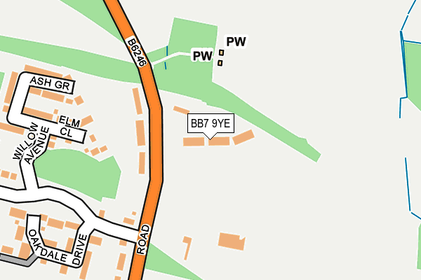
BB7 9YE is located in the Whalley Nethertown electoral ward, within the local authority district of Ribble Valley and the English Parliamentary constituency of Ribble Valley. The Sub Integrated Care Board (ICB) Location is NHS Lancashire and South Cumbria ICB - 01A and the police force is Lancashire. This postcode has been in use since May 2016.


GetTheData
Source: OS OpenMap – Local (Ordnance Survey)
Source: OS VectorMap District (Ordnance Survey)
Licence: Open Government Licence (requires attribution)
| Easting | 372764 |
| Northing | 437459 |
| Latitude | 53.832683 |
| Longitude | -2.415316 |
GetTheData
Source: Open Postcode Geo
Licence: Open Government Licence
| Country | England |
| Postcode District | BB7 |
➜ See where BB7 is on a map ➜ Where is Nethertown? | |
GetTheData
Source: Land Registry Price Paid Data
Licence: Open Government Licence
Elevation or altitude of BB7 9YE as distance above sea level:
| Metres | Feet | |
|---|---|---|
| Elevation | 60m | 197ft |
Elevation is measured from the approximate centre of the postcode, to the nearest point on an OS contour line from OS Terrain 50, which has contour spacing of ten vertical metres.
➜ How high above sea level am I? Find the elevation of your current position using your device's GPS.
GetTheData
Source: Open Postcode Elevation
Licence: Open Government Licence
| Ward | Whalley Nethertown |
| Constituency | Ribble Valley |
GetTheData
Source: ONS Postcode Database
Licence: Open Government Licence
| Cemetery (Mitton Road) | Calderstone | 115m |
| Cemetery (Mitton Road) | Calderstone | 122m |
| Calderstones Drive (Mitton Road) | Calderstone | 288m |
| Calderstones Drive (Mitton Road) | Calderstone | 335m |
| Hospital (Mitton Road) | Calderstone | 482m |
| Whalley Station | 1km |
| Langho Station | 3.8km |
| Clitheroe Station | 4.7km |
GetTheData
Source: NaPTAN
Licence: Open Government Licence
| Median download speed | 77.2Mbps |
| Average download speed | 51.8Mbps |
| Maximum download speed | 80.00Mbps |
| Median upload speed | 19.5Mbps |
| Average upload speed | 11.6Mbps |
| Maximum upload speed | 20.00Mbps |
GetTheData
Source: Ofcom
Licence: Ofcom Terms of Use (requires attribution)
GetTheData
Source: ONS Postcode Database
Licence: Open Government Licence

➜ Get more ratings from the Food Standards Agency
GetTheData
Source: Food Standards Agency
Licence: FSA terms & conditions
| Last Collection | |||
|---|---|---|---|
| Location | Mon-Fri | Sat | Distance |
| Station Whalley | 16:15 | 12:30 | 1,022m |
| 2 Beverley Drive | 17:00 | 11:00 | 3,581m |
| Hurst Green Post Office | 16:00 | 11:30 | 4,234m |
GetTheData
Source: Dracos
Licence: Creative Commons Attribution-ShareAlike
The below table lists the International Territorial Level (ITL) codes (formerly Nomenclature of Territorial Units for Statistics (NUTS) codes) and Local Administrative Units (LAU) codes for BB7 9YE:
| ITL 1 Code | Name |
|---|---|
| TLD | North West (England) |
| ITL 2 Code | Name |
| TLD4 | Lancashire |
| ITL 3 Code | Name |
| TLD45 | Mid Lancashire |
| LAU 1 Code | Name |
| E07000124 | Ribble Valley |
GetTheData
Source: ONS Postcode Directory
Licence: Open Government Licence
The below table lists the Census Output Area (OA), Lower Layer Super Output Area (LSOA), and Middle Layer Super Output Area (MSOA) for BB7 9YE:
| Code | Name | |
|---|---|---|
| OA | E00128665 | |
| LSOA | E01025350 | Ribble Valley 007D |
| MSOA | E02005276 | Ribble Valley 007 |
GetTheData
Source: ONS Postcode Directory
Licence: Open Government Licence
| BB7 9JY | Mitton Road | 68m |
| BB7 9UT | Elm Close | 240m |
| BB7 9UW | Ash Grove | 252m |
| BB7 9US | Willow Avenue | 259m |
| BB7 9FW | Oakdale Drive | 261m |
| BB7 9UU | Alder Drive | 303m |
| BB7 9PF | Mitton Road | 309m |
| BB7 9SH | Regency Close | 393m |
| BB7 9SJ | Pasture Grove | 409m |
| BB7 9UJ | Meadow Field Close | 447m |
GetTheData
Source: Open Postcode Geo; Land Registry Price Paid Data
Licence: Open Government Licence