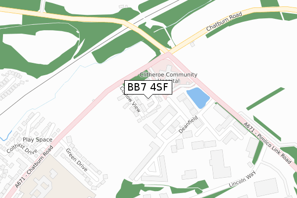
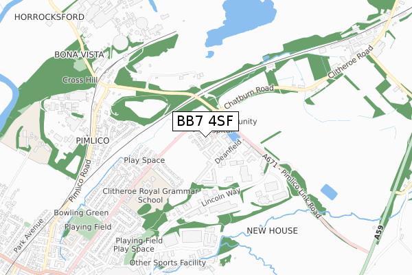
BB7 4SF is located in the Salthill electoral ward, within the local authority district of Ribble Valley and the English Parliamentary constituency of Ribble Valley. The Sub Integrated Care Board (ICB) Location is NHS Lancashire and South Cumbria ICB - 01A and the police force is Lancashire. This postcode has been in use since June 2019.


GetTheData
Source: OS Open Zoomstack (Ordnance Survey)
Licence: Open Government Licence (requires attribution)
Attribution: Contains OS data © Crown copyright and database right 2025
Source: Open Postcode Geo
Licence: Open Government Licence (requires attribution)
Attribution: Contains OS data © Crown copyright and database right 2025; Contains Royal Mail data © Royal Mail copyright and database right 2025; Source: Office for National Statistics licensed under the Open Government Licence v.3.0
| Easting | 375466 |
| Northing | 442987 |
| Latitude | 53.882502 |
| Longitude | -2.374706 |
GetTheData
Source: Open Postcode Geo
Licence: Open Government Licence
| Country | England |
| Postcode District | BB7 |
➜ See where BB7 is on a map ➜ Where is Clitheroe? | |
GetTheData
Source: Land Registry Price Paid Data
Licence: Open Government Licence
| Ward | Salthill |
| Constituency | Ribble Valley |
GetTheData
Source: ONS Postcode Database
Licence: Open Government Licence
2023 8 DEC £275,000 |
11, GUARDIANS CLOSE, CLITHEROE, BB7 4SF 2020 14 FEB £289,995 |
2019 28 JUN £227,500 |
8, GUARDIANS CLOSE, CLITHEROE, BB7 4SF 2019 28 JUN £304,995 |
10, GUARDIANS CLOSE, CLITHEROE, BB7 4SF 2019 28 JUN £314,995 |
6, GUARDIANS CLOSE, CLITHEROE, BB7 4SF 2019 21 JUN £304,995 |
4, GUARDIANS CLOSE, CLITHEROE, BB7 4SF 2019 14 JUN £284,995 |
2, GUARDIANS CLOSE, CLITHEROE, BB7 4SF 2019 14 JUN £314,995 |
GetTheData
Source: HM Land Registry Price Paid Data
Licence: Contains HM Land Registry data © Crown copyright and database right 2025. This data is licensed under the Open Government Licence v3.0.
| Hospital (Chatburn Road) | Chatburn Road | 90m |
| Hospital (Chatburn Road) | Chatburn Road | 107m |
| Grammar School (Chatburn Road) | Chatburn Road | 481m |
| Grammar School (Chatburn Road) | Chatburn Road | 559m |
| Black Horse (Pimlico Road) | Pimlico | 666m |
| Clitheroe Station | 1.6km |
GetTheData
Source: NaPTAN
Licence: Open Government Licence
| Percentage of properties with Next Generation Access | 100.0% |
| Percentage of properties with Superfast Broadband | 100.0% |
| Percentage of properties with Ultrafast Broadband | 100.0% |
| Percentage of properties with Full Fibre Broadband | 100.0% |
Superfast Broadband is between 30Mbps and 300Mbps
Ultrafast Broadband is > 300Mbps
| Percentage of properties unable to receive 2Mbps | 0.0% |
| Percentage of properties unable to receive 5Mbps | 0.0% |
| Percentage of properties unable to receive 10Mbps | 0.0% |
| Percentage of properties unable to receive 30Mbps | 0.0% |
GetTheData
Source: Ofcom
Licence: Ofcom Terms of Use (requires attribution)
GetTheData
Source: ONS Postcode Database
Licence: Open Government Licence


➜ Get more ratings from the Food Standards Agency
GetTheData
Source: Food Standards Agency
Licence: FSA terms & conditions
| Last Collection | |||
|---|---|---|---|
| Location | Mon-Fri | Sat | Distance |
| 144 Chatburn Road | 16:00 | 11:30 | 631m |
| 2 Beverley Drive | 17:00 | 11:00 | 2,606m |
GetTheData
Source: Dracos
Licence: Creative Commons Attribution-ShareAlike
The below table lists the International Territorial Level (ITL) codes (formerly Nomenclature of Territorial Units for Statistics (NUTS) codes) and Local Administrative Units (LAU) codes for BB7 4SF:
| ITL 1 Code | Name |
|---|---|
| TLD | North West (England) |
| ITL 2 Code | Name |
| TLD4 | Lancashire |
| ITL 3 Code | Name |
| TLD45 | Mid Lancashire |
| LAU 1 Code | Name |
| E07000124 | Ribble Valley |
GetTheData
Source: ONS Postcode Directory
Licence: Open Government Licence
The below table lists the Census Output Area (OA), Lower Layer Super Output Area (LSOA), and Middle Layer Super Output Area (MSOA) for BB7 4SF:
| Code | Name | |
|---|---|---|
| OA | E00128645 | |
| LSOA | E01025347 | Ribble Valley 002E |
| MSOA | E02005271 | Ribble Valley 002 |
GetTheData
Source: ONS Postcode Directory
Licence: Open Government Licence
| BB7 1QJ | Deanfield Drive | 74m |
| BB7 1QS | Deanfield Court | 223m |
| BB7 1QU | Deanfield Way | 258m |
| BB7 2BB | Green Drive | 299m |
| BB7 2EQ | Kiln Close | 365m |
| BB7 2EY | Crangle Fold | 399m |
| BB7 2ES | Cringle Way | 403m |
| BB7 2ER | Long Close | 470m |
| BB7 2EJ | Colthirst Drive | 495m |
| BB7 4PY | Moorland Crescent | 539m |
GetTheData
Source: Open Postcode Geo; Land Registry Price Paid Data
Licence: Open Government Licence