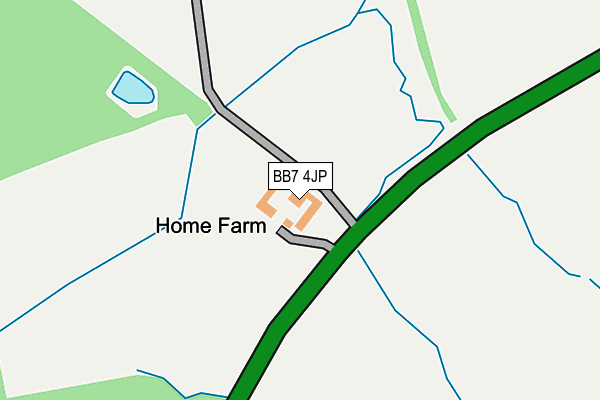
BB7 4JP is located in the Gisburn & Rimington electoral ward, within the local authority district of Ribble Valley and the English Parliamentary constituency of Ribble Valley. The Sub Integrated Care Board (ICB) Location is NHS Lancashire and South Cumbria ICB - 01A and the police force is Lancashire. This postcode has been in use since June 2005.


GetTheData
Source: OS OpenMap – Local (Ordnance Survey)
Source: OS VectorMap District (Ordnance Survey)
Licence: Open Government Licence (requires attribution)
| Easting | 381613 |
| Northing | 448283 |
| Latitude | 53.930357 |
| Longitude | -2.281519 |
GetTheData
Source: Open Postcode Geo
Licence: Open Government Licence
| Country | England |
| Postcode District | BB7 |
➜ See where BB7 is on a map | |
GetTheData
Source: Land Registry Price Paid Data
Licence: Open Government Licence
Elevation or altitude of BB7 4JP as distance above sea level:
| Metres | Feet | |
|---|---|---|
| Elevation | 140m | 459ft |
Elevation is measured from the approximate centre of the postcode, to the nearest point on an OS contour line from OS Terrain 50, which has contour spacing of ten vertical metres.
➜ How high above sea level am I? Find the elevation of your current position using your device's GPS.
GetTheData
Source: Open Postcode Elevation
Licence: Open Government Licence
| Ward | Gisburn & Rimington |
| Constituency | Ribble Valley |
GetTheData
Source: ONS Postcode Database
Licence: Open Government Licence
| Business Park (Gisburn Road) | Gisburn | 56m |
| Primary School (Burnley Road) | Gisburn | 1,276m |
| Post Office (Main Street) | Gisburn | 1,325m |
| Mylah Farm (Rimington Lane) | Howgill | 1,336m |
| White Bull (Main Street) | Gisburn | 1,402m |
GetTheData
Source: NaPTAN
Licence: Open Government Licence
GetTheData
Source: ONS Postcode Database
Licence: Open Government Licence


➜ Get more ratings from the Food Standards Agency
GetTheData
Source: Food Standards Agency
Licence: FSA terms & conditions
The below table lists the International Territorial Level (ITL) codes (formerly Nomenclature of Territorial Units for Statistics (NUTS) codes) and Local Administrative Units (LAU) codes for BB7 4JP:
| ITL 1 Code | Name |
|---|---|
| TLD | North West (England) |
| ITL 2 Code | Name |
| TLD4 | Lancashire |
| ITL 3 Code | Name |
| TLD45 | Mid Lancashire |
| LAU 1 Code | Name |
| E07000124 | Ribble Valley |
GetTheData
Source: ONS Postcode Directory
Licence: Open Government Licence
The below table lists the Census Output Area (OA), Lower Layer Super Output Area (LSOA), and Middle Layer Super Output Area (MSOA) for BB7 4JP:
| Code | Name | |
|---|---|---|
| OA | E00128567 | |
| LSOA | E01025331 | Ribble Valley 001C |
| MSOA | E02005270 | Ribble Valley 001 |
GetTheData
Source: ONS Postcode Directory
Licence: Open Government Licence
| BB7 4LJ | Gisburn Road | 477m |
| BB7 4ES | Gisburn Road | 1114m |
| BB7 4LN | Mill Lane | 1120m |
| BB7 4JW | Stable Close | 1217m |
| BB7 4ED | Rimington Lane | 1258m |
| BB7 4HT | Park Road | 1281m |
| BB7 4ET | Burnley Road | 1296m |
| BB7 4EB | Gisburn Road | 1307m |
| BB7 4HA | Park View | 1316m |
| BB7 4EY | Bentlea Road | 1336m |
GetTheData
Source: Open Postcode Geo; Land Registry Price Paid Data
Licence: Open Government Licence