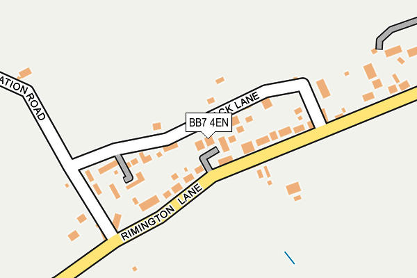
BB7 4EN lies on Carr Croft in Rimington, Clitheroe. BB7 4EN is located in the Gisburn & Rimington electoral ward, within the local authority district of Ribble Valley and the English Parliamentary constituency of Ribble Valley. The Sub Integrated Care Board (ICB) Location is NHS Lancashire and South Cumbria ICB - 01A and the police force is Lancashire. This postcode has been in use since October 1985.


GetTheData
Source: OS OpenMap – Local (Ordnance Survey)
Source: OS VectorMap District (Ordnance Survey)
Licence: Open Government Licence (requires attribution)
| Easting | 380458 |
| Northing | 445803 |
| Latitude | 53.908011 |
| Longitude | -2.298948 |
GetTheData
Source: Open Postcode Geo
Licence: Open Government Licence
| Street | Carr Croft |
| Locality | Rimington |
| Town/City | Clitheroe |
| Country | England |
| Postcode District | BB7 |
➜ See where BB7 is on a map ➜ Where is Rimington? | |
GetTheData
Source: Land Registry Price Paid Data
Licence: Open Government Licence
Elevation or altitude of BB7 4EN as distance above sea level:
| Metres | Feet | |
|---|---|---|
| Elevation | 150m | 492ft |
Elevation is measured from the approximate centre of the postcode, to the nearest point on an OS contour line from OS Terrain 50, which has contour spacing of ten vertical metres.
➜ How high above sea level am I? Find the elevation of your current position using your device's GPS.
GetTheData
Source: Open Postcode Elevation
Licence: Open Government Licence
| Ward | Gisburn & Rimington |
| Constituency | Ribble Valley |
GetTheData
Source: ONS Postcode Database
Licence: Open Government Licence
| Black Bull (Rimington Lane) | Rimington | 82m |
| Pendle Terrace (Rimington Lane) | Rimington | 134m |
| Stopper Lane | Rimington | 783m |
| Bridge End Cottage (Rimington Lane) | Rimington | 793m |
| Old Sawley Grange (Gisburn Road) | Sawley | 1,639m |
GetTheData
Source: NaPTAN
Licence: Open Government Licence
| Percentage of properties with Next Generation Access | 100.0% |
| Percentage of properties with Superfast Broadband | 100.0% |
| Percentage of properties with Ultrafast Broadband | 0.0% |
| Percentage of properties with Full Fibre Broadband | 0.0% |
Superfast Broadband is between 30Mbps and 300Mbps
Ultrafast Broadband is > 300Mbps
| Percentage of properties unable to receive 2Mbps | 0.0% |
| Percentage of properties unable to receive 5Mbps | 0.0% |
| Percentage of properties unable to receive 10Mbps | 0.0% |
| Percentage of properties unable to receive 30Mbps | 0.0% |
GetTheData
Source: Ofcom
Licence: Ofcom Terms of Use (requires attribution)
GetTheData
Source: ONS Postcode Database
Licence: Open Government Licence


➜ Get more ratings from the Food Standards Agency
GetTheData
Source: Food Standards Agency
Licence: FSA terms & conditions
The below table lists the International Territorial Level (ITL) codes (formerly Nomenclature of Territorial Units for Statistics (NUTS) codes) and Local Administrative Units (LAU) codes for BB7 4EN:
| ITL 1 Code | Name |
|---|---|
| TLD | North West (England) |
| ITL 2 Code | Name |
| TLD4 | Lancashire |
| ITL 3 Code | Name |
| TLD45 | Mid Lancashire |
| LAU 1 Code | Name |
| E07000124 | Ribble Valley |
GetTheData
Source: ONS Postcode Directory
Licence: Open Government Licence
The below table lists the Census Output Area (OA), Lower Layer Super Output Area (LSOA), and Middle Layer Super Output Area (MSOA) for BB7 4EN:
| Code | Name | |
|---|---|---|
| OA | E00128570 | |
| LSOA | E01025331 | Ribble Valley 001C |
| MSOA | E02005270 | Ribble Valley 001 |
GetTheData
Source: ONS Postcode Directory
Licence: Open Government Licence
| BB7 4DS | Rimington Lane | 40m |
| BB7 4EL | Back Lane | 57m |
| BB7 4DT | 275m | |
| BB7 4DR | Station Road | 285m |
| BB7 4DP | Rimington Lane | 639m |
| BB7 4EA | Rimington Lane | 714m |
| BB7 4DU | Stopper Lane | 733m |
| BB7 4DX | Back Stopper Lane | 811m |
| BB7 4DZ | Newby | 1159m |
| BB7 4EJ | Stopper Lane | 1234m |
GetTheData
Source: Open Postcode Geo; Land Registry Price Paid Data
Licence: Open Government Licence