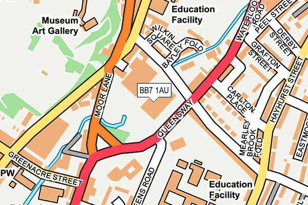
BB7 1AU is located in the Salthill electoral ward, within the local authority district of Ribble Valley and the English Parliamentary constituency of Ribble Valley. The Sub Integrated Care Board (ICB) Location is NHS Lancashire and South Cumbria ICB - 01A and the police force is Lancashire. This postcode has been in use since April 2009.


GetTheData
Source: OS OpenMap – Local (Ordnance Survey)
Source: OS VectorMap District (Ordnance Survey)
Licence: Open Government Licence (requires attribution)
| Easting | 374372 |
| Northing | 441466 |
| Latitude | 53.868765 |
| Longitude | -2.391220 |
GetTheData
Source: Open Postcode Geo
Licence: Open Government Licence
| Country | England |
| Postcode District | BB7 |
➜ See where BB7 is on a map ➜ Where is Clitheroe? | |
GetTheData
Source: Land Registry Price Paid Data
Licence: Open Government Licence
Elevation or altitude of BB7 1AU as distance above sea level:
| Metres | Feet | |
|---|---|---|
| Elevation | 70m | 230ft |
Elevation is measured from the approximate centre of the postcode, to the nearest point on an OS contour line from OS Terrain 50, which has contour spacing of ten vertical metres.
➜ How high above sea level am I? Find the elevation of your current position using your device's GPS.
GetTheData
Source: Open Postcode Elevation
Licence: Open Government Licence
| Ward | Salthill |
| Constituency | Ribble Valley |
GetTheData
Source: ONS Postcode Database
Licence: Open Government Licence
| Highfield Road (Waterloo Road) | Clitheroe Town Centre | 58m |
| Queensway (Waterloo Road) | Clitheroe Town Centre | 112m |
| Pendle Club (Lowergate) | Clitheroe Town Centre | 115m |
| Sainsburys (Moor Lane) | Clitheroe Town Centre | 116m |
| Ribblesdale Chs (Queens Road) | Clitheroe Town Centre | 124m |
| Clitheroe Station | 0.6km |
| Whalley Station | 5.2km |
GetTheData
Source: NaPTAN
Licence: Open Government Licence
GetTheData
Source: ONS Postcode Database
Licence: Open Government Licence


➜ Get more ratings from the Food Standards Agency
GetTheData
Source: Food Standards Agency
Licence: FSA terms & conditions
| Last Collection | |||
|---|---|---|---|
| Location | Mon-Fri | Sat | Distance |
| 2 Beverley Drive | 17:00 | 11:00 | 739m |
| 144 Chatburn Road | 16:00 | 11:30 | 1,284m |
GetTheData
Source: Dracos
Licence: Creative Commons Attribution-ShareAlike
| Risk of BB7 1AU flooding from rivers and sea | Low |
| ➜ BB7 1AU flood map | |
GetTheData
Source: Open Flood Risk by Postcode
Licence: Open Government Licence
The below table lists the International Territorial Level (ITL) codes (formerly Nomenclature of Territorial Units for Statistics (NUTS) codes) and Local Administrative Units (LAU) codes for BB7 1AU:
| ITL 1 Code | Name |
|---|---|
| TLD | North West (England) |
| ITL 2 Code | Name |
| TLD4 | Lancashire |
| ITL 3 Code | Name |
| TLD45 | Mid Lancashire |
| LAU 1 Code | Name |
| E07000124 | Ribble Valley |
GetTheData
Source: ONS Postcode Directory
Licence: Open Government Licence
The below table lists the Census Output Area (OA), Lower Layer Super Output Area (LSOA), and Middle Layer Super Output Area (MSOA) for BB7 1AU:
| Code | Name | |
|---|---|---|
| OA | E00128580 | |
| LSOA | E01025335 | Ribble Valley 003C |
| MSOA | E02005272 | Ribble Valley 003 |
GetTheData
Source: ONS Postcode Directory
Licence: Open Government Licence
| BB7 1AX | Highfield Industrial Estate | 92m |
| BB7 1AQ | Highfield Road | 97m |
| BB7 1NG | Carlton Place | 148m |
| BB7 1NF | Peel Street | 157m |
| BB7 1AG | Lowergate | 160m |
| BB7 1NE | Highfield Road | 166m |
| BB7 1AW | Whalley Road | 170m |
| BB7 1BE | Moor Lane | 190m |
| BB7 1RB | Brotherton Meadows | 202m |
| BB7 1PJ | Hayhurst Farm Terrace | 222m |
GetTheData
Source: Open Postcode Geo; Land Registry Price Paid Data
Licence: Open Government Licence